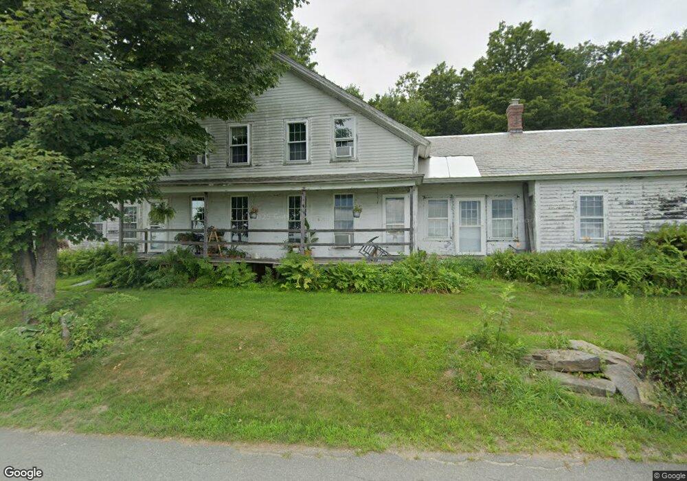
142 Patten Rd Shelburne Falls, MA 01370
Estimated Value: $364,000 - $574,000
4
Beds
3
Baths
2,475
Sq Ft
$192/Sq Ft
Est. Value
About This Home
This home is located at 142 Patten Rd, Shelburne Falls, MA 01370 and is currently estimated at $474,650, approximately $191 per square foot. 142 Patten Rd is a home located in Franklin County with nearby schools including Mohawk Trail Regional High School.
Ownership History
Date
Name
Owned For
Owner Type
Purchase Details
Closed on
Oct 31, 1997
Sold by
Truesdell Forrest Est
Bought by
Washer Charles G and Washer Debra M
Current Estimated Value
Home Financials for this Owner
Home Financials are based on the most recent Mortgage that was taken out on this home.
Original Mortgage
$100,000
Outstanding Balance
$16,455
Interest Rate
7.31%
Mortgage Type
Purchase Money Mortgage
Estimated Equity
$458,195
Create a Home Valuation Report for This Property
The Home Valuation Report is an in-depth analysis detailing your home's value as well as a comparison with similar homes in the area
Home Values in the Area
Average Home Value in this Area
Purchase History
| Date | Buyer | Sale Price | Title Company |
|---|---|---|---|
| Washer Charles G | $125,000 | -- |
Source: Public Records
Mortgage History
| Date | Status | Borrower | Loan Amount |
|---|---|---|---|
| Open | Washer Charles G | $50,000 | |
| Closed | Washer Charles G | $16,000 | |
| Open | Washer Charles G | $100,000 |
Source: Public Records
Tax History
| Year | Tax Paid | Tax Assessment Tax Assessment Total Assessment is a certain percentage of the fair market value that is determined by local assessors to be the total taxable value of land and additions on the property. | Land | Improvement |
|---|---|---|---|---|
| 2025 | $3,756 | $292,500 | $90,500 | $202,000 |
| 2024 | $3,868 | $291,700 | $90,500 | $201,200 |
| 2023 | $3,982 | $291,700 | $90,500 | $201,200 |
| 2022 | $4,077 | $281,400 | $90,500 | $190,900 |
| 2021 | $3,726 | $257,500 | $81,900 | $175,600 |
| 2020 | $3,600 | $257,500 | $81,900 | $175,600 |
| 2019 | $3,593 | $249,700 | $77,500 | $172,200 |
| 2018 | $3,171 | $201,200 | $41,400 | $159,800 |
| 2017 | $2,942 | $198,100 | $41,400 | $156,700 |
| 2015 | $2,888 | $207,900 | $38,900 | $169,000 |
| 2014 | $2,832 | $207,900 | $38,900 | $169,000 |
Source: Public Records
Map
Nearby Homes
- 10 Deerfield Ave Unit 5
- 10 Deerfield Ave Unit 2
- 00 Brook Rd
- 102 Elm St
- 2151 Route 2
- 2155 Massachusetts 2
- 151 Smead Hill Rd
- 414 Mohawk Trail
- 187 Plain Rd
- 32 Homestead Ave
- 163 S Shelburne Rd
- 23 Robbins Rd
- 4 Pickett Ln
- 6 Pickett Ln
- 83 Newton St
- 143 E Buckland Rd
- 89 Columbus Ave
- 46 Colrain St
- 130 Laurel St
- 58A Laurel St
Your Personal Tour Guide
Ask me questions while you tour the home.