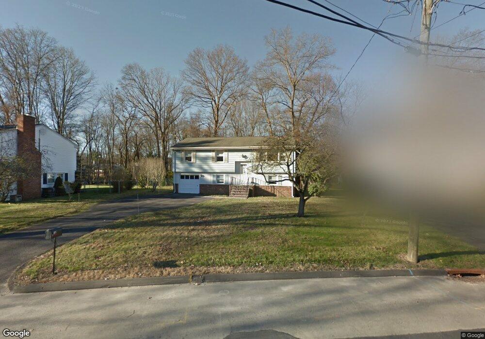
142 Prudence Dr Stamford, CT 06907
Springdale NeighborhoodEstimated Value: $771,000 - $819,629
4
Beds
2
Baths
1,688
Sq Ft
$468/Sq Ft
Est. Value
About This Home
This home is located at 142 Prudence Dr, Stamford, CT 06907 and is currently estimated at $789,907, approximately $467 per square foot. 142 Prudence Dr is a home located in Fairfield County with nearby schools including Springdale Elementary School, Dolan School, and Stamford High School.
Ownership History
Date
Name
Owned For
Owner Type
Purchase Details
Closed on
Dec 19, 2024
Sold by
Wascio Roger Est and Wasco
Bought by
Wasco Christine
Current Estimated Value
Home Financials for this Owner
Home Financials are based on the most recent Mortgage that was taken out on this home.
Original Mortgage
$81,400
Outstanding Balance
$80,751
Interest Rate
6.72%
Mortgage Type
FHA
Estimated Equity
$709,156
Purchase Details
Closed on
Dec 10, 1982
Bought by
Wasco Roger
Create a Home Valuation Report for This Property
The Home Valuation Report is an in-depth analysis detailing your home's value as well as a comparison with similar homes in the area
Home Values in the Area
Average Home Value in this Area
Purchase History
| Date | Buyer | Sale Price | Title Company |
|---|---|---|---|
| Wasco Christine | -- | None Available | |
| Wasco Christine | -- | None Available | |
| Wasco Roger | -- | -- |
Source: Public Records
Mortgage History
| Date | Status | Borrower | Loan Amount |
|---|---|---|---|
| Open | Wasco Christine | $81,400 | |
| Closed | Wasco Christine | $81,400 |
Source: Public Records
Tax History Compared to Growth
Tax History
| Year | Tax Paid | Tax Assessment Tax Assessment Total Assessment is a certain percentage of the fair market value that is determined by local assessors to be the total taxable value of land and additions on the property. | Land | Improvement |
|---|---|---|---|---|
| 2025 | $9,681 | $409,180 | $273,410 | $135,770 |
| 2024 | $9,468 | $409,180 | $273,410 | $135,770 |
| 2023 | $10,172 | $409,180 | $273,410 | $135,770 |
| 2022 | $8,585 | $321,050 | $205,690 | $115,360 |
| 2021 | $8,492 | $321,050 | $205,690 | $115,360 |
| 2020 | $8,273 | $321,050 | $205,690 | $115,360 |
| 2019 | $8,273 | $321,050 | $205,690 | $115,360 |
| 2018 | $7,968 | $321,050 | $205,690 | $115,360 |
| 2017 | $7,783 | $299,340 | $190,440 | $108,900 |
| 2016 | $7,564 | $299,340 | $190,440 | $108,900 |
| 2015 | $7,367 | $299,340 | $190,440 | $108,900 |
| 2014 | $7,121 | $299,340 | $190,440 | $108,900 |
Source: Public Records
Map
Nearby Homes
- 19 Woodway Rd Unit 14
- 77 Putter Dr
- 17 Oenoke Place
- 23 Oenoke Place
- 1157 Hope St
- 95 Columbus Place Unit 6
- 1148 Hope St
- 358 Hoyt St
- 16 Columbus Place
- 1552 Hope St
- 32 Kensett Ln Unit 32
- 72 Kensett Ln
- 83 Mulberry St
- 44 Brundage St
- 393 Upper Haig Ave
- 44 Scofield Farms
- 41 Wakemore St
- 970 Hope St Unit 4J
- 119 Wedgemere Rd
- 39 Running Brook Ln
- 146 Prudence Dr
- 134 Prudence Dr
- 131 Prudence Dr
- 149 Prudence Dr
- 145 Prudence Dr
- 128 Prudence Dr
- 154 Prudence Dr
- 127 Prudence Dr
- 157 Prudence Dr
- 120 Prudence Dr
- 158 Prudence Dr
- 163 Prudence Dr
- 164 Prudence Dr
- 112 Prudence Dr
- 1344 Hope St
- 1322 Hope St
- 115 Prudence Dr
- 104 Prudence Dr
- 170 Prudence Dr
- 169 Prudence Dr