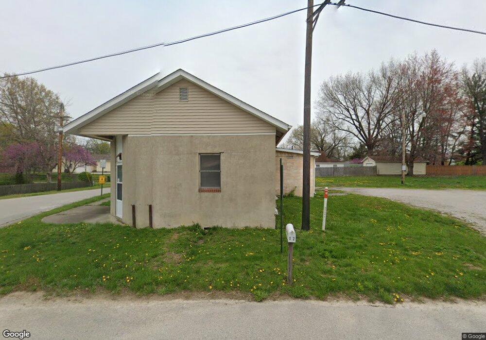
142 Route 4 Staunton, IL 62088
Estimated Value: $76,352 - $228,000
1
Bed
1
Bath
1,250
Sq Ft
$116/Sq Ft
Est. Value
About This Home
This home is located at 142 Route 4, Staunton, IL 62088 and is currently estimated at $145,588, approximately $116 per square foot. 142 Route 4 is a home located in Macoupin County with nearby schools including Staunton Elementary School, Staunton Junior High School, and Staunton High School.
Ownership History
Date
Name
Owned For
Owner Type
Purchase Details
Closed on
May 22, 2025
Sold by
Vogel Michael C
Bought by
Johnson Timothy and Johnson Rodjai
Current Estimated Value
Purchase Details
Closed on
Jul 1, 2014
Bought by
Vogel Michael C
Purchase Details
Closed on
Jun 26, 2013
Sold by
Reger Bette M
Bought by
Miller Marion
Purchase Details
Closed on
Jun 3, 2013
Sold by
Reger Bette M and Miller Marion
Bought by
Ewing William Paul and Bohlen Kimberly Sue
Create a Home Valuation Report for This Property
The Home Valuation Report is an in-depth analysis detailing your home's value as well as a comparison with similar homes in the area
Home Values in the Area
Average Home Value in this Area
Purchase History
| Date | Buyer | Sale Price | Title Company |
|---|---|---|---|
| Johnson Timothy | -- | None Listed On Document | |
| Vogel Michael C | $18,000 | -- | |
| Miller Marion | -- | -- | |
| Ewing William Paul | $1,517 | -- |
Source: Public Records
Mortgage History
| Date | Status | Borrower | Loan Amount |
|---|---|---|---|
| Closed | Ewing William Paul | -- |
Source: Public Records
Tax History Compared to Growth
Tax History
| Year | Tax Paid | Tax Assessment Tax Assessment Total Assessment is a certain percentage of the fair market value that is determined by local assessors to be the total taxable value of land and additions on the property. | Land | Improvement |
|---|---|---|---|---|
| 2024 | $1,105 | $19,635 | $1,542 | $18,093 |
| 2023 | $1,090 | $18,181 | $1,428 | $16,753 |
| 2022 | $1,082 | $16,992 | $1,335 | $15,657 |
| 2021 | $1,050 | $15,881 | $1,248 | $14,633 |
| 2020 | $995 | $14,982 | $1,177 | $13,805 |
| 2019 | $1,049 | $14,982 | $1,177 | $13,805 |
| 2018 | $1,013 | $14,546 | $1,143 | $13,403 |
| 2017 | $993 | $13,813 | $1,085 | $12,728 |
| 2016 | $988 | $13,813 | $1,085 | $12,728 |
| 2015 | $1,004 | $13,813 | $1,085 | $12,728 |
| 2014 | -- | $13,813 | $1,085 | $12,728 |
| 2013 | -- | $15,491 | $1,678 | $13,813 |
Source: Public Records
Map
Nearby Homes
- 311 S Hibbard St
- 311 S Edwardsville St
- 515 N Edwardsville St
- 125 N Wood St
- 1032 W Pearl St
- 230 W Lafayette St
- 708 N Hibbard St
- 517 N Laurel St
- 225 E MacOupin St
- 619 S Wood St
- 706 S Hibbard St
- 402 E MacOupin St
- 904 W Miller Dr
- 626 W 6th St
- 841 N Franklin St
- 701 S Maple St
- 816 S Wood St
- 1107 W 6th St
- 840 N Union St
- 0 Stonecreek Subdivision