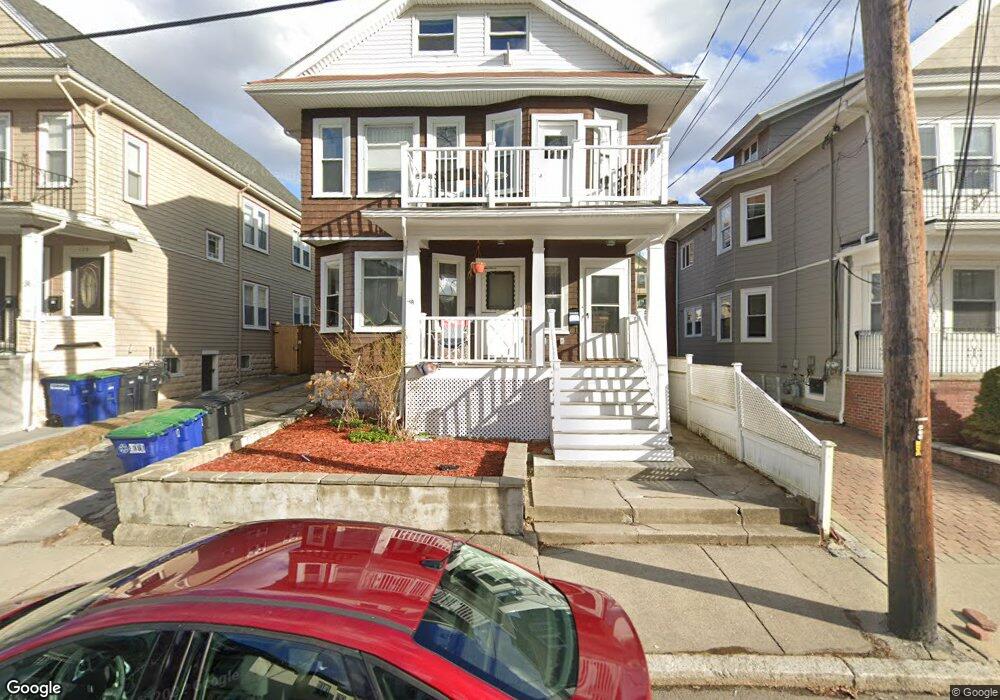
142 W Adams St Somerville, MA 02144
West Somerville NeighborhoodEstimated Value: $1,060,000 - $1,340,183
6
Beds
3
Baths
999
Sq Ft
$1,212/Sq Ft
Est. Value
About This Home
8 Bed 3 Bath by Tufts
Hardwood Floors
Laundry in Basement
Driveway Parking Available
Sizable Bedrooms
Ownership History
Date
Name
Owned For
Owner Type
Purchase Details
Closed on
Apr 20, 2012
Sold by
Wang Yu-Ling
Bought by
Wang Ft and Wang Yu-Ling
Current Estimated Value
Purchase Details
Closed on
Jun 1, 2001
Sold by
Moses Fredric M
Bought by
Wong Yu-Ling
Home Financials for this Owner
Home Financials are based on the most recent Mortgage that was taken out on this home.
Original Mortgage
$393,300
Interest Rate
7.09%
Mortgage Type
Purchase Money Mortgage
Create a Home Valuation Report for This Property
The Home Valuation Report is an in-depth analysis detailing your home's value as well as a comparison with similar homes in the area
Home Values in the Area
Average Home Value in this Area
Purchase History
| Date | Buyer | Sale Price | Title Company |
|---|---|---|---|
| Wang Ft | -- | -- | |
| Wong Yu-Ling | $437,000 | -- |
Source: Public Records
Mortgage History
| Date | Status | Borrower | Loan Amount |
|---|---|---|---|
| Previous Owner | Wong Yu-Ling | $393,300 |
Source: Public Records
Property History
| Date | Event | Price | List to Sale | Price per Sq Ft |
|---|---|---|---|---|
| 09/01/2025 09/01/25 | For Rent | $10,400 | 0.0% | -- |
| 10/22/2024 10/22/24 | Off Market | $10,400 | -- | -- |
| 10/08/2024 10/08/24 | Off Market | $10,400 | -- | -- |
| 09/19/2024 09/19/24 | For Rent | $10,400 | -- | -- |
Tax History Compared to Growth
Tax History
| Year | Tax Paid | Tax Assessment Tax Assessment Total Assessment is a certain percentage of the fair market value that is determined by local assessors to be the total taxable value of land and additions on the property. | Land | Improvement |
|---|---|---|---|---|
| 2025 | $11,234 | $1,029,700 | $576,600 | $453,100 |
| 2024 | $10,586 | $1,006,300 | $576,600 | $429,700 |
| 2023 | $10,331 | $999,100 | $576,600 | $422,500 |
| 2022 | $9,534 | $936,500 | $549,100 | $387,400 |
| 2021 | $9,288 | $911,500 | $545,100 | $366,400 |
| 2020 | $9,130 | $904,900 | $545,500 | $359,400 |
| 2019 | $8,581 | $797,500 | $496,500 | $301,000 |
| 2018 | $8,288 | $732,800 | $451,400 | $281,400 |
| 2017 | $7,982 | $684,000 | $425,900 | $258,100 |
| 2016 | $8,166 | $651,700 | $380,300 | $271,400 |
| 2015 | $7,792 | $617,900 | $351,200 | $266,700 |
Source: Public Records
Map
Nearby Homes
- 33 Conwell Ave
- 16 High St Unit 2
- 21 High St
- 235 Powder House Blvd
- 9 Woods Ave
- 202 Powder House Blvd Unit 2
- 31 Fairfax St
- 327 Alewife Brook Pkwy Unit A
- 6 Hamilton Rd Unit 6
- 44 Woods Ave Unit 44
- 16 Hamilton Rd
- 34 Belknap St
- 69 Sterling St
- 11 Watson St Unit 1
- 11 Watson St Unit 2
- 55 Packard Ave Unit 1
- 395 Alewife Brook Pkwy Unit 2C
- 395 Alewife Brook Pkwy Unit PH E
- 76 Orchard St
- 29 Packard Ave
- 140 W Adams St Unit 1
- 140 W Adams St
- 138 W Adams St
- 146 W Adams St
- 144 W Adams St Unit 2
- 146 W Adams St Unit 1
- 144 W Adams St Unit 1
- 146 W Adams St Unit 2
- 144 W Adams St
- 136 W Adams St Unit 2
- 136 W Adams St
- 150 W Adams St
- 134 W Adams St
- 133 Hillsdale Rd Unit 2
- 133 Hillsdale Rd
- 129 Hillsdale Rd
- 135 Hillsdale Rd
- 64 Chetwynd Rd
- 64 Chetwynd Rd
- 64 Chetwynd Rd Unit 1