Estimated Value: $58,000 - $139,000
--
Bed
2
Baths
1,548
Sq Ft
$72/Sq Ft
Est. Value
About This Home
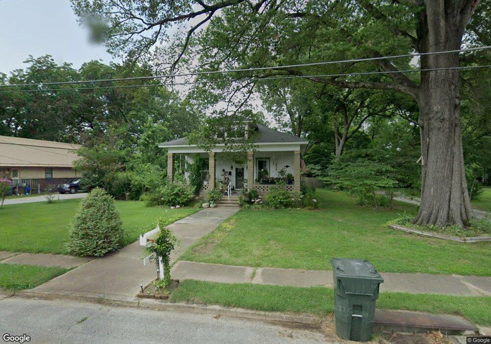
This home is located at 142 W Broad St, Dyer, TN 38330 and is currently estimated at $110,746, approximately $71 per square foot. 142 W Broad St is a home located in Gibson County with nearby schools including Dyer Elementary School and Gibson County High School.
Ownership History
Date
Name
Owned For
Owner Type
Purchase Details
Closed on
Jan 28, 2025
Sold by
Fesmire Wilson
Bought by
Wollseiffen Lisa
Current Estimated Value
Home Financials for this Owner
Home Financials are based on the most recent Mortgage that was taken out on this home.
Original Mortgage
$23,133
Outstanding Balance
$22,161
Interest Rate
6.6%
Mortgage Type
Credit Line Revolving
Estimated Equity
$88,585
Purchase Details
Closed on
Nov 19, 2001
Sold by
Fesmire Margaret B
Bought by
Wilson Fesmire
Purchase Details
Closed on
Jun 26, 1989
Bought by
Fesmire Margaret Barid
Purchase Details
Closed on
Dec 27, 1987
Bought by
Fesmire Wilson
Purchase Details
Closed on
Jan 2, 1900
Bought by
Fesmire Margaret B
Create a Home Valuation Report for This Property
The Home Valuation Report is an in-depth analysis detailing your home's value as well as a comparison with similar homes in the area
Home Values in the Area
Average Home Value in this Area
Purchase History
| Date | Buyer | Sale Price | Title Company |
|---|---|---|---|
| Wollseiffen Lisa | $55,000 | Dyer Land Title | |
| Wollseiffen Lisa | $55,000 | Dyer Land Title | |
| Wilson Fesmire | $21,480 | -- | |
| Fesmire Margaret Barid | $35,200 | -- | |
| Fesmire Wilson | $45,000 | -- | |
| Fesmire Margaret B | -- | -- |
Source: Public Records
Mortgage History
| Date | Status | Borrower | Loan Amount |
|---|---|---|---|
| Open | Wollseiffen Lisa | $23,133 | |
| Closed | Wollseiffen Lisa | $23,133 |
Source: Public Records
Tax History Compared to Growth
Tax History
| Year | Tax Paid | Tax Assessment Tax Assessment Total Assessment is a certain percentage of the fair market value that is determined by local assessors to be the total taxable value of land and additions on the property. | Land | Improvement |
|---|---|---|---|---|
| 2024 | $917 | $26,450 | $4,500 | $21,950 |
| 2023 | $488 | $15,675 | $3,175 | $12,500 |
| 2022 | $477 | $15,675 | $3,175 | $12,500 |
| 2021 | $477 | $15,675 | $3,175 | $12,500 |
| 2020 | $780 | $15,675 | $3,175 | $12,500 |
| 2019 | $776 | $15,675 | $3,175 | $12,500 |
| 2018 | $753 | $14,900 | $3,175 | $11,725 |
| 2017 | $722 | $14,900 | $3,175 | $11,725 |
| 2016 | $722 | $14,900 | $3,175 | $11,725 |
| 2015 | $658 | $14,900 | $3,175 | $11,725 |
| 2014 | $658 | $14,900 | $3,175 | $11,725 |
Source: Public Records
Map
Nearby Homes
- 208 & 210 Lee St
- 117 Washington St
- 0 Royal St
- 288 W Broad St
- 137 W South St
- 142 S Poplar St
- 173 Orr Rd
- 205 Division St
- 299 E Walnut St
- 246 Thomas St
- 354 E Maple St
- 217 Central St
- 139 Peach St
- 163 Monroe St
- 548 E College St
- 153 New Hope St
- 0 Reed Rd
- 23 Gravettes Crossing Rd W
- 106 Scattered Acres Dr
- 0 Ernest Paschall Rd Unit RRA45339