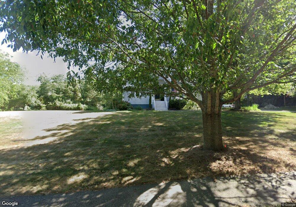
142 Westmoreland Ln Saunderstown, RI 02874
Saunderstown NeighborhoodEstimated Value: $1,095,884 - $1,330,000
5
Beds
4
Baths
4,000
Sq Ft
$298/Sq Ft
Est. Value
About This Home
This home is located at 142 Westmoreland Ln, Saunderstown, RI 02874 and is currently estimated at $1,190,471, approximately $297 per square foot. 142 Westmoreland Ln is a home located in Washington County with nearby schools including Hamilton Elementary School, Wickford Middle School, and North Kingstown Sr. High School.
Ownership History
Date
Name
Owned For
Owner Type
Purchase Details
Closed on
Jun 27, 2007
Sold by
Adams Richard and Adams Diane
Bought by
Sabo Roger J and Carey Mary A
Current Estimated Value
Home Financials for this Owner
Home Financials are based on the most recent Mortgage that was taken out on this home.
Original Mortgage
$242,000
Interest Rate
6.24%
Mortgage Type
Purchase Money Mortgage
Create a Home Valuation Report for This Property
The Home Valuation Report is an in-depth analysis detailing your home's value as well as a comparison with similar homes in the area
Home Values in the Area
Average Home Value in this Area
Purchase History
| Date | Buyer | Sale Price | Title Company |
|---|---|---|---|
| Sabo Roger J | $692,000 | -- |
Source: Public Records
Mortgage History
| Date | Status | Borrower | Loan Amount |
|---|---|---|---|
| Open | Sabo Roger J | $390,000 | |
| Closed | Sabo Roger J | $388,200 | |
| Closed | Sabo Roger J | $325,114 | |
| Closed | Sabo Roger J | $242,000 |
Source: Public Records
Tax History Compared to Growth
Tax History
| Year | Tax Paid | Tax Assessment Tax Assessment Total Assessment is a certain percentage of the fair market value that is determined by local assessors to be the total taxable value of land and additions on the property. | Land | Improvement |
|---|---|---|---|---|
| 2025 | $11,241 | $1,018,200 | $356,700 | $661,500 |
| 2024 | $11,684 | $814,800 | $311,100 | $503,700 |
| 2023 | $11,684 | $814,800 | $311,100 | $503,700 |
| 2022 | $11,456 | $814,800 | $311,100 | $503,700 |
| 2021 | $10,409 | $594,800 | $169,600 | $425,200 |
| 2020 | $10,165 | $594,800 | $169,600 | $425,200 |
| 2019 | $10,165 | $594,800 | $169,600 | $425,200 |
| 2018 | $10,305 | $543,200 | $169,600 | $373,600 |
| 2017 | $10,098 | $543,200 | $169,600 | $373,600 |
| 2016 | $9,810 | $543,200 | $169,600 | $373,600 |
| 2015 | $9,810 | $508,300 | $164,300 | $344,000 |
| 2014 | $9,612 | $508,300 | $164,300 | $344,000 |
Source: Public Records
Map
Nearby Homes
- 66 Essex Manor Ln
- 46 Hillside Ct
- 2424 Tower Hill Rd
- 2180 Tower Hill Rd
- 297 Walmsley Ln
- 47 Wake Robin Trail
- 49 Meadow Sweet Trail
- 12 Overlook Rd
- 416 Bridgetown Rd
- 18 Lakeview Dr
- 48 Fieldstone Ln
- 65 Village Hill Ln
- 1081 Mooresfield Rd
- 604 Stony Fort Rd
- 247 Glen Hill Dr
- 51 Osceola Ave
- 0 Johnny Cake Trail Trail S Unit 1391340
- 210 Explorer Dr
- 202 Explorer Dr
- 158 Explorer Dr
- 122 Westmoreland Ln
- 166 Westmoreland Ln
- 182 Westmoreland Ln
- 194 Westmoreland Ln
- 173 Westmoreland Ln
- 206 Westmoreland Ln
- 0 Westmoreland Ln
- 91 Westmoreland Ln
- 218 Westmoreland Ln
- 191 Westmoreland Ln
- 228 Westmoreland Ln
- 205 Westmoreland Ln
- 238 Westmoreland Ln
- 213 Westmoreland Ln
- 197 Westmoreland Ln
- 40 Westmoreland Ln
- 30 Jasmine Cir
- 24 Jasmine Cir
- 223 Westmoreland Ln
- 10 Jasmine Cir