Estimated Value: $89,000 - $186,000
3
Beds
2
Baths
1,680
Sq Ft
$81/Sq Ft
Est. Value
About This Home
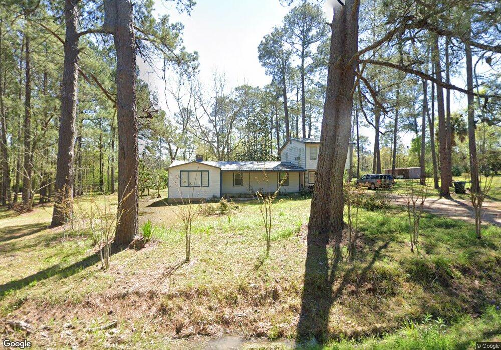
This home is located at 1420 5th St NE, Cairo, GA 39828 and is currently estimated at $136,517, approximately $81 per square foot. 1420 5th St NE is a home located in Grady County with nearby schools including Cairo High School.
Ownership History
Date
Name
Owned For
Owner Type
Purchase Details
Closed on
Sep 19, 2008
Sold by
Staffordjohn Charles M
Bought by
Escalante Anatolia
Current Estimated Value
Home Financials for this Owner
Home Financials are based on the most recent Mortgage that was taken out on this home.
Original Mortgage
$25,560
Interest Rate
6.45%
Mortgage Type
New Conventional
Purchase Details
Closed on
Jul 6, 2005
Sold by
Reagan Burt L
Bought by
Piland Larry W
Purchase Details
Closed on
Dec 13, 1988
Bought by
Reagan Burt L
Create a Home Valuation Report for This Property
The Home Valuation Report is an in-depth analysis detailing your home's value as well as a comparison with similar homes in the area
Home Values in the Area
Average Home Value in this Area
Purchase History
| Date | Buyer | Sale Price | Title Company |
|---|---|---|---|
| Escalante Anatolia | $35,000 | -- | |
| Piland Larry W | $37,000 | -- | |
| Reagan Burt L | $25,000 | -- |
Source: Public Records
Mortgage History
| Date | Status | Borrower | Loan Amount |
|---|---|---|---|
| Closed | Escalante Anatolia | $25,560 |
Source: Public Records
Tax History Compared to Growth
Tax History
| Year | Tax Paid | Tax Assessment Tax Assessment Total Assessment is a certain percentage of the fair market value that is determined by local assessors to be the total taxable value of land and additions on the property. | Land | Improvement |
|---|---|---|---|---|
| 2024 | $1,546 | $39,182 | $6,800 | $32,382 |
| 2023 | $638 | $17,224 | $4,002 | $13,222 |
| 2022 | $663 | $17,224 | $4,002 | $13,222 |
| 2021 | $665 | $17,224 | $4,002 | $13,222 |
| 2020 | $667 | $17,224 | $4,002 | $13,222 |
| 2019 | $667 | $17,224 | $4,002 | $13,222 |
| 2018 | $634 | $17,224 | $4,002 | $13,222 |
| 2017 | $609 | $17,224 | $4,002 | $13,222 |
| 2016 | $532 | $14,716 | $4,002 | $10,714 |
| 2015 | $527 | $14,716 | $4,002 | $10,714 |
| 2014 | $527 | $14,716 | $4,002 | $10,714 |
| 2013 | -- | $14,726 | $4,001 | $10,725 |
Source: Public Records
Map
Nearby Homes
- 00 NW 9th Ave
- 2975 U S 84
- 1420 Parallel Dr NW
- 0 State Route 188
- 711 2nd Ave NE
- 000 15th Ave Nw -- Tract 2
- 000 15th Ave Nw -- Tract 1
- 4761 Hadley Ferry Rd
- 220 8th Ave NW
- 00 00 Hwy 111 South Tract 2
- 125 6th Ave NW
- 00 6th St NW
- 0 20th St NE
- 00 20th St NE
- 698 12th Ave NW
- X 1st St
- 00 Hwy 111 South Tract 1
- 316,322 NW 1st St + Lot
- 0 1st St
- 1490 Magnolia Dr
- 1486 5th St NE
- 1288 Ga Highway 188
- 1298 Ga Highway 188
- 1291 Ga Highway 188
- 1210 5th St NE
- 1206 5th St NE
- 655 12th Ave NE
- 1346 Ga Highway 188
- 541 12th Ave NE
- 909 12th Ave NE
- 909 12th Ave Ne & 1298 Hwy 188 N
- 590 12th Ave NE
- 590 12th Ave NE
- 580 12th Ave NE
- 570 12th Ave NE
- 666 12th Ave NE
- 550 12th Ave NE
- 540 12th Ave NE
- 908 12th Ave NE
- 595 11th Ave NE