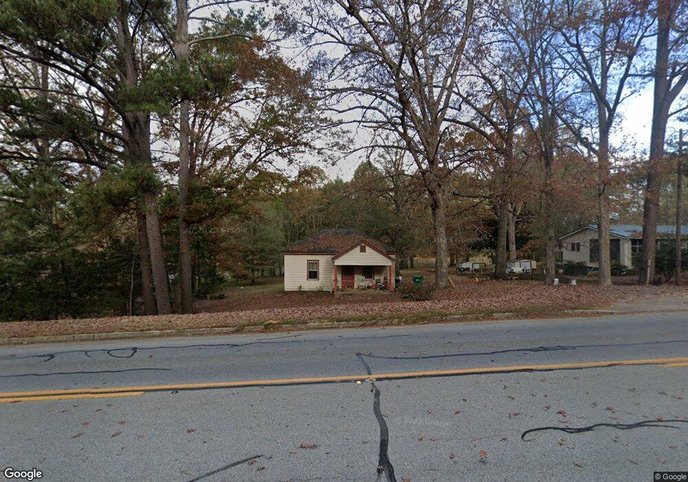
1420 E Broad St Greensboro, GA 30642
Estimated Value: $63,489 - $236,000
2
Beds
2
Baths
1,089
Sq Ft
$163/Sq Ft
Est. Value
About This Home
This home is located at 1420 E Broad St, Greensboro, GA 30642 and is currently estimated at $177,622, approximately $163 per square foot. 1420 E Broad St is a home located in Greene County with nearby schools including Greene County High School.
Ownership History
Date
Name
Owned For
Owner Type
Purchase Details
Closed on
Jun 26, 2017
Sold by
Harvill Jere D
Bought by
Billtown Llc
Current Estimated Value
Home Financials for this Owner
Home Financials are based on the most recent Mortgage that was taken out on this home.
Original Mortgage
$32,408
Interest Rate
3.95%
Mortgage Type
Purchase Money Mortgage
Purchase Details
Closed on
May 4, 1998
Sold by
Farmers Bank The
Bought by
Harvill Jere D
Purchase Details
Closed on
Jan 15, 1998
Sold by
Bates James L
Bought by
Farmers Bank The
Purchase Details
Closed on
Aug 10, 1995
Sold by
Bates James L and Bates Jeannie L
Bought by
Bates James L
Purchase Details
Closed on
Jul 8, 1993
Sold by
Amos James R
Bought by
Bates James L and Bates Jeannie L
Purchase Details
Closed on
Jan 1, 1987
Sold by
Evans W B Est
Bought by
Amos James R
Purchase Details
Closed on
Jan 1, 1960
Bought by
Evans W B Est
Create a Home Valuation Report for This Property
The Home Valuation Report is an in-depth analysis detailing your home's value as well as a comparison with similar homes in the area
Home Values in the Area
Average Home Value in this Area
Purchase History
| Date | Buyer | Sale Price | Title Company |
|---|---|---|---|
| Billtown Llc | $31,000 | -- | |
| Harvill Jere D | $28,000 | -- | |
| Farmers Bank The | $19,300 | -- | |
| Bates James L | -- | -- | |
| Bates James L | $14,500 | -- | |
| Amos James R | -- | -- | |
| Evans W B Est | -- | -- |
Source: Public Records
Mortgage History
| Date | Status | Borrower | Loan Amount |
|---|---|---|---|
| Closed | Billtown Llc | $32,408 |
Source: Public Records
Tax History Compared to Growth
Tax History
| Year | Tax Paid | Tax Assessment Tax Assessment Total Assessment is a certain percentage of the fair market value that is determined by local assessors to be the total taxable value of land and additions on the property. | Land | Improvement |
|---|---|---|---|---|
| 2024 | $651 | $19,646 | $12,393 | $7,253 |
| 2023 | $505 | $20,680 | $13,600 | $7,080 |
| 2022 | $420 | $14,200 | $8,000 | $6,200 |
| 2021 | $380 | $13,520 | $8,000 | $5,520 |
| 2020 | $376 | $10,480 | $4,400 | $6,080 |
| 2019 | $385 | $10,480 | $4,400 | $6,080 |
| 2018 | $363 | $10,480 | $4,400 | $6,080 |
| 2017 | $143 | $10,540 | $4,420 | $6,120 |
| 2016 | $355 | $10,818 | $4,420 | $6,398 |
| 2015 | $325 | $10,817 | $4,420 | $6,398 |
| 2014 | $322 | $10,386 | $4,420 | $5,966 |
Source: Public Records
Map
Nearby Homes
- 1531 E Broad St
- 0 Railroad St Unit 218854
- 0 Railroad St Unit 10578007
- 0 Railroad St Unit 531919
- 1020 Horton Dr
- 301 N East St
- 1060 Twin Pines Cir
- LOT 1 Penfield
- 15 South St Unit Siloam Road
- 504 Martin Luther King Junior Dr
- 0 Canaan St
- 314 W South St
- 1131 Planing Mill Rd
- 1141 Planing Mill Rd
- 109 Reynolds Dr
- 105 Wilson St
- 805 S West St
- 0 Maple Cir
- 1061 Grimes St
- 1141 Armour Cir
- 1430 E Broad St
- 1390 E Broad St
- 1450 E Broad St
- 1380 E Broad St
- 1441 E Broad St
- 1371 E Broad St
- 1461 E Broad St
- 1360 E Broad St
- 1361 E Broad St
- 1080 Phelps Rd
- 102 Pinecrest St
- 0 Phelps Dr Unit 8796691
- 0 Phelps Dr Unit 8756034
- 0 Phelps Dr Unit 8176918
- 0 Phelps Dr Unit 7429407
- 0 Phelps Dr Unit 7250642
- 0 Phelps Dr Unit 7113622
- 0 Phelps Dr
- 102 Pinecrest Dr
- 1481 E Broad St