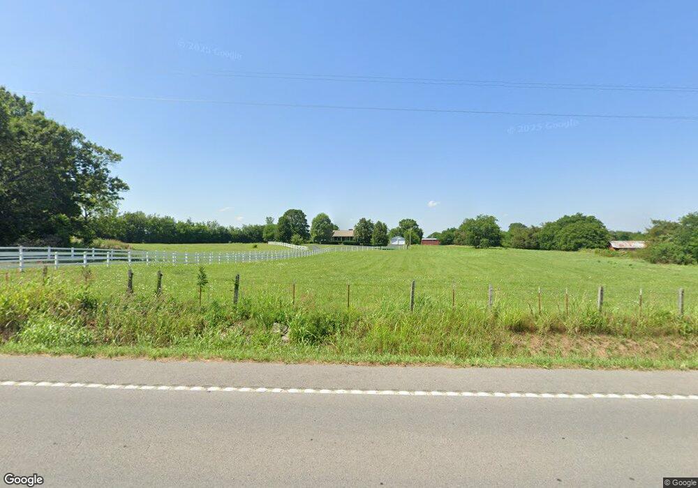
1420 Highway 64 W Shelbyville, TN 37160
Estimated Value: $387,000 - $725,491
--
Bed
3
Baths
3,168
Sq Ft
$168/Sq Ft
Est. Value
About This Home
This home is located at 1420 Highway 64 W, Shelbyville, TN 37160 and is currently estimated at $533,373, approximately $168 per square foot. 1420 Highway 64 W is a home located in Bedford County with nearby schools including Liberty Elementary School.
Ownership History
Date
Name
Owned For
Owner Type
Purchase Details
Closed on
Sep 24, 2021
Sold by
Alpha Strategic Fund I Llc
Bought by
Odom Larry D and Gann Teresa O
Current Estimated Value
Purchase Details
Closed on
Mar 12, 2001
Sold by
Damron Brent
Bought by
Damron L Brent Wanda
Purchase Details
Closed on
Jun 13, 1997
Sold by
Damron Jesse Lee
Bought by
Damron Brent and Damron Wanda
Purchase Details
Closed on
Apr 3, 1991
Bought by
Damron Jesse Lee and Eula Mae
Purchase Details
Closed on
Sep 22, 1970
Bought by
Damron Jesse Lee and Eula Mae
Create a Home Valuation Report for This Property
The Home Valuation Report is an in-depth analysis detailing your home's value as well as a comparison with similar homes in the area
Home Values in the Area
Average Home Value in this Area
Purchase History
| Date | Buyer | Sale Price | Title Company |
|---|---|---|---|
| Odom Larry D | -- | None Available | |
| Damron L Brent Wanda | -- | -- | |
| Brent Damron L | -- | -- | |
| Damron Brent | $23,000 | -- | |
| Damron Jesse Lee | $1,000 | -- | |
| Damron Jesse Lee | -- | -- |
Source: Public Records
Tax History Compared to Growth
Tax History
| Year | Tax Paid | Tax Assessment Tax Assessment Total Assessment is a certain percentage of the fair market value that is determined by local assessors to be the total taxable value of land and additions on the property. | Land | Improvement |
|---|---|---|---|---|
| 2025 | $2,287 | $98,375 | $0 | $0 |
| 2024 | $2,287 | $98,375 | $15,800 | $82,575 |
| 2023 | $2,287 | $98,375 | $15,800 | $82,575 |
| 2022 | $2,287 | $98,375 | $15,800 | $82,575 |
| 2021 | $1,933 | $98,375 | $15,800 | $82,575 |
| 2020 | $1,671 | $98,375 | $15,800 | $82,575 |
| 2019 | $1,671 | $62,825 | $10,675 | $52,150 |
| 2018 | $1,608 | $62,825 | $10,675 | $52,150 |
| 2017 | $1,833 | $71,600 | $13,525 | $58,075 |
| 2016 | $1,804 | $71,600 | $0 | $0 |
| 2015 | $1,804 | $71,600 | $0 | $0 |
| 2014 | $1,488 | $65,547 | $0 | $0 |
Source: Public Records
Map
Nearby Homes
- 388 Coble Rd
- 395 Harrison Rd
- 332 Coble Rd
- 1106 Highway 130 W
- 1261 Highway 130 W
- 321 Dixon Rd
- 143 Coble Rd
- 0 Dixon Rd Unit RTC3045417
- 7 Dixon Rd
- 12 Dixon Rd
- 8 Farris Ln
- 0 Knight Campground Rd
- 3 Knight Campground Rd
- 349 Naron Rd
- 116 Stonebrook Dr
- 107 Stonebrook Dr
- 127 Doak St
- 102 Doak St
- 201 Shelbyville Mills Rd
- 112 August Way
- 1418 Highway 64 W
- 1424 Highway 64 W
- 1428 Highway 64 W
- 1426 Highway 64 W
- 1430 Highway 64 W
- 1415 Highway 64 W
- 1416 Highway 64 W
- 1405 Highway 64 W
- 1425 Highway 64 W
- 1425 Highway 64 W
- 1436 Highway 64 W
- 1435 Highway 64 W
- 1341 Highway 64 W
- 1436 Highway 64w
- 119 Greer Rd
- 1337 Tennessee 64
- 1337 Highway 64 W
- 125 Greer Rd
- 135 Greer Rd
- 1328 Highway 64 W