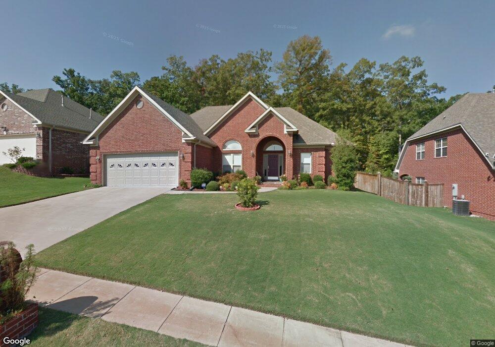
1420 Lansing St Little Rock, AR 72223
Estimated Value: $317,000 - $358,000
--
Bed
2
Baths
1,919
Sq Ft
$176/Sq Ft
Est. Value
About This Home
This home is located at 1420 Lansing St, Little Rock, AR 72223 and is currently estimated at $337,353, approximately $175 per square foot. 1420 Lansing St is a home located in Pulaski County with nearby schools including Baker Interdistrict Elementary School, Joe T. Robinson Middle School, and Joe T. Robinson High School.
Ownership History
Date
Name
Owned For
Owner Type
Purchase Details
Closed on
Mar 30, 2006
Sold by
Drc Custom Homes
Bought by
Patel Mukesh
Current Estimated Value
Home Financials for this Owner
Home Financials are based on the most recent Mortgage that was taken out on this home.
Original Mortgage
$29,250
Interest Rate
5.88%
Mortgage Type
Stand Alone Second
Purchase Details
Closed on
Oct 5, 2005
Sold by
Capitol Lakes Management Llc
Bought by
Drc Custom Homes
Home Financials for this Owner
Home Financials are based on the most recent Mortgage that was taken out on this home.
Original Mortgage
$161,500
Interest Rate
5.65%
Mortgage Type
Construction
Create a Home Valuation Report for This Property
The Home Valuation Report is an in-depth analysis detailing your home's value as well as a comparison with similar homes in the area
Home Values in the Area
Average Home Value in this Area
Purchase History
| Date | Buyer | Sale Price | Title Company |
|---|---|---|---|
| Patel Mukesh | $195,000 | American Abstract & Title Co | |
| Drc Custom Homes | $46,000 | Standard Abstract & Title Co |
Source: Public Records
Mortgage History
| Date | Status | Borrower | Loan Amount |
|---|---|---|---|
| Closed | Patel Mukesh | $29,250 | |
| Open | Patel Mukesh | $156,000 | |
| Previous Owner | Drc Custom Homes | $161,500 |
Source: Public Records
Tax History Compared to Growth
Tax History
| Year | Tax Paid | Tax Assessment Tax Assessment Total Assessment is a certain percentage of the fair market value that is determined by local assessors to be the total taxable value of land and additions on the property. | Land | Improvement |
|---|---|---|---|---|
| 2025 | $3,287 | $57,354 | $9,600 | $47,754 |
| 2024 | $3,013 | $57,354 | $9,600 | $47,754 |
| 2023 | $3,013 | $57,354 | $9,600 | $47,754 |
| 2022 | $3,051 | $57,354 | $9,600 | $47,754 |
| 2021 | $2,935 | $42,600 | $7,900 | $34,700 |
| 2020 | $2,539 | $42,600 | $7,900 | $34,700 |
| 2019 | $2,539 | $42,600 | $7,900 | $34,700 |
| 2018 | $2,564 | $42,600 | $7,900 | $34,700 |
| 2017 | $2,564 | $42,600 | $7,900 | $34,700 |
| 2016 | $2,753 | $42,810 | $6,800 | $36,010 |
| 2015 | $2,774 | $42,810 | $6,800 | $36,010 |
| 2014 | $2,774 | $42,810 | $6,800 | $36,010 |
Source: Public Records
Map
Nearby Homes
- 15516 Hartford St
- 8 Pennsylvania Ct
- 16300 Cooper Orbit Rd
- 8 Weatherstone Point
- 11 Flatrock Point
- 6 Weatherstone Point
- 901 Cape St
- 15 Weatherstone Point
- 8 Ledge Rock Cove
- 708 Edgewood Cir
- 710 Edgewood Cir
- 5 Secluded Point
- 106 Weatherstone Cove
- 728 Edgewood Cir
- 16 Driftwood Ln
- 22 Driftwood Ln
- 20 Driftwood Ln
- 102 Edgewood Cir
- 14025 Overcreek Pass
- 27001 Kanis Rd
- 1424 Lansing St
- 1416 Lansing St
- 1428 Lansing St
- 1419 Lansing St
- 1423 Lansing St
- 1415 Lansing St
- 1408 Lansing St
- 1427 Lansing St
- 1409 Lansing St
- 1404 Lansing St
- 18 Frankfort Ct
- 20 Frankfort Ct
- 16 Frankfort Ct
- 14 Frankfort Ct
- 1405 Lansing St
- 12 Frankfort Ct
- 1400 Lansing St
- 22 Frankfort Ct
- 1401 Lansing St
- 10 Frankfort Ct