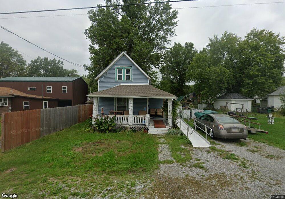
1420 Leland Ave Lima, OH 45805
Central Lima NeighborhoodEstimated Value: $92,571 - $147,000
4
Beds
2
Baths
1,505
Sq Ft
$80/Sq Ft
Est. Value
About This Home
This home is located at 1420 Leland Ave, Lima, OH 45805 and is currently estimated at $120,893, approximately $80 per square foot. 1420 Leland Ave is a home located in Allen County with nearby schools including Heritage Elementary School, Lima West Middle School, and Lima North Middle School.
Ownership History
Date
Name
Owned For
Owner Type
Purchase Details
Closed on
Oct 9, 2023
Sold by
Mcvicker Peggy A and Mcvicker James
Bought by
Woods William M and Woods Canoy J
Current Estimated Value
Purchase Details
Closed on
Apr 4, 2017
Sold by
Combs Larry D and Combs Linda
Bought by
Mcvicker Peggy A and Mcvicker James
Purchase Details
Closed on
Jan 1, 1982
Bought by
Combs Ruth
Create a Home Valuation Report for This Property
The Home Valuation Report is an in-depth analysis detailing your home's value as well as a comparison with similar homes in the area
Home Values in the Area
Average Home Value in this Area
Purchase History
| Date | Buyer | Sale Price | Title Company |
|---|---|---|---|
| Woods William M | $39,900 | None Listed On Document | |
| Mcvicker Peggy A | -- | None Available | |
| Combs Ruth | $5,000 | -- |
Source: Public Records
Tax History Compared to Growth
Tax History
| Year | Tax Paid | Tax Assessment Tax Assessment Total Assessment is a certain percentage of the fair market value that is determined by local assessors to be the total taxable value of land and additions on the property. | Land | Improvement |
|---|---|---|---|---|
| 2024 | $825 | $21,950 | $3,290 | $18,660 |
| 2023 | $757 | $16,870 | $2,520 | $14,350 |
| 2022 | $760 | $16,870 | $2,520 | $14,350 |
| 2021 | $802 | $16,870 | $2,520 | $14,350 |
| 2020 | $688 | $13,200 | $2,450 | $10,750 |
| 2019 | $688 | $12,670 | $2,450 | $10,220 |
| 2018 | $677 | $12,670 | $2,450 | $10,220 |
| 2017 | $645 | $11,730 | $2,450 | $9,280 |
| 2016 | $649 | $11,730 | $2,450 | $9,280 |
| 2015 | $595 | $11,730 | $2,450 | $9,280 |
| 2014 | $595 | $10,580 | $2,560 | $8,020 |
| 2013 | $580 | $10,580 | $2,560 | $8,020 |
Source: Public Records
Map
Nearby Homes
- 621 Fairfield Dr
- 1206 Rice Ave
- 1517 Allentown Rd
- 1120 Richie Ave
- 1023 Leland Ave
- 1703 W Wayne St
- 1719 Latham Ave
- 918 Cornell Dr
- 1753 Leland Ave
- 0 Sherman Ave
- 618 Woodward Ave
- 1036 W High St
- 120 S Woodlawn Ave
- 1459 W Market St
- 676 Cortlandt Ave
- 1630 W Market St
- 109 N Pears Ave
- 2100 University Blvd
- 102 Charwood Dr
- 765 Ewing Ave