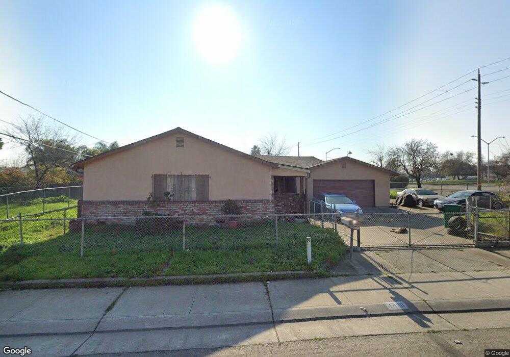
1420 Michael Ave Stockton, CA 95206
Kennedy NeighborhoodEstimated Value: $318,000 - $386,000
3
Beds
2
Baths
1,456
Sq Ft
$237/Sq Ft
Est. Value
About This Home
This home is located at 1420 Michael Ave, Stockton, CA 95206 and is currently estimated at $345,482, approximately $237 per square foot. 1420 Michael Ave is a home located in San Joaquin County with nearby schools including Van Buren Elementary School, Alexander Hamilton Elementary, and Monroe Elementary School.
Ownership History
Date
Name
Owned For
Owner Type
Purchase Details
Closed on
Jan 8, 2025
Sold by
Clear Recon Corp
Bought by
Secretary Of Housing And Urban Development
Current Estimated Value
Purchase Details
Closed on
Jan 26, 2004
Sold by
Roots Theadois
Bought by
Roots Theadois and Roots Louise
Home Financials for this Owner
Home Financials are based on the most recent Mortgage that was taken out on this home.
Original Mortgage
$153,000
Interest Rate
5.79%
Mortgage Type
New Conventional
Purchase Details
Closed on
Feb 8, 1996
Sold by
Roots Theadois
Bought by
Roots Louise
Home Financials for this Owner
Home Financials are based on the most recent Mortgage that was taken out on this home.
Original Mortgage
$39,515
Interest Rate
7.14%
Create a Home Valuation Report for This Property
The Home Valuation Report is an in-depth analysis detailing your home's value as well as a comparison with similar homes in the area
Home Values in the Area
Average Home Value in this Area
Purchase History
| Date | Buyer | Sale Price | Title Company |
|---|---|---|---|
| Secretary Of Housing And Urban Development | $386,293 | Alliance Title | |
| Roots Theadois | -- | First Amer Title Co | |
| Roots Theadois | -- | First Amer Title Co | |
| Roots Louise | -- | Alliance Title Company |
Source: Public Records
Mortgage History
| Date | Status | Borrower | Loan Amount |
|---|---|---|---|
| Previous Owner | Roots Theadois | $153,000 | |
| Previous Owner | Roots Louise | $39,515 |
Source: Public Records
Tax History Compared to Growth
Tax History
| Year | Tax Paid | Tax Assessment Tax Assessment Total Assessment is a certain percentage of the fair market value that is determined by local assessors to be the total taxable value of land and additions on the property. | Land | Improvement |
|---|---|---|---|---|
| 2025 | $666 | $57,279 | $5,879 | $51,400 |
| 2024 | $653 | $56,157 | $5,764 | $50,393 |
| 2023 | $637 | $55,056 | $5,651 | $49,405 |
| 2022 | $620 | $53,978 | $5,541 | $48,437 |
| 2021 | $595 | $52,921 | $5,433 | $47,488 |
| 2020 | $604 | $52,380 | $5,378 | $47,002 |
| 2019 | $600 | $51,354 | $5,273 | $46,081 |
| 2018 | $587 | $50,348 | $5,170 | $45,178 |
| 2017 | $555 | $49,362 | $5,069 | $44,293 |
| 2016 | $562 | $48,395 | $4,970 | $43,425 |
| 2014 | $534 | $46,734 | $4,799 | $41,935 |
Source: Public Records
Map
Nearby Homes
- 3204 Volney St
- 3028 Malisa Way
- 1711 Benedino Cir
- 3349 Zamora Way
- 3338 Zamora Way
- 2427 S Pilgrim St
- 1646 E 8th St
- 1521 Spring St
- 2121 Scribner St
- 2150 Michael Ave
- 1105 E 7th St
- 2041 Superior St
- 2033 Superior St
- 2213 Peralta Ave
- 2211 Peralta Ave
- 2040 Sikh Temple St
- 719 Hyde Ct
- 2288 E Loomis Rd
- 2318 E Loomis Rd
- 2321 Amboy Ave
- 3003 Phelps St
- 3011 Phelps St
- 2944 S Airport Way
- 3019 Phelps St
- 3036 S Airport Way
- 3027 Phelps St
- 2935 Phelps St
- 3044 S Airport Way
- 3035 Phelps St
- 2929 Phelps St
- 3043 Phelps St
- 3052 S Airport Way Unit 1
- 3051 Phelps St
- 2921 Phelps St
- 3060 S Airport Way
- 1451 Michael Ave
- 1408 Bandoni Dr
- 3012 Phelps St
- 3022 Phelps St
- 3059 Phelps St