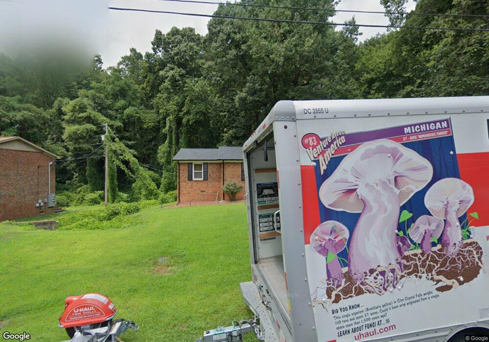
1420 Nottingham Rd Kannapolis, NC 28081
Estimated Value: $214,000 - $238,740
3
Beds
2
Baths
1,076
Sq Ft
$208/Sq Ft
Est. Value
About This Home
This home is located at 1420 Nottingham Rd, Kannapolis, NC 28081 and is currently estimated at $223,685, approximately $207 per square foot. 1420 Nottingham Rd is a home located in Cabarrus County with nearby schools including Shady Brook Elementary School, Kannapolis Middle, and A.L. Brown High School.
Ownership History
Date
Name
Owned For
Owner Type
Purchase Details
Closed on
Oct 20, 2016
Sold by
Fidai Shafique and Mamdani Fatima
Bought by
Davis Ronnie
Current Estimated Value
Home Financials for this Owner
Home Financials are based on the most recent Mortgage that was taken out on this home.
Original Mortgage
$4,977
Outstanding Balance
$3,998
Interest Rate
3.44%
Mortgage Type
Unknown
Estimated Equity
$219,687
Purchase Details
Closed on
Apr 13, 2015
Sold by
Pope William D
Bought by
Wells Fargo Bank Na
Purchase Details
Closed on
Dec 15, 2003
Sold by
Pope William D and Pope Sharon P
Bought by
Pope William D
Purchase Details
Closed on
May 1, 1979
Bought by
Pope William D and Pope Sharon R
Create a Home Valuation Report for This Property
The Home Valuation Report is an in-depth analysis detailing your home's value as well as a comparison with similar homes in the area
Home Values in the Area
Average Home Value in this Area
Purchase History
| Date | Buyer | Sale Price | Title Company |
|---|---|---|---|
| Davis Ronnie | $102,000 | None Available | |
| Wells Fargo Bank Na | $26,765 | None Available | |
| Pope William D | -- | -- | |
| Pope William D | $37,500 | -- |
Source: Public Records
Mortgage History
| Date | Status | Borrower | Loan Amount |
|---|---|---|---|
| Open | Davis Ronnie | $4,977 | |
| Open | Davis Ronnie | $99,545 |
Source: Public Records
Tax History Compared to Growth
Tax History
| Year | Tax Paid | Tax Assessment Tax Assessment Total Assessment is a certain percentage of the fair market value that is determined by local assessors to be the total taxable value of land and additions on the property. | Land | Improvement |
|---|---|---|---|---|
| 2025 | $2,673 | $235,420 | $60,000 | $175,420 |
| 2024 | $2,673 | $235,420 | $60,000 | $175,420 |
| 2023 | $1,736 | $126,720 | $45,000 | $81,720 |
| 2022 | $1,736 | $126,720 | $45,000 | $81,720 |
| 2021 | $1,736 | $126,720 | $45,000 | $81,720 |
| 2020 | $1,736 | $126,720 | $45,000 | $81,720 |
| 2019 | $1,216 | $88,760 | $19,000 | $69,760 |
| 2018 | $1,198 | $88,760 | $19,000 | $69,760 |
| 2017 | $1,164 | $87,520 | $19,000 | $68,520 |
| 2016 | $1,164 | $84,950 | $22,000 | $62,950 |
| 2015 | $1,070 | $84,950 | $22,000 | $62,950 |
| 2014 | $1,070 | $84,950 | $22,000 | $62,950 |
Source: Public Records
Map
Nearby Homes
- 1408 Nottingham Rd
- 1441 Sherwood Dr
- 1003 Robinhood Ln
- 1620 Longbow Dr
- 1418 Oakwood Ave
- 1410 Oakwood Ave
- 1110 Rogers Lake Rd
- 1229 Brecken Ct
- 1200 Berkshire Dr
- 915 Sprucewood St
- 1208 Berkshire Dr
- 703 Brookcrest Dr
- 1209 Derbyshire Rd
- 1408 Wildwood Dr
- 00 Sapp Rd
- 1828 Independence Square
- 1010 Sprucewood St
- 1693 Azalea Ave
- 2009 Independence Square
- 1309 Red Birch Place
- 1422 Nottingham Rd
- 1424 Nottingham Rd
- 1428 Nottingham Rd
- 1468 Sherwood Dr
- 1416 Nottingham Rd
- 1421 Nottingham Rd
- 1470 Sherwood Dr
- 1419 Nottingham Rd
- 1426 Sherwood Dr
- 1417 Nottingham Rd
- 1422 Sherwood Dr
- 1414 Nottingham Rd
- 1437 Sherwood Dr
- 1472 Sherwood Dr
- 1415 Nottingham Rd
- 1431 Sherwood Dr
- 1429 Sherwood Dr
- 1433 Sherwood Dr
- 1412 Nottingham Rd
- 1448 Sherwood Dr
