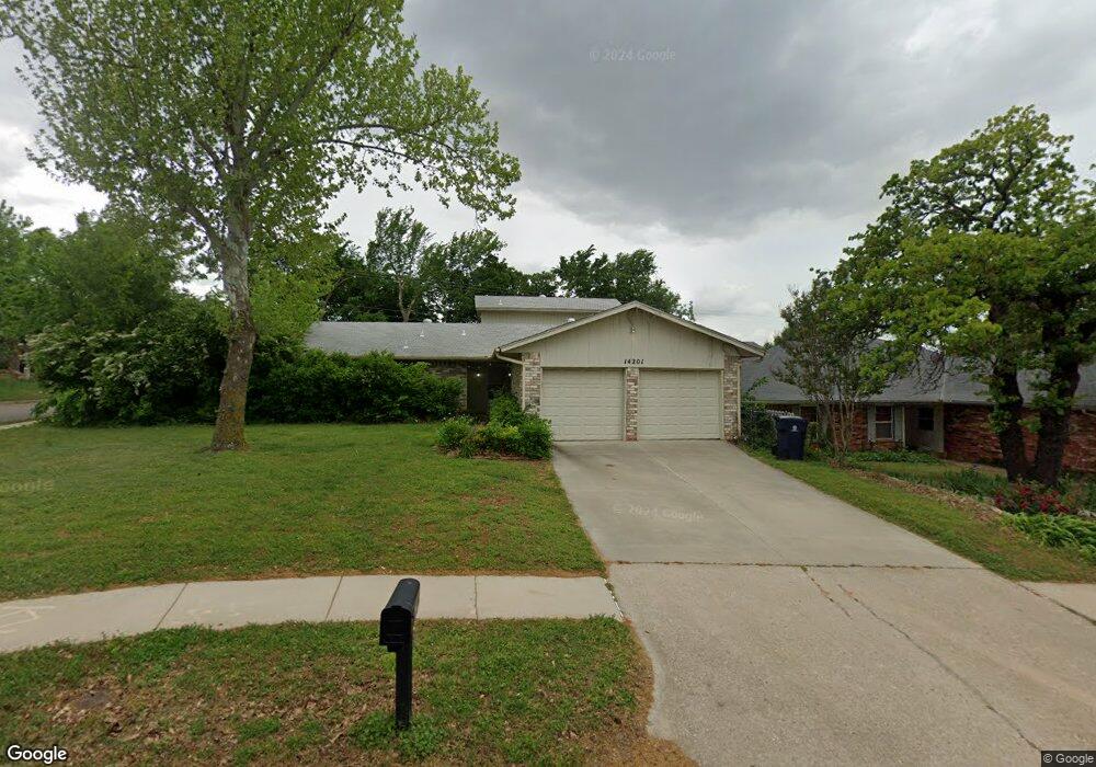
14201 Scott St Edmond, OK 73013
Chisholm NeighborhoodEstimated Value: $252,000 - $281,218
3
Beds
3
Baths
1,939
Sq Ft
$139/Sq Ft
Est. Value
About This Home
This home is located at 14201 Scott St, Edmond, OK 73013 and is currently estimated at $269,555, approximately $139 per square foot. 14201 Scott St is a home located in Oklahoma County with nearby schools including Chisholm Elementary School, Cimarron Middle School, and Memorial High School.
Ownership History
Date
Name
Owned For
Owner Type
Purchase Details
Closed on
Aug 12, 2015
Sold by
Beckloff Patricia J and Beckloff Kenneth E
Bought by
Contreras Michele Eliz and Contreras C
Current Estimated Value
Home Financials for this Owner
Home Financials are based on the most recent Mortgage that was taken out on this home.
Original Mortgage
$149,246
Outstanding Balance
$117,779
Interest Rate
4.13%
Mortgage Type
FHA
Estimated Equity
$151,776
Purchase Details
Closed on
May 24, 1999
Sold by
Rice Barry T and Mayo Delbert Robert
Bought by
Beckloff Kenneth and Beckloff Patricia J
Create a Home Valuation Report for This Property
The Home Valuation Report is an in-depth analysis detailing your home's value as well as a comparison with similar homes in the area
Home Values in the Area
Average Home Value in this Area
Purchase History
| Date | Buyer | Sale Price | Title Company |
|---|---|---|---|
| Contreras Michele Eliz | $152,000 | Oklahoma City Abstract | |
| Beckloff Kenneth | $102,000 | -- |
Source: Public Records
Mortgage History
| Date | Status | Borrower | Loan Amount |
|---|---|---|---|
| Open | Contreras Michele Eliz | $149,246 |
Source: Public Records
Tax History Compared to Growth
Tax History
| Year | Tax Paid | Tax Assessment Tax Assessment Total Assessment is a certain percentage of the fair market value that is determined by local assessors to be the total taxable value of land and additions on the property. | Land | Improvement |
|---|---|---|---|---|
| 2024 | $2,385 | $21,671 | $3,031 | $18,640 |
| 2023 | $2,385 | $21,039 | $3,126 | $17,913 |
| 2022 | $2,333 | $20,426 | $2,723 | $17,703 |
| 2021 | $2,239 | $19,832 | $2,974 | $16,858 |
| 2020 | $2,202 | $19,255 | $3,169 | $16,086 |
| 2019 | $2,147 | $18,694 | $3,112 | $15,582 |
| 2018 | $2,093 | $18,150 | $0 | $0 |
| 2017 | $2,050 | $17,901 | $2,857 | $15,044 |
| 2016 | $1,976 | $17,379 | $2,861 | $14,518 |
| 2015 | $1,858 | $16,314 | $2,796 | $13,518 |
| 2014 | $1,796 | $15,839 | $2,763 | $13,076 |
Source: Public Records
Map
Nearby Homes
- 3605 NE 141st Ct
- 3812 NE 140th Terrace Cir
- 3725 NE 140th St
- 14213 Pecan Hollow Terrace
- 13925 Middleberry Rd
- 3712 Spring Hill Dr
- 1913 Walking Sky Rd
- 3810 Marked Tree Dr
- 4108 NE 141st St
- 3600 Smoky Hollow Rd
- 13817 Crest Glen Rd
- 13917 Briarwyck
- 4213 NE 143rd St
- 3512 Lytal Ln
- 13509 Silver Eagle Trail
- 3701 Summer Cloud Dr
- 2902 Village Cir
- 3405 Lytal Ln
- 1816 Smoky Hollow Rd
- 3317 Hunting Hawk Cir
- 14205 Scott St
- 14200 Oxford Dr
- 14117 Scott St
- 14209 Scott St
- 14208 Scott St
- 3601 NE 140th Terrace Ct
- 14116 Oxford Dr
- 14208 Oxford Dr
- 14113 Scott St
- 14213 Scott St
- 3604 NE 141st Ct
- 14212 Scott St
- 3605 NE 140th Terrace Ct
- 14112 Oxford Dr
- 14212 Oxford Dr
- 14109 Scott St
- 14217 Scott St
- 3508 NE 141st St
- 3608 NE 141st Ct
- 3600 NE 140th Terrace Ct