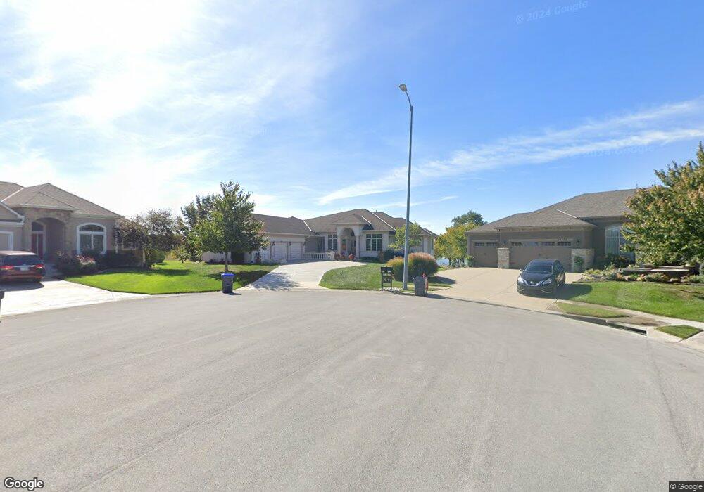
14207 Independence Ct Basehor, KS 66007
Estimated Value: $810,000 - $1,048,000
5
Beds
5
Baths
2,511
Sq Ft
$367/Sq Ft
Est. Value
About This Home
This home is located at 14207 Independence Ct, Basehor, KS 66007 and is currently estimated at $921,097, approximately $366 per square foot. 14207 Independence Ct is a home located in Leavenworth County with nearby schools including Basehor Elementary School, Basehor-Linwood Middle School, and Basehor-Linwood High School.
Ownership History
Date
Name
Owned For
Owner Type
Purchase Details
Closed on
May 23, 2024
Sold by
Day3 Development Llc
Bought by
Mcqueen Homes And Rv Inc
Current Estimated Value
Home Financials for this Owner
Home Financials are based on the most recent Mortgage that was taken out on this home.
Original Mortgage
$524,000
Outstanding Balance
$516,653
Interest Rate
6.88%
Mortgage Type
Construction
Estimated Equity
$404,444
Purchase Details
Closed on
Feb 6, 2008
Sold by
K & P Homes Inc
Bought by
Dugan Karen J
Create a Home Valuation Report for This Property
The Home Valuation Report is an in-depth analysis detailing your home's value as well as a comparison with similar homes in the area
Home Values in the Area
Average Home Value in this Area
Purchase History
| Date | Buyer | Sale Price | Title Company |
|---|---|---|---|
| Mcqueen Homes And Rv Inc | -- | Security 1St Title | |
| Dugan Karen J | $521,250 | Kansas City Title |
Source: Public Records
Mortgage History
| Date | Status | Borrower | Loan Amount |
|---|---|---|---|
| Open | Mcqueen Homes And Rv Inc | $524,000 |
Source: Public Records
Tax History Compared to Growth
Tax History
| Year | Tax Paid | Tax Assessment Tax Assessment Total Assessment is a certain percentage of the fair market value that is determined by local assessors to be the total taxable value of land and additions on the property. | Land | Improvement |
|---|---|---|---|---|
| 2025 | $14,683 | $104,925 | $21,798 | $83,127 |
| 2024 | $13,642 | $101,869 | $21,798 | $80,071 |
| 2023 | $13,642 | $98,916 | $16,838 | $82,078 |
| 2022 | $13,236 | $91,606 | $18,216 | $73,390 |
| 2021 | $11,231 | $78,114 | $15,180 | $62,934 |
| 2020 | $10,412 | $71,197 | $15,180 | $56,017 |
| 2019 | $10,297 | $71,197 | $8,867 | $62,330 |
| 2018 | $10,549 | $67,818 | $8,867 | $58,951 |
| 2017 | $9,977 | $63,561 | $8,867 | $54,694 |
| 2016 | $9,577 | $61,116 | $8,867 | $52,249 |
| 2015 | $9,102 | $59,801 | $8,867 | $50,934 |
| 2014 | $9,022 | $59,800 | $8,018 | $51,782 |
Source: Public Records
Map
Nearby Homes
- 4310 N 141st Place
- 4270 Lake Shore Dr
- 4271 Aspen Dr
- 4250 Aspen Dr
- 4417 N 141st St
- 4248 Lake Shore Dr
- 4418 Tee Box Dr
- 4151 Lake Shore Dr
- The Azalea I Plan at The Communities of Falcon Lakes - Falcon Lakes
- 14574 Aurora Ln
- 4145 Lake Shore Dr
- 4282 Lake Shore Dr
- Yorkshire V Plan at The Communities of Falcon Lakes - The Communities at Falcon Lakes
- Ashwood Plan at The Communities of Falcon Lakes - The Communities at Falcon Lakes
- Cypress II Plan at The Communities of Falcon Lakes - The Communities at Falcon Lakes
- The York Plan at The Communities of Falcon Lakes - The Communties of Falcon Lakes
- The Wyndham V Plan at The Communities of Falcon Lakes - The Communties of Falcon Lakes
- The Wyndham II Plan at The Communities of Falcon Lakes - The Communties of Falcon Lakes
- The Timberland Reverse Plan at The Communities of Falcon Lakes - The Communties of Falcon Lakes
- The Timberland Expanded Plan at The Communities of Falcon Lakes - The Communties of Falcon Lakes
- 14205 Independence Ct
- 14208 Independence Ct
- 4308 N 141st Place
- 4306 N 141st Ct
- 14206 Independence Ct
- 14203 Independence Ct
- 4410 N 142nd St
- 14204 Independence Ct
- 14202 Independence Ct
- 4309 N 141st Place
- 4301 N 141st Ct
- 4309 N 141st Place
- 4418 N 142nd St
- 4413 N 142nd St
- 4311 N 141st Place
- 4415 N 142nd St
- 4303 N 141st Ct
- 4307 N 141st Ct
- 4420 N 142nd St
- 4305 N 141st Ct