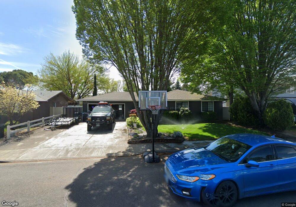
1421 Timothy St Central Point, OR 97502
Estimated Value: $356,961 - $371,000
3
Beds
2
Baths
1,236
Sq Ft
$294/Sq Ft
Est. Value
About This Home
This home is located at 1421 Timothy St, Central Point, OR 97502 and is currently estimated at $363,740, approximately $294 per square foot. 1421 Timothy St is a home located in Jackson County with nearby schools including Richardson Elementary School, Scenic Middle School, and Crater High School.
Ownership History
Date
Name
Owned For
Owner Type
Purchase Details
Closed on
Dec 1, 2000
Sold by
Brown Colleen J
Bought by
Brown Keith H
Current Estimated Value
Home Financials for this Owner
Home Financials are based on the most recent Mortgage that was taken out on this home.
Original Mortgage
$90,000
Interest Rate
7.66%
Create a Home Valuation Report for This Property
The Home Valuation Report is an in-depth analysis detailing your home's value as well as a comparison with similar homes in the area
Home Values in the Area
Average Home Value in this Area
Purchase History
| Date | Buyer | Sale Price | Title Company |
|---|---|---|---|
| Brown Keith H | -- | Jackson County Title |
Source: Public Records
Mortgage History
| Date | Status | Borrower | Loan Amount |
|---|---|---|---|
| Closed | Brown Keith H | $90,000 |
Source: Public Records
Tax History Compared to Growth
Tax History
| Year | Tax Paid | Tax Assessment Tax Assessment Total Assessment is a certain percentage of the fair market value that is determined by local assessors to be the total taxable value of land and additions on the property. | Land | Improvement |
|---|---|---|---|---|
| 2025 | $3,233 | $194,430 | $79,470 | $114,960 |
| 2024 | $3,233 | $188,770 | $77,160 | $111,610 |
| 2023 | $3,129 | $183,280 | $74,920 | $108,360 |
| 2022 | $3,056 | $183,280 | $74,920 | $108,360 |
| 2021 | $2,968 | $177,950 | $72,740 | $105,210 |
| 2020 | $2,882 | $172,770 | $70,620 | $102,150 |
| 2019 | $2,811 | $162,860 | $66,560 | $96,300 |
| 2018 | $2,725 | $158,120 | $64,620 | $93,500 |
| 2017 | $2,657 | $158,120 | $64,620 | $93,500 |
| 2016 | $2,579 | $149,050 | $60,900 | $88,150 |
| 2015 | $2,471 | $149,050 | $60,900 | $88,150 |
| 2014 | $2,248 | $136,870 | $42,730 | $94,140 |
Source: Public Records
Map
Nearby Homes
- 739 S Haskell St
- 3364 Snowy Butte Ln
- 887 Silver Fox Dr
- 114 Cedar St
- 755 S 4th St
- 871 Holley Way
- 895 Holley Way
- 1065 Edwina Ave
- 350 Alder St
- 349 W Pine St
- 531 Bush St
- 3496 Edella St
- 487 Creekside Cir
- 21 Hickory Ln
- 3364 Bursell Rd
- 659 Jackson Creek Dr
- 555 Freeman Rd Unit 128
- 555 Freeman Rd Unit 146
- 555 Freeman Rd Unit 204
- 555 Freeman Rd Unit 209
- 1425 Timothy St Unit 2
- 1417 Timothy St
- 618 Farnsworth Dr
- 610 Farnsworth Dr
- 603 Malabar St
- 626 Farnsworth Dr
- 611 Malabar St
- 1426 Timothy St
- 1420 Timothy St
- 619 Malabar St
- 1496 Timothy St
- 1416 Timothy St
- 607 Farnsworth Dr
- 634 Farnsworth Dr
- 627 Malabar St
- 613 Farnsworth Dr
- 1570 Timothy St
- 601 Farnsworth Dr
- 585 Chicory Ln
- 1182 Lindsey Ct