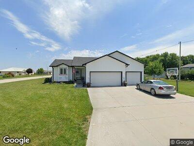
1421 West St Unit WR Wood River, NE 68883
Estimated Value: $278,000 - $332,000
3
Beds
3
Baths
1,346
Sq Ft
$230/Sq Ft
Est. Value
About This Home
This home is located at 1421 West St Unit WR, Wood River, NE 68883 and is currently estimated at $308,952, approximately $229 per square foot. 1421 West St Unit WR is a home located in Hall County with nearby schools including Wood River Elementary School, Wood River Rural Middle School, and Wood River Rural High School.
Ownership History
Date
Name
Owned For
Owner Type
Purchase Details
Closed on
Mar 26, 2010
Sold by
Hayes Hayes & Soto Invest Llc
Bought by
Morgan Jamie A and Morgan Mandi J
Current Estimated Value
Home Financials for this Owner
Home Financials are based on the most recent Mortgage that was taken out on this home.
Original Mortgage
$162,011
Interest Rate
4.93%
Mortgage Type
FHA
Purchase Details
Closed on
Mar 19, 2010
Sold by
Hayes & Soto Investments Llc
Bought by
Morgan Jamie A and Morgan Mandi J
Home Financials for this Owner
Home Financials are based on the most recent Mortgage that was taken out on this home.
Original Mortgage
$162,011
Interest Rate
4.93%
Mortgage Type
FHA
Purchase Details
Closed on
Aug 3, 2007
Sold by
Thelen Grain Co
Bought by
Hayes Hayes & Soto Invest Llc
Create a Home Valuation Report for This Property
The Home Valuation Report is an in-depth analysis detailing your home's value as well as a comparison with similar homes in the area
Home Values in the Area
Average Home Value in this Area
Purchase History
| Date | Buyer | Sale Price | Title Company |
|---|---|---|---|
| Morgan Jamie A | $165,000 | -- | |
| Morgan Jamie A | $165,000 | -- | |
| Hayes Hayes & Soto Invest Llc | $34,374 | -- |
Source: Public Records
Mortgage History
| Date | Status | Borrower | Loan Amount |
|---|---|---|---|
| Open | Morgan Jamie A | $162,666 | |
| Closed | Morgan Jamie A | $162,011 | |
| Previous Owner | Hayes & Soto Investment Llc | $126,113 |
Source: Public Records
Tax History Compared to Growth
Tax History
| Year | Tax Paid | Tax Assessment Tax Assessment Total Assessment is a certain percentage of the fair market value that is determined by local assessors to be the total taxable value of land and additions on the property. | Land | Improvement |
|---|---|---|---|---|
| 2024 | $4,167 | $266,918 | $13,923 | $252,995 |
| 2023 | $4,167 | $211,841 | $13,923 | $197,918 |
| 2022 | $4,496 | $211,151 | $13,233 | $197,918 |
| 2021 | $4,468 | $211,151 | $13,233 | $197,918 |
| 2020 | $3,640 | $211,151 | $13,233 | $197,918 |
| 2019 | $3,603 | $174,761 | $13,233 | $161,528 |
| 2017 | $3,234 | $173,524 | $13,233 | $160,291 |
| 2016 | $3,249 | $173,524 | $13,233 | $160,291 |
| 2015 | $3,269 | $162,260 | $16,541 | $145,719 |
| 2014 | $3,117 | $155,644 | $9,925 | $145,719 |
Source: Public Records
Map
Nearby Homes
- 1508 Marshall Ct
- 307 W Green St Unit WR
- 1508 Marshall St
- Lot 14 Thelen St
- Lot 13 Thelen St
- Lot 11 Thelen St
- Lot 9 Thelen St
- Lot 8 Thelen St
- Lot 10 Thelen St
- Lot 12 Thelen St
- 1112 East St Unit WR
- 1010 East St Unit WR
- 1007 Walnut St Unit WR
- 511 Walnut St
- 1104 Harrison St
- 805 Cottonwood St
- 806 Cottonwood St
- 13263 W Giza Ave
- 13325 W Giza Ave
- 13367 W Giza Ave
- 1421 West St Unit WR
- 107 W Green St Unit WR
- N/A Green St
- 207 W Green
- 1503 West St Unit WR
- 1409 West St Unit WR
- 1420 West St Unit WR
- 103 W Green St Unit WR
- 1410 West St Unit WR
- 1502 West St Unit WR
- 1407 West St Unit WR
- 207 W Green St Unit WR
- 1408 West St Unit WR
- 1406 Main St Unit WR
- 1405 West St Unit WR
- 103 E Green
- 1409 Marshall St Unit WR
- 1421 Marshall St Unit WR
- 1404 Main St Unit WR
- 1404 West St Unit WR