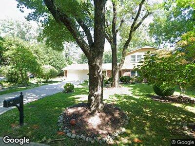
14217 Burning Bush Ln Silver Spring, MD 20906
Hermitage Park NeighborhoodEstimated Value: $609,051 - $747,000
--
Bed
3
Baths
2,456
Sq Ft
$276/Sq Ft
Est. Value
About This Home
This home is located at 14217 Burning Bush Ln, Silver Spring, MD 20906 and is currently estimated at $677,763, approximately $275 per square foot. 14217 Burning Bush Ln is a home located in Montgomery County with nearby schools including Bel Pre Elementary School, Strathmore Elementary School, and Argyle Middle School.
Ownership History
Date
Name
Owned For
Owner Type
Purchase Details
Closed on
Feb 7, 2006
Sold by
Muhawi Hiam F
Bought by
Muhawi Hiam F
Current Estimated Value
Purchase Details
Closed on
Sep 6, 2005
Sold by
Muhawi Hiam F
Bought by
Muhawi Hiam F
Home Financials for this Owner
Home Financials are based on the most recent Mortgage that was taken out on this home.
Original Mortgage
$337,000
Interest Rate
5.75%
Mortgage Type
Stand Alone Refi Refinance Of Original Loan
Create a Home Valuation Report for This Property
The Home Valuation Report is an in-depth analysis detailing your home's value as well as a comparison with similar homes in the area
Home Values in the Area
Average Home Value in this Area
Purchase History
| Date | Buyer | Sale Price | Title Company |
|---|---|---|---|
| Muhawi Hiam F | -- | -- | |
| Muhawi Hiam F | -- | -- |
Source: Public Records
Mortgage History
| Date | Status | Borrower | Loan Amount |
|---|---|---|---|
| Open | Muhawi Hiam F | $269,000 | |
| Closed | Muhawi Hiam | $280,470 | |
| Closed | Muhawi Hiam | $287,000 | |
| Previous Owner | Muhawi Hiam F | $337,000 |
Source: Public Records
Tax History Compared to Growth
Tax History
| Year | Tax Paid | Tax Assessment Tax Assessment Total Assessment is a certain percentage of the fair market value that is determined by local assessors to be the total taxable value of land and additions on the property. | Land | Improvement |
|---|---|---|---|---|
| 2024 | $6,306 | $484,300 | $0 | $0 |
| 2023 | $6,581 | $450,100 | $0 | $0 |
| 2022 | $4,551 | $415,900 | $179,900 | $236,000 |
| 2021 | $4,347 | $411,233 | $0 | $0 |
| 2020 | $4,347 | $406,567 | $0 | $0 |
| 2019 | $4,260 | $401,900 | $179,900 | $222,000 |
| 2018 | $4,095 | $389,067 | $0 | $0 |
| 2017 | $4,018 | $376,233 | $0 | $0 |
| 2016 | -- | $363,400 | $0 | $0 |
| 2015 | $3,801 | $363,400 | $0 | $0 |
| 2014 | $3,801 | $363,400 | $0 | $0 |
Source: Public Records
Map
Nearby Homes
- 14208 Burning Bush Ln
- 2727 Bel Pre Rd
- 14333 Bel Pre Dr
- 14301 Astrodome Dr
- 14311 Astrodome Dr
- 2350 Sun Valley Cir Unit 2C
- 2456 Sun Valley Cir Unit 7M
- 2405 Sun Valley Cir
- 2346 Sun Valley Cir Unit 2-A
- 2700 Bellmawr Ct
- 13909 Broomall Ln
- 14702 Lindsey Ln
- 14527 Kelmscot Dr
- 14206 Plum Run Way
- 3109 Birchtree Ln
- 2841 Aquarius Ave
- 3004 Bluff Point Ln
- 2109 Wagon Trail Place
- 3350 Chiswick Ct Unit 571C
- 3350 Chiswick Ct Unit 573C
- 14217 Burning Bush Ln
- 14213 Burning Bush Ln
- 14221 Burning Bush Ln
- 2812 Bel Pre Rd
- 2808 Bel Pre Rd
- 2816 Bel Pre Rd
- 14212 Burning Bush Ln
- 14209 Burning Bush Ln
- 14225 Burning Bush Ln
- 14216 Burning Bush Ln
- 2804 Bel Pre Rd
- 2820 Bel Pre Rd
- 14220 Burning Bush Ln
- 2805 Bel Pre Rd
- 2801 Village Ln
- 2805 Village Ln
- 2800 Bel Pre Rd
- 2916 Beaverwood Ln
- 2809 Village Ln
- 2801 Bel Pre Rd
