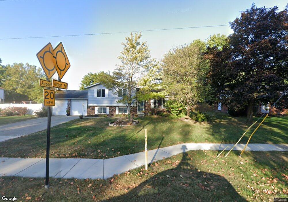
1422 Hornaday Rd Brownsburg, IN 46112
Estimated Value: $389,000 - $490,000
4
Beds
4
Baths
3,600
Sq Ft
$125/Sq Ft
Est. Value
About This Home
This home is located at 1422 Hornaday Rd, Brownsburg, IN 46112 and is currently estimated at $451,696, approximately $125 per square foot. 1422 Hornaday Rd is a home located in Hendricks County with nearby schools including Reagan Elementary School, Brownsburg East Middle School, and Brownsburg High School.
Ownership History
Date
Name
Owned For
Owner Type
Purchase Details
Closed on
Jun 4, 2020
Sold by
Hill Daniel H and Hill Jennifer L
Bought by
Town Of Brownsburg
Current Estimated Value
Purchase Details
Closed on
Sep 30, 2015
Sold by
Mahoney Gary L and Mahoney Vicki S
Bought by
Hill Daniel H and Hill Jennifer L
Home Financials for this Owner
Home Financials are based on the most recent Mortgage that was taken out on this home.
Original Mortgage
$201,872
Interest Rate
3.91%
Mortgage Type
FHA
Create a Home Valuation Report for This Property
The Home Valuation Report is an in-depth analysis detailing your home's value as well as a comparison with similar homes in the area
Home Values in the Area
Average Home Value in this Area
Purchase History
| Date | Buyer | Sale Price | Title Company |
|---|---|---|---|
| Town Of Brownsburg | $16,870 | None Available | |
| Hill Daniel H | -- | -- |
Source: Public Records
Mortgage History
| Date | Status | Borrower | Loan Amount |
|---|---|---|---|
| Previous Owner | Hill Daniel H | $201,872 |
Source: Public Records
Tax History Compared to Growth
Tax History
| Year | Tax Paid | Tax Assessment Tax Assessment Total Assessment is a certain percentage of the fair market value that is determined by local assessors to be the total taxable value of land and additions on the property. | Land | Improvement |
|---|---|---|---|---|
| 2024 | $4,370 | $437,000 | $52,800 | $384,200 |
| 2023 | $4,065 | $406,500 | $47,800 | $358,700 |
| 2022 | $3,661 | $366,100 | $45,400 | $320,700 |
| 2021 | $3,182 | $318,200 | $42,900 | $275,300 |
| 2020 | $2,781 | $278,100 | $42,900 | $235,200 |
| 2019 | $2,529 | $252,900 | $38,800 | $214,100 |
| 2018 | $2,489 | $248,000 | $38,800 | $209,200 |
| 2017 | $2,365 | $235,600 | $37,300 | $198,300 |
| 2016 | $2,273 | $226,400 | $37,300 | $189,100 |
| 2014 | $2,150 | $214,000 | $35,500 | $178,500 |
Source: Public Records
Map
Nearby Homes
- 3 Fairwood Dr
- 56 Presidential Way
- 1628 Woodstock Dr
- 5 Roselawn Ave
- 35 Fairwood Dr
- 29 Robinwood Dr
- 1711 Hunters Trail
- 1027 Plum St Unit 39
- 1030 Woodridge Unit 52
- 1031 Woodridge
- 1139 Brunes Blvd Unit 139
- 1119 Manchester Dr Unit 188
- 3947 Wren Dr
- 3931 Wren Dr
- 8542 Goldfinch Rd
- 8524 Goldfinch Rd
- 8516 Goldfinch Rd
- 8520 Goldfinch Rd
- 8562 Goldfinch Rd
- 8558 Goldfinch Rd
- 1418 Hornaday Rd
- 900 Airport Rd
- 904 Airport Rd
- 1414 Hornaday Rd
- 1417 Beechwood Dr
- 1413 Beechwood Dr
- 1421 Beechwood Dr
- 1410 Hornaday Rd
- 1409 Beechwood Dr
- 1435 Hornaday Rd
- 1419 Hornaday Rd
- 1415 Hornaday Rd
- 1423 Hornaday Rd
- 1406 Hornaday Rd
- 1405 Beechwood Dr
- 1416 Beechwood Dr
- 1408 Beechwood Dr
- 8030 E County Road 400 N
- 44 Presidential Way
- 1420 Beechwood Dr