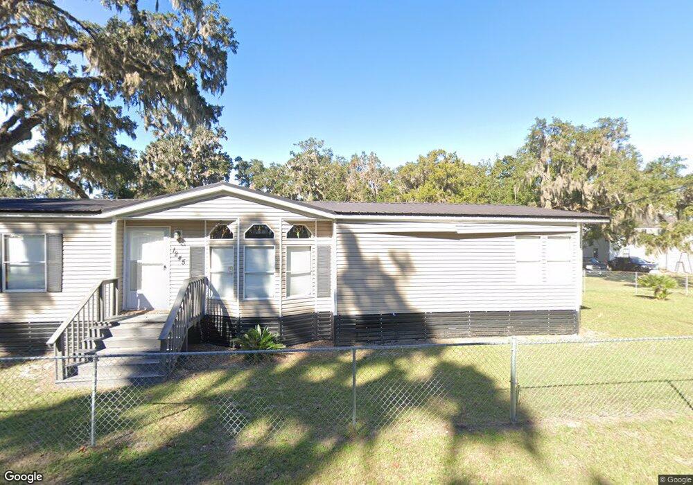
1422 Norman Ave NE Townsend, GA 31331
Crescent NeighborhoodEstimated Value: $83,000 - $165,000
Studio
--
Bath
--
Sq Ft
8,712
Sq Ft Lot
About This Home
This home is located at 1422 Norman Ave NE, Townsend, GA 31331 and is currently estimated at $112,333. 1422 Norman Ave NE is a home with nearby schools including Todd Grant Elementary School, McIntosh County Middle School, and McIntosh County Academy.
Ownership History
Date
Name
Owned For
Owner Type
Purchase Details
Closed on
Oct 3, 2024
Sold by
Cutsail Clarence Harvey
Bought by
Cutsail Family Revocable Trust
Current Estimated Value
Purchase Details
Closed on
Feb 13, 2013
Sold by
Fdic
Bought by
Cutsail Clarence H and Cutsail Edie L
Purchase Details
Closed on
Mar 13, 2012
Sold by
Tidal Water Properties Inc
Bought by
Montgomery Bank & Trust
Purchase Details
Closed on
Mar 8, 2012
Purchase Details
Closed on
Dec 4, 2007
Sold by
Randall Foy
Bought by
Tidal Water Properties Inc
Purchase Details
Closed on
Nov 27, 2007
Sold by
Randall Foy
Bought by
Tidal Water Properties Inc
Purchase Details
Closed on
Jul 9, 2007
Sold by
Swindell B Jay
Bought by
Randall Foy
Purchase Details
Closed on
Jan 13, 2006
Sold by
Randall Darrie C
Bought by
Swindell B Jay and Mccullough Hugh J
Purchase Details
Closed on
Jul 12, 2001
Sold by
Thompson Grace H
Bought by
Randall Darrie Etal
Create a Home Valuation Report for This Property
The Home Valuation Report is an in-depth analysis detailing your home's value as well as a comparison with similar homes in the area
Home Values in the Area
Average Home Value in this Area
Purchase History
| Date | Buyer | Sale Price | Title Company |
|---|---|---|---|
| Cutsail Family Revocable Trust | -- | -- | |
| Cutsail Clarence H | $10,000 | -- | |
| Montgomery Bank & Trust | -- | -- | |
| -- | $175,000 | -- | |
| Tidal Water Properties Inc | $260,000 | -- | |
| Tidal Water Properties Inc | $260,000 | -- | |
| Randall Foy | $225,000 | -- | |
| Swindell B Jay | $63,000 | -- | |
| Randall Darrie Etal | $50,000 | -- |
Source: Public Records
Tax History
| Year | Tax Paid | Tax Assessment Tax Assessment Total Assessment is a certain percentage of the fair market value that is determined by local assessors to be the total taxable value of land and additions on the property. | Land | Improvement |
|---|---|---|---|---|
| 2024 | $472 | $17,000 | $17,000 | $0 |
| 2023 | $186 | $6,680 | $6,600 | $80 |
| 2022 | $186 | $6,680 | $6,600 | $80 |
| 2021 | $178 | $6,680 | $6,600 | $80 |
| 2020 | $228 | $8,080 | $8,000 | $80 |
| 2019 | $215 | $8,080 | $8,000 | $80 |
| 2018 | $215 | $8,080 | $8,000 | $80 |
| 2017 | $290 | $9,680 | $9,600 | $80 |
| 2016 | $257 | $9,680 | $9,600 | $80 |
| 2015 | $215 | $8,080 | $8,000 | $80 |
| 2014 | $216 | $8,080 | $8,000 | $80 |
Source: Public Records
Map
Nearby Homes
- 1207 Lewis Ln NE
- 1334 Azalea Rd NE
- Lot 1 Thompson Rd NE
- 1237 Oneal Dr NE
- 1048 NE Sapelo Gardens Rd
- 1262 Sapelo Gardens
- 1090 Goldfinch Loop NE
- 3308 Fair Hope Rd NE
- Lot 45 Marsh Dr NE
- 0 Marsh Dr NE Unit SA351566
- 1156 Marsh Dr NE
- 1214 Shell Point Rd NE
- 0 Pelican Perch Rd
- 1106 Shell Point Rd NE
- 1304 Old Smokey
- 1057 Shell Point Rd NE
- 2050 Belle Hammock Rd NE
- 3558 Belle Hammock Rd NE
- LOT 230 Coopers Landind Dr NE
- 3217 Coopers Point Dr NE
- 1245 Cedar St NE
- 1346 Sapelo Ave NE
- 1259 N Cedar St NE
- 1429 Norman Ave NE
- 2463 C Norman
- 1195 Cedar St NE
- 1232 Cedar St NE
- 1031 Flounder Ln NE
- 1260 Cedar St NE
- 1345 Sapelo Ave NE
- Lot 1 Cedar St NE
- Lot 10 Cedar St NE
- Lot 9 Cedar St NE
- 1290 Cedar St NE
- 1227 River St NE
- 1381 Sapelo Ave NE
- 1381 Sapelo Ave NE
- 1193 River St NE
- 1418 Sapelo Ave NE
- 1300 Cedar St NE
Your Personal Tour Guide
Ask me questions while you tour the home.