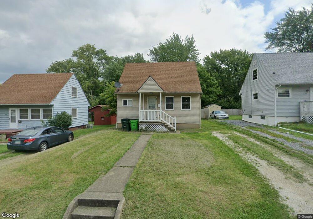
1422 Wade Ave Alliance, OH 44601
Estimated Value: $112,466 - $139,000
3
Beds
1
Bath
1,008
Sq Ft
$128/Sq Ft
Est. Value
About This Home
This home is located at 1422 Wade Ave, Alliance, OH 44601 and is currently estimated at $128,867, approximately $127 per square foot. 1422 Wade Ave is a home located in Stark County with nearby schools including Alliance Elementary School at Rockhill, Alliance Intermediate School at Northside, and Alliance Middle School.
Ownership History
Date
Name
Owned For
Owner Type
Purchase Details
Closed on
May 1, 2024
Sold by
Columbia Holdings Llc
Bought by
Jet Properties Of Ohio Llc
Current Estimated Value
Home Financials for this Owner
Home Financials are based on the most recent Mortgage that was taken out on this home.
Original Mortgage
$857,920
Outstanding Balance
$657,056
Interest Rate
6.87%
Mortgage Type
Credit Line Revolving
Estimated Equity
-$528,189
Purchase Details
Closed on
Jul 8, 2019
Bought by
Columbia Holdings Llc
Home Financials for this Owner
Home Financials are based on the most recent Mortgage that was taken out on this home.
Interest Rate
3.75%
Purchase Details
Closed on
Apr 4, 2017
Sold by
J Saleh Properties Llc
Bought by
Premier Home Inc
Home Financials for this Owner
Home Financials are based on the most recent Mortgage that was taken out on this home.
Original Mortgage
$23,000
Interest Rate
4.15%
Mortgage Type
New Conventional
Purchase Details
Closed on
Jan 7, 2016
Bought by
Premier Homes Inc
Home Financials for this Owner
Home Financials are based on the most recent Mortgage that was taken out on this home.
Interest Rate
3.97%
Purchase Details
Closed on
Feb 13, 2007
Sold by
Wm Specialty Mortgage Llc
Bought by
George Property Group Inc
Purchase Details
Closed on
Feb 21, 2006
Sold by
Mullenix Maria
Bought by
Wm Specialty Mortgage Llc
Purchase Details
Closed on
Oct 18, 2002
Sold by
Second Chance Investments Llc
Bought by
Mullennix Maria
Home Financials for this Owner
Home Financials are based on the most recent Mortgage that was taken out on this home.
Original Mortgage
$56,250
Interest Rate
9.75%
Mortgage Type
Purchase Money Mortgage
Purchase Details
Closed on
Sep 10, 1999
Sold by
Shefelton Frank E and Shefelton Patricia M
Bought by
Smith John S and Holbrook Brian K
Home Financials for this Owner
Home Financials are based on the most recent Mortgage that was taken out on this home.
Original Mortgage
$35,776
Interest Rate
9.25%
Mortgage Type
Purchase Money Mortgage
Create a Home Valuation Report for This Property
The Home Valuation Report is an in-depth analysis detailing your home's value as well as a comparison with similar homes in the area
Home Values in the Area
Average Home Value in this Area
Purchase History
| Date | Buyer | Sale Price | Title Company |
|---|---|---|---|
| Jet Properties Of Ohio Llc | $372,700 | None Listed On Document | |
| Columbia Holdings Llc | $24,250 | -- | |
| Premier Home Inc | $34,800 | None Available | |
| Premier Homes Inc | -- | -- | |
| George Property Group Inc | $10,000 | Resource Title Agency Inc | |
| Wm Specialty Mortgage Llc | $38,000 | None Available | |
| Mullennix Maria | $55,000 | Quality Title Agency Inc | |
| Smith John S | $44,800 | Union Title Company |
Source: Public Records
Mortgage History
| Date | Status | Borrower | Loan Amount |
|---|---|---|---|
| Open | Jet Properties Of Ohio Llc | $857,920 | |
| Previous Owner | Columbia Holdings Llc | -- | |
| Previous Owner | Premier Home Inc | $23,000 | |
| Previous Owner | Columbia Holdings Llc | -- | |
| Previous Owner | Mullennix Maria | $56,250 | |
| Previous Owner | Smith John S | $35,776 | |
| Closed | Smith John S | $8,944 |
Source: Public Records
Tax History
| Year | Tax Paid | Tax Assessment Tax Assessment Total Assessment is a certain percentage of the fair market value that is determined by local assessors to be the total taxable value of land and additions on the property. | Land | Improvement |
|---|---|---|---|---|
| 2025 | -- | $29,050 | $5,110 | $23,940 |
| 2024 | -- | $29,050 | $5,110 | $23,940 |
| 2023 | $834 | $20,270 | $4,900 | $15,370 |
| 2022 | $840 | $20,270 | $4,900 | $15,370 |
| 2021 | $842 | $20,270 | $4,900 | $15,370 |
| 2020 | $755 | $16,980 | $4,270 | $12,710 |
| 2019 | $745 | $16,980 | $4,270 | $12,710 |
Source: Public Records
Map
Nearby Homes
- 1522 Wade Ave
- 834 Devine St
- 1608 S Liberty Ave
- 1350 S Freedom Ave
- 935 S Morgan Ave
- 1823 S Seneca Ave
- 233 Shadyside Ct
- 955 E Summit St
- 22862 Norman Ave
- 167 11th St
- 226 Milner St
- 231 Rosenberry St
- 234 Rosenberry St
- 134 11th St
- 452 E Summit St
- 726 S Arch Ave
- 2041 Watson Ave
- 442 S Liberty Ave
- 46 Rosenberry St
- 2408 S Linden Ave
- 1428 Wade Ave
- 1412 Wade Ave
- 1438 Wade Ave
- 1435 Wade Ave
- 1421 Wade Ave
- 1411 Wade Ave
- 1448 Wade Ave
- 1458 Wade Ave
- 1392 Wade Ave
- 1466 Wade Ave
- 1424 S Morgan Ave
- 1434 S Morgan Ave
- 936 Waugh St
- 1416 S Morgan Ave
- 1442 S Morgan Ave
- 1512 Wade Ave
- 1406 S Morgan Ave
- 1452 S Morgan Ave
- 1460 S Morgan Ave
- 1371 Woodland Ave
Your Personal Tour Guide
Ask me questions while you tour the home.