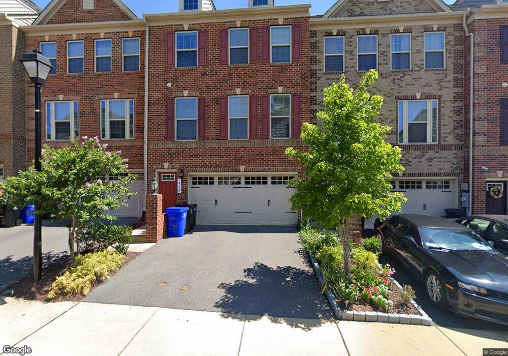
14220 Westside Ridge Dr Laurel, MD 20707
Estimated Value: $525,000 - $603,000
--
Bed
2
Baths
1,848
Sq Ft
$306/Sq Ft
Est. Value
About This Home
This home is located at 14220 Westside Ridge Dr, Laurel, MD 20707 and is currently estimated at $565,177, approximately $305 per square foot. 14220 Westside Ridge Dr is a home located in Prince George's County with nearby schools including Bond Mill Elementary, Martin Luther King Jr. Middle School, and Laurel High School.
Ownership History
Date
Name
Owned For
Owner Type
Purchase Details
Closed on
Mar 16, 2018
Sold by
Nvr Inc
Bought by
Williams Michael
Current Estimated Value
Home Financials for this Owner
Home Financials are based on the most recent Mortgage that was taken out on this home.
Original Mortgage
$421,243
Outstanding Balance
$360,886
Interest Rate
4.37%
Mortgage Type
FHA
Estimated Equity
$204,291
Purchase Details
Closed on
Oct 27, 2017
Sold by
Gudmar Westise Llc
Bought by
Nvr Inc
Purchase Details
Closed on
Apr 28, 2016
Sold by
Strittmatter Land Llc
Bought by
Gudmar Westside Llc
Create a Home Valuation Report for This Property
The Home Valuation Report is an in-depth analysis detailing your home's value as well as a comparison with similar homes in the area
Home Values in the Area
Average Home Value in this Area
Purchase History
| Date | Buyer | Sale Price | Title Company |
|---|---|---|---|
| Williams Michael | $429,015 | Stewart Title Guaranty Co | |
| Nvr Inc | $958,800 | None Available | |
| Gudmar Westside Llc | $3,360,000 | First American Title Ins Co |
Source: Public Records
Mortgage History
| Date | Status | Borrower | Loan Amount |
|---|---|---|---|
| Open | Williams Michael | $421,243 |
Source: Public Records
Tax History Compared to Growth
Tax History
| Year | Tax Paid | Tax Assessment Tax Assessment Total Assessment is a certain percentage of the fair market value that is determined by local assessors to be the total taxable value of land and additions on the property. | Land | Improvement |
|---|---|---|---|---|
| 2025 | $9,527 | $505,100 | $140,000 | $365,100 |
| 2024 | $9,527 | $476,667 | $0 | $0 |
| 2023 | $8,911 | $448,233 | $0 | $0 |
| 2022 | $8,276 | $419,800 | $100,000 | $319,800 |
| 2021 | $7,782 | $397,133 | $0 | $0 |
| 2020 | $14,671 | $374,467 | $0 | $0 |
| 2019 | $6,892 | $351,800 | $75,000 | $276,800 |
| 2018 | $0 | $349,000 | $0 | $0 |
| 2017 | $134 | $9,000 | $0 | $0 |
| 2016 | -- | $9,000 | $0 | $0 |
Source: Public Records
Map
Nearby Homes
- 6703 Bonnett Ct
- 14847 Willow Run Ln
- 14730 Spring Haven Ln
- 14502 Star View Ln
- 1106 Overlook Way
- 1013 Highpoint Trail
- 1023 Flester Ln
- 1027 Overlook Way
- 7232 Contee Rd
- 7234 Contee Rd
- 7236 Contee Rd
- 7238 Contee Rd
- 7240 Contee Rd
- Elmwood Rear Load Garage Plan at Anderson's Green
- Elmwood Front Load garage Plan at Anderson's Green
- 13939 Anderson Garden Rd
- 7266 Contee Rd
- 7502 Contee Rd
- 13601 Belle Chasse Blvd
- 13801 Belle Chasse Blvd
- 14224 Westside Ridge Dr
- 14222 Westside Ridge Dr
- 14218 Westside Ridge Dr
- 14216 Westside Ridge Dr
- 14226 Laurel Ridge Dr
- 14226 Westside Ridge Dr
- 14228 Laurel Ridge Dr
- 14228 Westside Ridge Dr
- 14214 Westside Ridge Dr
- 14214 Laurel Ridge Dr
- 14301 Ridge View Ln
- 14230 Westside Ridge Dr
- 14212 Westside Ridge Dr
- 14303 Ridge View Ln
- 14305 Sandy View Ct
- 14305 Ridge View Ln
- 14300 Ridge View Ln
- 14307 Ridge View Ln
- 14210 Westside Ridge Dr
- 14208 Westside Ridge Dr