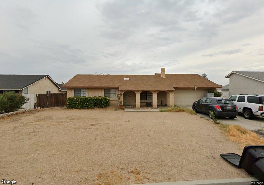
14223 Fort Apache Ct Victorville, CA 92392
Estimated Value: $350,947 - $397,000
3
Beds
2
Baths
1,113
Sq Ft
$340/Sq Ft
Est. Value
About This Home
This home is located at 14223 Fort Apache Ct, Victorville, CA 92392 and is currently estimated at $377,987, approximately $339 per square foot. 14223 Fort Apache Ct is a home located in San Bernardino County with nearby schools including Liberty Elementary School, Park View Elementary School, and Imogene Garner Hook Junior High School.
Ownership History
Date
Name
Owned For
Owner Type
Purchase Details
Closed on
Apr 16, 1998
Sold by
Ocwen Federal Bank Fsb
Bought by
Sweany James and Sweany Jennifer L
Current Estimated Value
Home Financials for this Owner
Home Financials are based on the most recent Mortgage that was taken out on this home.
Original Mortgage
$57,200
Interest Rate
7.05%
Purchase Details
Closed on
Nov 19, 1997
Sold by
Pusateri William S and Pusateri Christine L
Bought by
Ocwen Federal Bank Fsb and Berkeley Federal Bank & Trust
Create a Home Valuation Report for This Property
The Home Valuation Report is an in-depth analysis detailing your home's value as well as a comparison with similar homes in the area
Home Values in the Area
Average Home Value in this Area
Purchase History
| Date | Buyer | Sale Price | Title Company |
|---|---|---|---|
| Sweany James | $71,500 | Chicago Title Co | |
| Ocwen Federal Bank Fsb | $58,851 | Chicago Title Co |
Source: Public Records
Mortgage History
| Date | Status | Borrower | Loan Amount |
|---|---|---|---|
| Closed | Sweany James | $57,200 |
Source: Public Records
Tax History Compared to Growth
Tax History
| Year | Tax Paid | Tax Assessment Tax Assessment Total Assessment is a certain percentage of the fair market value that is determined by local assessors to be the total taxable value of land and additions on the property. | Land | Improvement |
|---|---|---|---|---|
| 2025 | $1,260 | $112,093 | $28,062 | $84,031 |
| 2024 | $1,260 | $109,895 | $27,512 | $82,383 |
| 2023 | $1,245 | $107,741 | $26,973 | $80,768 |
| 2022 | $1,221 | $105,628 | $26,444 | $79,184 |
| 2021 | $1,197 | $103,556 | $25,925 | $77,631 |
| 2020 | $1,174 | $102,494 | $25,659 | $76,835 |
| 2019 | $1,153 | $100,484 | $25,156 | $75,328 |
| 2018 | $1,226 | $98,514 | $24,663 | $73,851 |
| 2017 | $1,199 | $96,582 | $24,179 | $72,403 |
| 2016 | $1,173 | $94,688 | $23,705 | $70,983 |
| 2015 | $1,131 | $93,266 | $23,349 | $69,917 |
| 2014 | $1,108 | $91,439 | $22,892 | $68,547 |
Source: Public Records
Map
Nearby Homes
- 12610 Alta Mar Way
- 12441 Petaluma Rd
- 14133 Pacoima Cir
- 14390 Northstar Ave
- 12471 Pacoima Rd
- 14230 Hillsborough Dr
- 12761 Paso Robles Dr
- 14389 Las Flores Dr
- 14200 La Mirada St
- 12867 Banyon Tree Ln
- 13847 Galaxy Way
- 14535 Owens River Rd
- 12668 Galaxy St
- 12452 Mount Baldy Dr
- 12446 Mount Baldy Dr
- 14583 Owens River Rd
- 12977 Dusty Rd
- 12831 Stage Coach Dr
- 13745 Gemini St
- 14195 Whispering Sands Dr
- 14211 Fort Apache Ct
- 14235 Fort Apache Ct
- 14197 Fort Apache Ct
- 14249 Fort Apache Ct
- 14224 Northstar Ave
- 14210 Northstar Ave
- 14236 Northstar Ave
- 14224 Fort Apache Ct
- 14250 Northstar Ave
- 14198 Northstar Ave
- 14210 Fort Apache Ct
- 14185 Fort Apache Ct
- 14236 Fort Apache Ct
- 14198 Fort Apache Ct
- 14250 Fort Apache Ct
- 14184 Northstar Ave
- 14175 Fort Apache Ct
- 12553 Petaluma Rd
- 12565 Petaluma Rd
- 12539 Petaluma Rd