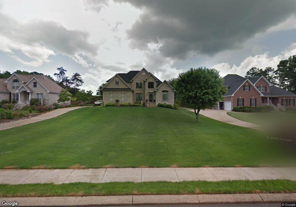
1424 Cambridge Point Dr Hixson, TN 37343
Estimated Value: $503,173 - $590,000
4
Beds
3
Baths
2,635
Sq Ft
$206/Sq Ft
Est. Value
About This Home
This home is located at 1424 Cambridge Point Dr, Hixson, TN 37343 and is currently estimated at $543,293, approximately $206 per square foot. 1424 Cambridge Point Dr is a home located in Hamilton County with nearby schools including Ganns Middle Valley Elementary School, Hixson Middle School, and Hixson High School.
Ownership History
Date
Name
Owned For
Owner Type
Purchase Details
Closed on
May 1, 2006
Sold by
Miller Karl E and Miller Martha M
Bought by
Jeffries Paul and Jeffries Nancy
Current Estimated Value
Purchase Details
Closed on
Sep 9, 1996
Sold by
Stanley Construction Company
Bought by
Miller Karl E and Miller Martha M
Home Financials for this Owner
Home Financials are based on the most recent Mortgage that was taken out on this home.
Original Mortgage
$223,182
Interest Rate
7.5%
Mortgage Type
Purchase Money Mortgage
Create a Home Valuation Report for This Property
The Home Valuation Report is an in-depth analysis detailing your home's value as well as a comparison with similar homes in the area
Home Values in the Area
Average Home Value in this Area
Purchase History
| Date | Buyer | Sale Price | Title Company |
|---|---|---|---|
| Jeffries Paul | $260,000 | Legal Title | |
| Miller Karl E | $21,500 | First Title |
Source: Public Records
Mortgage History
| Date | Status | Borrower | Loan Amount |
|---|---|---|---|
| Previous Owner | Miller Karl E | $223,182 |
Source: Public Records
Tax History Compared to Growth
Tax History
| Year | Tax Paid | Tax Assessment Tax Assessment Total Assessment is a certain percentage of the fair market value that is determined by local assessors to be the total taxable value of land and additions on the property. | Land | Improvement |
|---|---|---|---|---|
| 2024 | $1,921 | $85,850 | $0 | $0 |
| 2023 | $1,930 | $85,850 | $0 | $0 |
| 2022 | $1,930 | $85,850 | $0 | $0 |
| 2021 | $1,930 | $85,850 | $0 | $0 |
| 2020 | $2,002 | $72,075 | $0 | $0 |
| 2019 | $2,002 | $72,075 | $0 | $0 |
| 2018 | $2,002 | $72,075 | $0 | $0 |
| 2017 | $2,002 | $72,075 | $0 | $0 |
| 2016 | $1,869 | $0 | $0 | $0 |
| 2015 | $1,869 | $67,275 | $0 | $0 |
| 2014 | $1,869 | $0 | $0 | $0 |
Source: Public Records
Map
Nearby Homes
- 920 Carrie Ln
- 7626 Wynhill Ln
- 7812 Huntington Forest Dr
- 1343 Thrasher Pike
- 7770 Lenox Trace Dr
- 999 Wyndsor Dr
- 8665 Reba Ln
- 1640 Thrasher Pike
- 8706 Arbutus Dr
- 8692 Arbutus Dr
- 8155 Richland Dr
- 1705 Longview St
- 6506 Middle Valley Rd
- 1861 Abington Farms Way
- 707 Charlee Ln
- 1713 Thrasher Pike
- 409 Sandalwood Dr
- 670 Charbell St
- 1948 Abington Farms Way
- 1625 Lisa Lynn Dr
- 1428 Cambridge Point Dr
- 1420 Cambridge Point Dr
- 1432 Cambridge Point Dr
- 1414 Cambridge Point Dr
- 1425 Cambridge Point Dr
- 1436 Cambridge Point Dr
- 1429 Cambridge Point Dr
- 7640 Gann Rd
- 1421 Cambridge Point Dr
- 0 Cambridge Point Dr Unit 977862
- 7814 Haverton Crossing
- 1417 Cambridge Point Dr
- 1408 Cambridge Point Dr
- 1433 Cambridge Point Dr
- 7818 Haverton Crossing
- 7810 Haverton Crossing
- 1437 Cambridge Point Dr
- 1409 Cambridge Point Dr
- 7806 Haverton Crossing
- 940 Wyndsor Dr