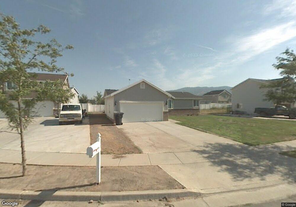
1424 W 2550 S Woods Cross, UT 84087
Estimated Value: $462,000 - $491,000
3
Beds
2
Baths
1,365
Sq Ft
$352/Sq Ft
Est. Value
About This Home
This home is located at 1424 W 2550 S, Woods Cross, UT 84087 and is currently estimated at $480,547, approximately $352 per square foot. 1424 W 2550 S is a home located in Davis County with nearby schools including Odyssey School, South Davis Junior High School, and Woods Cross High School.
Ownership History
Date
Name
Owned For
Owner Type
Purchase Details
Closed on
Nov 25, 2013
Sold by
Secretary Of Hud
Bought by
Bush Cody L
Current Estimated Value
Home Financials for this Owner
Home Financials are based on the most recent Mortgage that was taken out on this home.
Original Mortgage
$125,086
Outstanding Balance
$94,273
Interest Rate
4.5%
Mortgage Type
FHA
Estimated Equity
$386,274
Purchase Details
Closed on
Jul 8, 2013
Sold by
Utah Housing Corp
Bought by
The Secretary Of Hud
Purchase Details
Closed on
May 15, 2013
Sold by
Cook Carole
Bought by
Utah Housing Corp
Purchase Details
Closed on
Jul 29, 2005
Sold by
Binks Jason
Bought by
Cook Carolee
Home Financials for this Owner
Home Financials are based on the most recent Mortgage that was taken out on this home.
Original Mortgage
$157,429
Interest Rate
5.46%
Mortgage Type
FHA
Purchase Details
Closed on
Oct 21, 2004
Sold by
Emc Mortgage Corp
Bought by
Binks Jason
Home Financials for this Owner
Home Financials are based on the most recent Mortgage that was taken out on this home.
Original Mortgage
$133,567
Interest Rate
5.82%
Mortgage Type
Purchase Money Mortgage
Purchase Details
Closed on
Jul 13, 2004
Sold by
Johnson Justin V and Johnson Traci C
Bought by
Emc Mortgage Corp
Purchase Details
Closed on
Nov 20, 2000
Sold by
Ashley Richard H
Bought by
Johnson Justin and Johnson Traci C
Home Financials for this Owner
Home Financials are based on the most recent Mortgage that was taken out on this home.
Original Mortgage
$141,533
Interest Rate
7.82%
Mortgage Type
FHA
Purchase Details
Closed on
Nov 15, 1999
Sold by
Newport Holding Inc
Bought by
Ashley Richard H
Home Financials for this Owner
Home Financials are based on the most recent Mortgage that was taken out on this home.
Original Mortgage
$105,600
Interest Rate
7.84%
Purchase Details
Closed on
Apr 19, 1999
Sold by
Newport Holding Inc
Bought by
Newport Holding Inc and Ashley Richard H
Create a Home Valuation Report for This Property
The Home Valuation Report is an in-depth analysis detailing your home's value as well as a comparison with similar homes in the area
Home Values in the Area
Average Home Value in this Area
Purchase History
| Date | Buyer | Sale Price | Title Company |
|---|---|---|---|
| Bush Cody L | -- | First American Title | |
| The Secretary Of Hud | -- | None Available | |
| Utah Housing Corp | -- | Lincoln Title Insurance Agen | |
| Cook Carolee | -- | Backman Title Services | |
| Binks Jason | -- | First American Title Co | |
| Emc Mortgage Corp | $119,765 | Backman Stewart Title Servic | |
| Johnson Justin | -- | Backman Stewart Title Servic | |
| Ashley Richard H | -- | Aspen Title Insurance Agency | |
| Newport Holding Inc | -- | Equity Title Agency |
Source: Public Records
Mortgage History
| Date | Status | Borrower | Loan Amount |
|---|---|---|---|
| Open | Bush Cody L | $125,086 | |
| Previous Owner | Cook Carolee | $157,429 | |
| Previous Owner | Binks Jason | $133,567 | |
| Previous Owner | Johnson Justin | $141,533 | |
| Previous Owner | Ashley Richard H | $105,600 |
Source: Public Records
Tax History Compared to Growth
Tax History
| Year | Tax Paid | Tax Assessment Tax Assessment Total Assessment is a certain percentage of the fair market value that is determined by local assessors to be the total taxable value of land and additions on the property. | Land | Improvement |
|---|---|---|---|---|
| 2025 | $2,702 | $229,900 | $109,958 | $119,942 |
| 2024 | $2,549 | $221,650 | $116,886 | $104,764 |
| 2023 | $2,681 | $388,000 | $154,544 | $233,456 |
| 2022 | $2,686 | $234,300 | $67,185 | $167,115 |
| 2021 | $2,556 | $334,000 | $98,451 | $235,549 |
| 2020 | $2,325 | $293,000 | $93,665 | $199,335 |
| 2019 | $2,200 | $283,000 | $87,563 | $195,437 |
| 2018 | $1,921 | $265,000 | $86,141 | $178,859 |
| 2016 | $1,562 | $117,645 | $36,326 | $81,319 |
| 2015 | $1,147 | $81,565 | $36,326 | $45,239 |
| 2014 | $975 | $70,426 | $36,326 | $34,100 |
| 2013 | -- | $103,168 | $25,709 | $77,459 |
Source: Public Records
Map
Nearby Homes
- 1384 W 2175 S
- 1255 W 2050 S
- 1984 S 1500 W
- 1998 S 1600 W
- 1153 N Meridian Ln Unit 120
- 1156 N Clifton Dr Unit 115
- 1160 N Clifton Dr Unit 114
- 826 W Ivywell Ln Unit 219
- Kensington Plan at Clifton Place Townhomes
- Charleston Plan at Clifton Place Townhomes
- Camden Plan at Clifton Place Townhomes
- Somerset A Plan at Clifton Place Townhomes
- Somerset B Plan at Clifton Place Townhomes
- 828 W Ivywell Ln Unit 220
- 1846 W 2280 S
- 1064 Darcy Dr
- 908 Halstead Dr
- 997 Amberly Dr
- 928 Amberly Dr
- 979 Amberly Dr