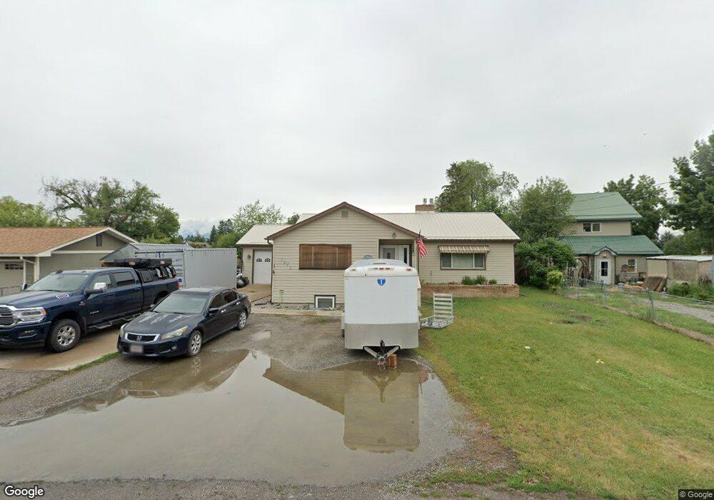
1425 8th Ave E Kalispell, MT 59901
Estimated Value: $506,990 - $624,000
2
Beds
2
Baths
2,606
Sq Ft
$209/Sq Ft
Est. Value
About This Home
This home is located at 1425 8th Ave E, Kalispell, MT 59901 and is currently estimated at $545,748, approximately $209 per square foot. 1425 8th Ave E is a home located in Flathead County with nearby schools including Cornelius Hedges School, Kalispell Middle School, and Flathead High School.
Ownership History
Date
Name
Owned For
Owner Type
Purchase Details
Closed on
Nov 18, 2014
Sold by
Babcock Bernard L and Babcock Angel L
Bought by
Tindale Mathew A and Tindale Nicole M
Current Estimated Value
Home Financials for this Owner
Home Financials are based on the most recent Mortgage that was taken out on this home.
Original Mortgage
$204,250
Outstanding Balance
$164,639
Interest Rate
5.5%
Mortgage Type
Adjustable Rate Mortgage/ARM
Estimated Equity
$381,109
Purchase Details
Closed on
Mar 24, 2008
Sold by
Deutsche Bank National Trust Co
Bought by
Babcock Bernard L and Babcock Angel L
Home Financials for this Owner
Home Financials are based on the most recent Mortgage that was taken out on this home.
Original Mortgage
$144,000
Interest Rate
6.22%
Mortgage Type
New Conventional
Purchase Details
Closed on
Aug 6, 2007
Sold by
Brown Jo
Bought by
Deutsche Bank National Trust Co and Long Beach Mortgage Loan Trust
Create a Home Valuation Report for This Property
The Home Valuation Report is an in-depth analysis detailing your home's value as well as a comparison with similar homes in the area
Purchase History
| Date | Buyer | Sale Price | Title Company |
|---|---|---|---|
| Tindale Mathew A | -- | Sterling Title Services Inc | |
| Babcock Bernard L | -- | Chicago Title Insurance Comp | |
| Deutsche Bank National Trust Co | $228,467 | None Available |
Source: Public Records
Mortgage History
| Date | Status | Borrower | Loan Amount |
|---|---|---|---|
| Open | Tindale Mathew A | $204,250 | |
| Previous Owner | Babcock Bernard L | $144,000 |
Source: Public Records
Tax History
| Year | Tax Paid | Tax Assessment Tax Assessment Total Assessment is a certain percentage of the fair market value that is determined by local assessors to be the total taxable value of land and additions on the property. | Land | Improvement |
|---|---|---|---|---|
| 2025 | $1,990 | $496,500 | $0 | $0 |
| 2024 | $2,470 | $376,000 | $0 | $0 |
| 2023 | $2,507 | $376,000 | $0 | $0 |
| 2022 | $2,540 | $281,500 | $0 | $0 |
| 2021 | $2,484 | $281,500 | $0 | $0 |
| 2020 | $2,345 | $255,900 | $0 | $0 |
| 2019 | $2,339 | $255,900 | $0 | $0 |
| 2018 | $2,023 | $211,200 | $0 | $0 |
| 2017 | $2,032 | $211,200 | $0 | $0 |
| 2016 | $1,781 | $204,534 | $0 | $0 |
| 2015 | $1,806 | $204,534 | $0 | $0 |
| 2014 | $1,543 | $104,304 | $0 | $0 |
Source: Public Records
Map
Nearby Homes
- 1705 8th Ave E
- 1710 8th Ave E
- 1545 Lehi Ln
- 1681 Bull Run
- 1683 Bull Run
- 826 11th St E
- 1690 Bull Run
- 1519 Woodland Ave
- 1724 Bison Dr
- 1305 4th Ave E
- 446 Valley Dr
- 51 Selders Ln
- 1312 2nd Ave E
- 3953 US Highway 93 S
- 715 8th St E
- 386 Willow Glen Dr
- 723 5th Ave E Unit 318-S
- 305 Kelly Rd Unit F-22
- 305 Kelly Rd Unit F21
- 141 Beargrass Ln
Your Personal Tour Guide
Ask me questions while you tour the home.