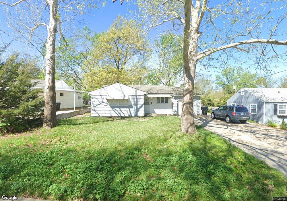
1425 SW Amhurst Rd Topeka, KS 66604
West Topeka NeighborhoodEstimated Value: $145,000 - $183,000
3
Beds
2
Baths
1,112
Sq Ft
$147/Sq Ft
Est. Value
About This Home
This home is located at 1425 SW Amhurst Rd, Topeka, KS 66604 and is currently estimated at $164,004, approximately $147 per square foot. 1425 SW Amhurst Rd is a home located in Shawnee County with nearby schools including McCarter Elementary School, Landon Middle School, and Topeka West High School.
Ownership History
Date
Name
Owned For
Owner Type
Purchase Details
Closed on
Jul 6, 2015
Sold by
Purkey Richard K
Bought by
Purkey Robert P
Current Estimated Value
Home Financials for this Owner
Home Financials are based on the most recent Mortgage that was taken out on this home.
Original Mortgage
$76,500
Interest Rate
3.9%
Mortgage Type
Purchase Money Mortgage
Purchase Details
Closed on
Dec 13, 2007
Sold by
Purkey Richard K L and Purkey Robert L
Bought by
Purkey Richard K
Create a Home Valuation Report for This Property
The Home Valuation Report is an in-depth analysis detailing your home's value as well as a comparison with similar homes in the area
Home Values in the Area
Average Home Value in this Area
Purchase History
| Date | Buyer | Sale Price | Title Company |
|---|---|---|---|
| Purkey Robert P | -- | Lawyers Title Of Topeka Inc | |
| Purkey Richard K | -- | None Available |
Source: Public Records
Mortgage History
| Date | Status | Borrower | Loan Amount |
|---|---|---|---|
| Closed | Purkey Robert P | $76,500 |
Source: Public Records
Tax History Compared to Growth
Tax History
| Year | Tax Paid | Tax Assessment Tax Assessment Total Assessment is a certain percentage of the fair market value that is determined by local assessors to be the total taxable value of land and additions on the property. | Land | Improvement |
|---|---|---|---|---|
| 2025 | $1,821 | $13,653 | -- | -- |
| 2023 | $1,821 | $12,510 | $0 | $0 |
| 2022 | $1,590 | $10,878 | $0 | $0 |
| 2021 | $1,468 | $9,458 | $0 | $0 |
| 2020 | $1,380 | $9,008 | $0 | $0 |
| 2019 | $1,360 | $8,830 | $0 | $0 |
| 2018 | $1,321 | $8,573 | $0 | $0 |
| 2017 | $1,284 | $8,323 | $0 | $0 |
| 2014 | $1,297 | $8,323 | $0 | $0 |
Source: Public Records
Map
Nearby Homes
- 5518 SW Avalon Ln
- 5618 SW 14th St
- 5452 SW 12th Terrace Unit 3
- 1306 SW Glendale Dr
- 5802 SW Sterling Ln
- 1100 SW Amhurst Ct
- 1728 SW Fairlawn Rd
- 1042 SW Amhurst Ct
- 1274 SW Indian Trail Ct
- 1906 SW Village Dr
- 1609 SW Burnett Rd
- Lot 4 & .5 of 3 SW Balmoral Ln
- Lot 2 SW Balmoral Ln Unit and east 1/2 of Lot
- Lot 17 SW Balmoral Ln
- 1421 SW Mcalister Ave
- 1053 SW Harvey St
- 1212 SW New Forest Dr
- 1019 SW Exmoor Ln Unit Tract 17
- 1023 SW Exmoor Ln Unit Tract 16
- 1944 SW Quivira Dr
- 1429 SW Amhurst Rd
- 1417 SW Amhurst Rd
- 1424 SW Lancaster St
- 1433 SW Amhurst Rd
- 1428 SW Lancaster St
- 1402 SW Lancaster St
- 5307 SW 14th St
- 1424 SW Amhurst Rd
- 1428 SW Amhurst Rd
- 1432 SW Lancaster St
- 1437 SW Amhurst Rd
- 1420 SW Amhurst Rd
- 1401 SW Amhurst Rd
- 1432 SW Amhurst Rd
- 1436 SW Lancaster St
- 1408 SW Amhurst Rd
- 1441 SW Amhurst Rd
- 1436 SW Amhurst Rd
- 1401 SW Lancaster St
- 1425 SW Lancaster St