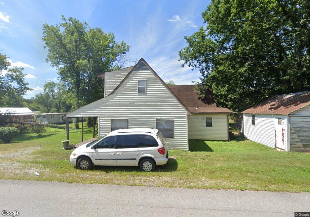
14253 Murfreesboro Hwy Unit 14253 Beechgrove, TN 37018
Estimated Value: $157,478 - $331,000
--
Bed
2
Baths
1,126
Sq Ft
$190/Sq Ft
Est. Value
About This Home
This home is located at 14253 Murfreesboro Hwy Unit 14253, Beechgrove, TN 37018 and is currently estimated at $213,870, approximately $189 per square foot. 14253 Murfreesboro Hwy Unit 14253 is a home located in Coffee County with nearby schools including North Coffee Elementary School, Coffee County Middle School, and Coffee County Central High School.
Ownership History
Date
Name
Owned For
Owner Type
Purchase Details
Closed on
Nov 30, 2007
Sold by
Dean Billy J
Bought by
Ashworth Gladys B
Current Estimated Value
Purchase Details
Closed on
Aug 18, 2006
Sold by
Conner Dennis
Bought by
Dean Billy J
Purchase Details
Closed on
Aug 15, 2006
Sold by
Conner Dennis
Bought by
Dean Billy J
Purchase Details
Closed on
Jun 27, 1997
Sold by
Green Medford N
Bought by
Conner Dennis and Conner Paula
Purchase Details
Closed on
Jul 2, 1987
Create a Home Valuation Report for This Property
The Home Valuation Report is an in-depth analysis detailing your home's value as well as a comparison with similar homes in the area
Home Values in the Area
Average Home Value in this Area
Purchase History
| Date | Buyer | Sale Price | Title Company |
|---|---|---|---|
| Ashworth Gladys B | $75,000 | -- | |
| Dean Billy J | $46,900 | -- | |
| Dean Billy J | $46,900 | -- | |
| Conner Dennis | -- | -- | |
| Conner Dennis | $65,000 | -- | |
| -- | $11,300 | -- |
Source: Public Records
Tax History Compared to Growth
Tax History
| Year | Tax Paid | Tax Assessment Tax Assessment Total Assessment is a certain percentage of the fair market value that is determined by local assessors to be the total taxable value of land and additions on the property. | Land | Improvement |
|---|---|---|---|---|
| 2024 | $418 | $22,950 | $1,725 | $21,225 |
| 2023 | $418 | $22,950 | $0 | $0 |
| 2022 | $418 | $22,950 | $1,725 | $21,225 |
| 2021 | $422 | $16,525 | $1,075 | $15,450 |
| 2020 | $422 | $16,525 | $1,075 | $15,450 |
| 2019 | $422 | $16,525 | $1,075 | $15,450 |
| 2018 | $422 | $16,525 | $1,075 | $15,450 |
| 2017 | $443 | $15,050 | $1,650 | $13,400 |
| 2016 | $442 | $15,050 | $1,650 | $13,400 |
| 2015 | $491 | $15,050 | $1,650 | $13,400 |
| 2014 | $491 | $15,045 | $0 | $0 |
Source: Public Records
Map
Nearby Homes
- 0 Gossburg Rd Unit RTC3007203
- 0 Gossburg Rd Unit RTC2516931
- 0 Gossburg Rd Unit RTC2516930
- 0 Gossburg Rd Unit RTC2516922
- 0 Earl Warren Rd
- 5 Earl Warren Rd
- 4C Old U S 41
- 4B Old U S 41
- 4A Old U S 41
- 15717 Manchester Pike
- 139 Bruce Meadows Dr
- 116 Dandelion Ln
- 126 Tom Walker Dr
- 750 Walker Rd
- 826 Norton Branch Rd
- 6988 Tennessee 64
- 264 Puncheon Camp Rd
- 131 Butterfly Ln
- 1959 French Brantley Rd
- 10B Puncheon Camp Ln
- 14281 Murfreesboro Hwy
- 1880 Oscar Crowell Rd
- 14231 Murfreesboro Hwy
- 14240 Murfreesboro Hwy
- 1903 Oscar Crowell Rd
- 1866 Oscar Crowell Rd
- 1 Tennessee 64
- 3 Tennessee 64
- 8 Hwy 64
- 1 Hwy 64
- 5 Gossburg Rd
- 5 Tennessee 64
- 3 Highway 64
- 7 Tn-64
- 9 Tennessee 64
- 7 Gossburg Rd
- 9 Gossburg Rd
- 2 Tn-64
- 1 Beech Grove Rd
- 2 Beech Grove Rd