Estimated Value: $230,391 - $276,000
3
Beds
3
Baths
1,392
Sq Ft
$188/Sq Ft
Est. Value
About This Home
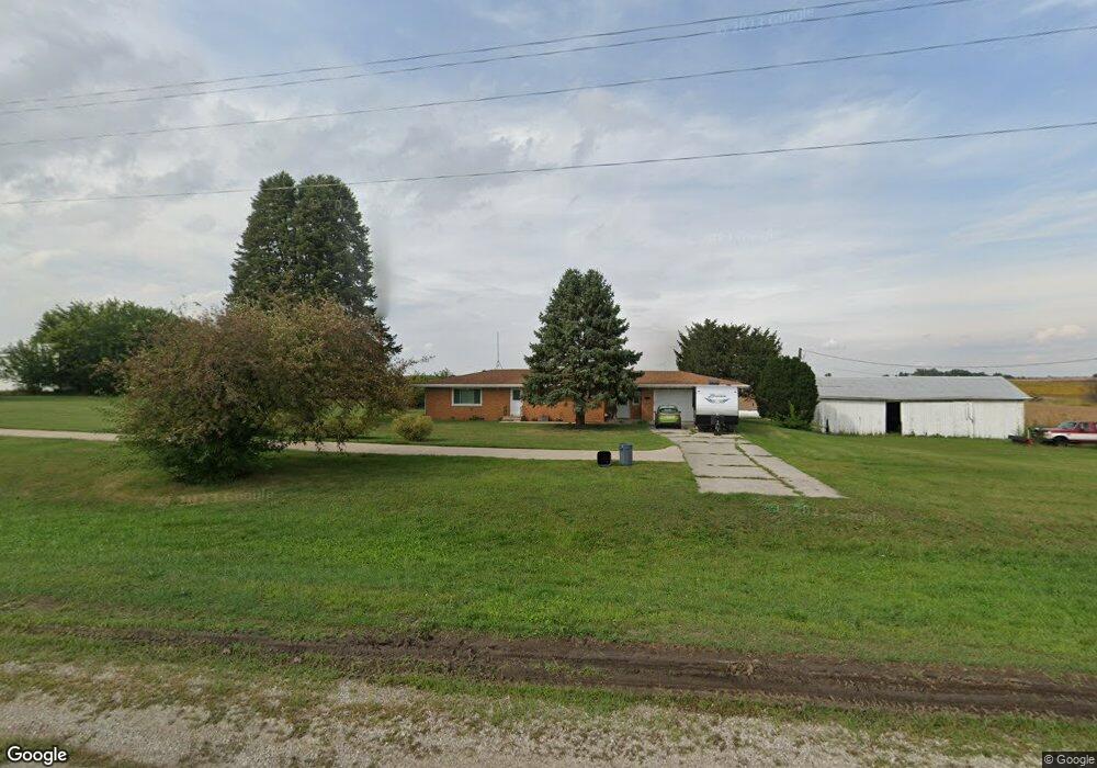
This home is located at 14254 Highway 92, Letts, IA 52754 and is currently estimated at $261,348, approximately $187 per square foot. 14254 Highway 92 is a home located in Louisa County with nearby schools including Louisa-Muscatine Elementary School and Louisa-Muscatine High School.
Ownership History
Date
Name
Owned For
Owner Type
Purchase Details
Closed on
May 14, 2021
Sold by
Wadden Gregory L and Wadden Carmen J
Bought by
Byrd Mark A and Byrd Carla
Current Estimated Value
Home Financials for this Owner
Home Financials are based on the most recent Mortgage that was taken out on this home.
Original Mortgage
$142,000
Outstanding Balance
$128,687
Interest Rate
3.1%
Mortgage Type
New Conventional
Estimated Equity
$132,661
Create a Home Valuation Report for This Property
The Home Valuation Report is an in-depth analysis detailing your home's value as well as a comparison with similar homes in the area
Home Values in the Area
Average Home Value in this Area
Purchase History
| Date | Buyer | Sale Price | Title Company |
|---|---|---|---|
| Byrd Mark A | $177,500 | None Available |
Source: Public Records
Mortgage History
| Date | Status | Borrower | Loan Amount |
|---|---|---|---|
| Open | Byrd Mark A | $142,000 |
Source: Public Records
Tax History Compared to Growth
Tax History
| Year | Tax Paid | Tax Assessment Tax Assessment Total Assessment is a certain percentage of the fair market value that is determined by local assessors to be the total taxable value of land and additions on the property. | Land | Improvement |
|---|---|---|---|---|
| 2025 | $1,884 | $182,640 | $33,980 | $148,660 |
| 2024 | $1,858 | $172,870 | $33,980 | $138,890 |
| 2023 | $1,858 | $174,660 | $33,980 | $140,680 |
| 2022 | $1,642 | $140,320 | $33,980 | $106,340 |
| 2021 | $1,782 | $140,320 | $33,980 | $106,340 |
| 2020 | $1,782 | $138,210 | $33,980 | $104,230 |
| 2019 | $1,440 | $138,210 | $33,980 | $104,230 |
| 2018 | $1,474 | $111,525 | $4,310 | $103,060 |
| 2017 | $1,474 | $111,448 | $0 | $0 |
| 2016 | $1,614 | $111,448 | $4,140 | $107,308 |
| 2015 | $1,614 | $111,448 | $4,140 | $107,308 |
| 2014 | $1,582 | $115,104 | $7,407 | $107,697 |
Source: Public Records
Map
Nearby Homes
- 17297 State Hwy 92
- 17297 Iowa 92
- 17297 Highway 92
- 16782 I Ave
- 0 G44x Parcel
- 125 N Cherry St
- 0000
- 0000 County Road X61
- 10257 County Road G44x
- 00 140th St
- 000 140th St
- 18173 115th St
- 17138 County Road X61
- 8965 Ripley Ave
- 0 Unit 24-52
- 18503 Maverick Ln
- 121 Turkey Rd
- 105 Spencer Ave
- 609 Townsend Ave
- 419 Van Buren St
- 14254 Iowa 92
- 14254 Highway 92
- 14336 Highway 92
- 14336 Iowa 92
- 14501 Highway 92
- 14253 Highway 92
- 14648 Highway 92
- 0 Petro & More Unit 22-754
- 13961 Hwy 252
- 13792 Highway 252
- 13791 Highway 252
- 307 W Union St
- 306 W Jackson St
- 307 W Jackson St
- 14419 145th St
- 307 W Monroe St
- 308 Vernon St
- 306 Washington St
- 307 W Washington St
- 307 W Vernon St