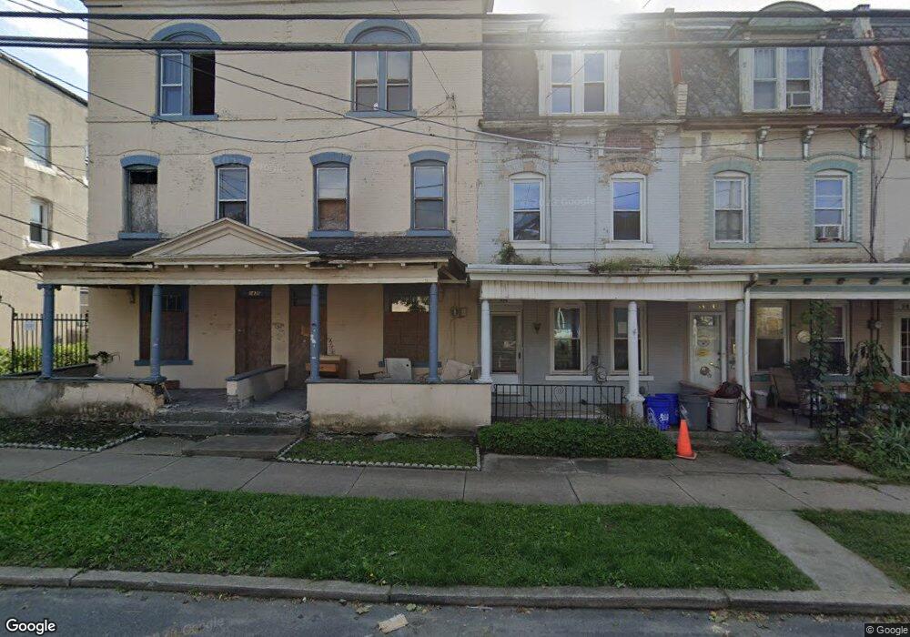
1426 Linden St Scranton, PA 18510
Hill Section NeighborhoodEstimated Value: $153,000 - $167,000
--
Bed
--
Bath
--
Sq Ft
1,263
Sq Ft Lot
About This Home
This home is located at 1426 Linden St, Scranton, PA 18510 and is currently estimated at $160,221. 1426 Linden St is a home located in Lackawanna County with nearby schools including Jackson Davis Elementary School, Longdale Elementary School, and Pinchbeck Elementary School.
Ownership History
Date
Name
Owned For
Owner Type
Purchase Details
Closed on
Feb 15, 2017
Sold by
Us Bank National Association
Bought by
Scranton Equities Llc
Current Estimated Value
Purchase Details
Closed on
Feb 5, 2007
Sold by
Wysokinski Thomas R and Wysokinski Kimberly
Bought by
Caramanno Robert
Home Financials for this Owner
Home Financials are based on the most recent Mortgage that was taken out on this home.
Original Mortgage
$72,000
Interest Rate
6.23%
Mortgage Type
New Conventional
Create a Home Valuation Report for This Property
The Home Valuation Report is an in-depth analysis detailing your home's value as well as a comparison with similar homes in the area
Home Values in the Area
Average Home Value in this Area
Purchase History
| Date | Buyer | Sale Price | Title Company |
|---|---|---|---|
| Scranton Equities Llc | $12,500 | None Available | |
| Caramanno Robert | $72,000 | None Available |
Source: Public Records
Mortgage History
| Date | Status | Borrower | Loan Amount |
|---|---|---|---|
| Previous Owner | Caramanno Robert | $72,000 |
Source: Public Records
Tax History Compared to Growth
Tax History
| Year | Tax Paid | Tax Assessment Tax Assessment Total Assessment is a certain percentage of the fair market value that is determined by local assessors to be the total taxable value of land and additions on the property. | Land | Improvement |
|---|---|---|---|---|
| 2025 | $2,483 | $7,500 | $1,550 | $5,950 |
| 2024 | $2,274 | $7,500 | $1,550 | $5,950 |
| 2023 | $2,274 | $7,500 | $1,550 | $5,950 |
| 2022 | $2,224 | $7,500 | $1,550 | $5,950 |
| 2021 | $2,224 | $7,500 | $1,550 | $5,950 |
| 2020 | $2,184 | $7,500 | $1,550 | $5,950 |
| 2019 | $2,055 | $7,500 | $1,550 | $5,950 |
| 2018 | $2,055 | $7,500 | $1,550 | $5,950 |
| 2017 | $2,020 | $7,500 | $1,550 | $5,950 |
| 2016 | $0 | $7,500 | $1,550 | $5,950 |
| 2015 | $1,529 | $7,500 | $1,550 | $5,950 |
| 2014 | -- | $7,500 | $1,550 | $5,950 |
Source: Public Records
Map
Nearby Homes
- 228 Prescott Ave
- 329 Prescott Ave
- 342 Harrison Ave
- 316 Taylor Ave
- 24 Stafford Ave
- 432 Taylor Ave
- 516 Harrison Ave
- 824 Hemlock St
- 545 Prescott Ave
- 0 Colfax Ave
- 910 Orchard St
- 610 Moosic St
- 1325 Olive St
- 307 Crown Ave
- 616-618 Harrison Ave
- 560 N Webster Ave
- 7 Oakwood Place
- 741 River St
- 550 Clay Ave Unit 8c
- 933 Hickory St
- 1426 Linden L 22 St
- 1424 Linden St
- 1428 Linden St
- 1422 Linden St
- 1430 Linden St
- 1420 Linden St
- 237 Nay Aug Place
- 1418 Linden St
- 1432 Linden St
- 235 Nay Aug Place
- 233 Nay Aug Place
- 1416 Linden St
- 233 Nay Aug Place
- 1434 Linden St
- 1436 Linden St
- 1414 Linden St
- 237 Prescott Ave
- 235 Prescott Ave
- 1412 Linden St
- 233 Prescott Ave