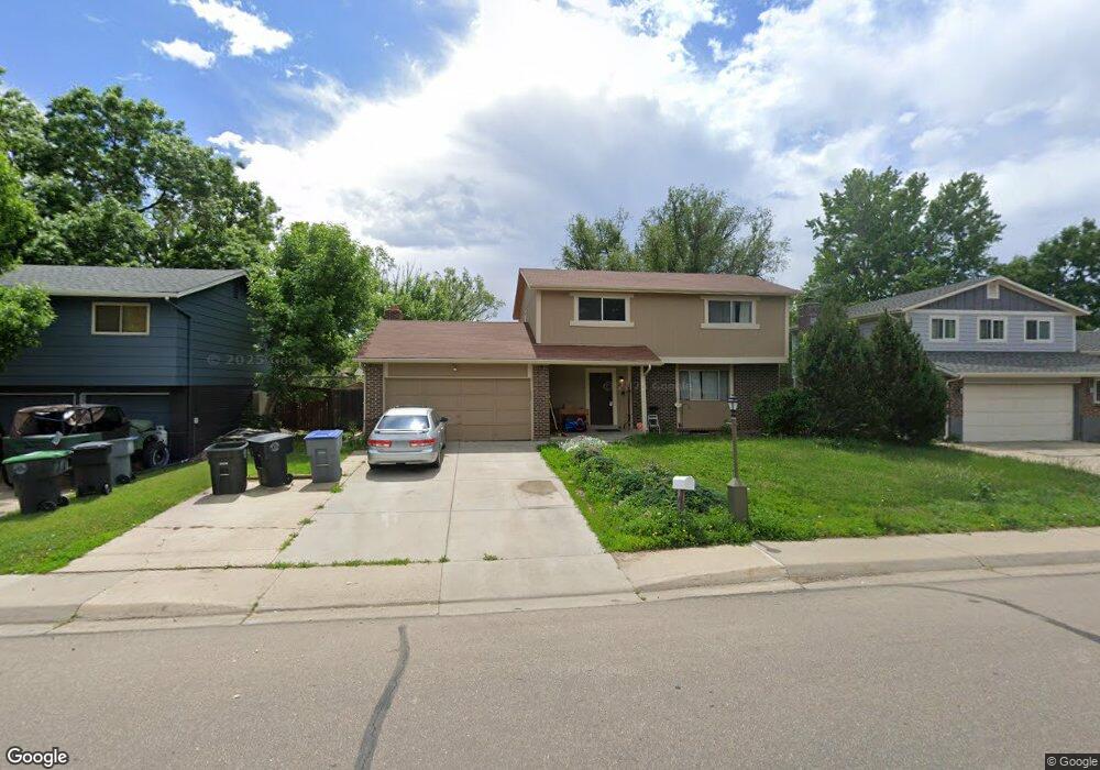
1427 Lefthand Dr Longmont, CO 80501
Southmoor NeighborhoodEstimated Value: $479,000 - $640,000
4
Beds
3
Baths
1,934
Sq Ft
$300/Sq Ft
Est. Value
About This Home
This home is located at 1427 Lefthand Dr, Longmont, CO 80501 and is currently estimated at $580,855, approximately $300 per square foot. 1427 Lefthand Dr is a home located in Boulder County with nearby schools including Indian Peaks Elementary School, Sunset Middle School, and Niwot High School.
Ownership History
Date
Name
Owned For
Owner Type
Purchase Details
Closed on
Sep 6, 2024
Sold by
Sommervolds Constructs Llc
Bought by
Grubb Dustin S
Current Estimated Value
Home Financials for this Owner
Home Financials are based on the most recent Mortgage that was taken out on this home.
Original Mortgage
$525,000
Outstanding Balance
$519,383
Interest Rate
6.73%
Mortgage Type
New Conventional
Estimated Equity
$61,472
Purchase Details
Closed on
Mar 28, 2012
Sold by
Teo Rene Michael and Wells Fargo Bank Na
Bought by
Brm Homes Llc
Purchase Details
Closed on
May 31, 1995
Sold by
Davis William E and Davis Joan F
Bought by
Teo Rene Michael
Home Financials for this Owner
Home Financials are based on the most recent Mortgage that was taken out on this home.
Original Mortgage
$97,500
Interest Rate
8.2%
Purchase Details
Closed on
Dec 2, 1991
Bought by
Brm Homes Llc
Purchase Details
Closed on
Jul 10, 1991
Bought by
Brm Homes Llc
Purchase Details
Closed on
Oct 28, 1977
Bought by
Brm Homes Llc
Create a Home Valuation Report for This Property
The Home Valuation Report is an in-depth analysis detailing your home's value as well as a comparison with similar homes in the area
Home Values in the Area
Average Home Value in this Area
Purchase History
| Date | Buyer | Sale Price | Title Company |
|---|---|---|---|
| Grubb Dustin S | $625,000 | Land Title Guarantee | |
| Sommervolds Constructs Llc | $460,000 | None Listed On Document | |
| Brm Homes Llc | -- | None Available | |
| Teo Rene Michael | $150,000 | Heritage Title | |
| Brm Homes Llc | $103,000 | -- | |
| Brm Homes Llc | -- | -- | |
| Brm Homes Llc | $55,400 | -- |
Source: Public Records
Mortgage History
| Date | Status | Borrower | Loan Amount |
|---|---|---|---|
| Open | Grubb Dustin S | $525,000 | |
| Previous Owner | Teo Rene Michael | $97,500 |
Source: Public Records
Tax History Compared to Growth
Tax History
| Year | Tax Paid | Tax Assessment Tax Assessment Total Assessment is a certain percentage of the fair market value that is determined by local assessors to be the total taxable value of land and additions on the property. | Land | Improvement |
|---|---|---|---|---|
| 2025 | $3,301 | $34,844 | $14,038 | $20,806 |
| 2024 | $3,301 | $34,844 | $14,038 | $20,806 |
| 2023 | $3,256 | $34,512 | $17,494 | $20,703 |
| 2022 | $2,895 | $29,253 | $12,392 | $16,861 |
| 2021 | $2,932 | $30,094 | $12,748 | $17,346 |
| 2020 | $2,611 | $26,877 | $10,082 | $16,795 |
| 2019 | $2,570 | $26,877 | $10,082 | $16,795 |
| 2018 | $2,273 | $23,933 | $7,272 | $16,661 |
| 2017 | $2,242 | $26,459 | $8,040 | $18,419 |
| 2016 | $2,000 | $20,919 | $7,721 | $13,198 |
| 2015 | $1,905 | $18,793 | $6,288 | $12,505 |
| 2014 | $1,755 | $18,793 | $6,288 | $12,505 |
Source: Public Records
Map
Nearby Homes
- 1435 Missouri Ave
- 1327 Brookfield Dr
- 1350 S Lincoln St
- 1801 S Pratt Pkwy
- 1527 S Vivian St
- 1435 Ashcroft Dr
- 1028 Katy Ln
- 2030 Emerald Dr
- 2050 Emerald Dr
- 1321 Onyx Cir
- 2119 Onyx Way
- 919 S Sherman St
- 1456 Sepia Ave
- 1518 Sepia Ave
- 912 Confidence Dr
- 802 Neon Forest Cir
- 2240 Summitview Dr
- 9 Seattle Ln
- 2215 Parkview Dr
- 1328 S Terry St
- 1421 Lefthand Dr
- 1433 Lefthand Dr
- 1415 Lefthand Dr
- 1441 Mayfield Cir
- 1409 Lefthand Dr
- 1442 Mayfield Cir
- 1445 Lefthand Dr
- 1415 Missouri Ave
- 1421 Missouri Ave
- 1493 Mayfield Cir
- 1443 Mayfield Cir
- 1527 Chapman Ln
- 1447 S Sherman St
- 1403 Lefthand Dr
- 1444 Mayfield Cir
- 1503 Mayfield Ln
- 1491 Mayfield Cir
- 1533 Chapman Ln
- 1443 S Sherman St
- 1445 Mayfield Cir