Estimated Value: $266,000 - $396,000
--
Bed
2
Baths
1,680
Sq Ft
$187/Sq Ft
Est. Value
About This Home
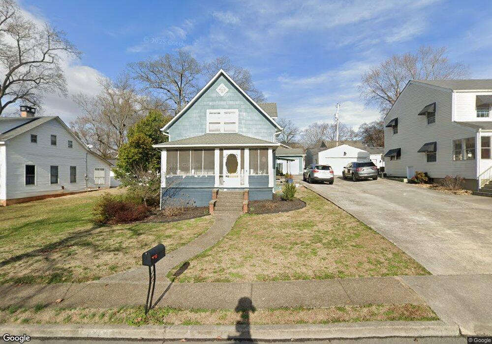
This home is located at 1428 Nobel St, Alcoa, TN 37701 and is currently estimated at $314,331, approximately $187 per square foot. 1428 Nobel St is a home located in Blount County with nearby schools including Alcoa Elementary School, Alcoa Middle School, and Alcoa High School.
Ownership History
Date
Name
Owned For
Owner Type
Purchase Details
Closed on
Jun 25, 2015
Sold by
Slaughter James Andrew
Bought by
Lamar James W and Lamar Caroline M
Current Estimated Value
Home Financials for this Owner
Home Financials are based on the most recent Mortgage that was taken out on this home.
Original Mortgage
$166,920
Outstanding Balance
$129,284
Interest Rate
3.75%
Mortgage Type
FHA
Estimated Equity
$185,047
Purchase Details
Closed on
Jul 20, 2006
Sold by
Gunning Michael Brooke
Bought by
Slaughter James Andrew
Purchase Details
Closed on
Oct 1, 2001
Sold by
Sise Randall
Bought by
Gunning Michael
Purchase Details
Closed on
Dec 2, 1996
Sold by
West Jeanne C
Bought by
Sise Randall
Purchase Details
Closed on
Jul 28, 1961
Bought by
West Lonnie B and West Jeanne C
Create a Home Valuation Report for This Property
The Home Valuation Report is an in-depth analysis detailing your home's value as well as a comparison with similar homes in the area
Home Values in the Area
Average Home Value in this Area
Purchase History
| Date | Buyer | Sale Price | Title Company |
|---|---|---|---|
| Lamar James W | $170,000 | -- | |
| Slaughter James Andrew | $122,000 | -- | |
| Gunning Michael | $95,000 | -- | |
| Sise Randall | $74,000 | -- | |
| West Lonnie B | -- | -- |
Source: Public Records
Mortgage History
| Date | Status | Borrower | Loan Amount |
|---|---|---|---|
| Open | Lamar James W | $166,920 |
Source: Public Records
Tax History Compared to Growth
Tax History
| Year | Tax Paid | Tax Assessment Tax Assessment Total Assessment is a certain percentage of the fair market value that is determined by local assessors to be the total taxable value of land and additions on the property. | Land | Improvement |
|---|---|---|---|---|
| 2025 | -- | $70,700 | $0 | $0 |
| 2024 | $2,319 | $70,700 | $11,250 | $59,450 |
| 2023 | $2,319 | $70,700 | $11,250 | $59,450 |
| 2022 | $2,005 | $42,300 | $7,500 | $34,800 |
| 2021 | $2,005 | $42,300 | $7,500 | $34,800 |
| 2020 | $2,005 | $42,300 | $7,500 | $34,800 |
| 2019 | $2,005 | $42,300 | $7,500 | $34,800 |
| 2018 | $1,471 | $33,200 | $5,325 | $27,875 |
| 2017 | $1,471 | $33,200 | $5,325 | $27,875 |
| 2016 | $1,471 | $33,200 | $5,325 | $27,875 |
| 2015 | $1,365 | $33,200 | $5,325 | $27,875 |
| 2014 | $1,391 | $33,200 | $5,325 | $27,875 |
| 2013 | $1,391 | $33,850 | $0 | $0 |
Source: Public Records
Map
Nearby Homes
- 1321 Nobel St Unit E
- 1367 Dalton St
- 1345 Dalton St
- 1340 Dalton St
- 1761 Dalton St
- 0 N Wright Rd
- 1765 N Wright Rd
- 1791 Ramsay St
- 947 Poplar St
- 1852 Kettering Rd
- 946 Poplar St
- 960 Poplar St
- 966 Poplar St
- 653 E Hunt Rd
- 1656 Peppertree Dr
- 1536 Tsuga Dr
- 1569 Ashwood Place
- 1301 Edenbridge Dr
- 2313 Grove St
- 1647 Banebury Ln
- 1422 Nobel St
- 1434 Nobel St
- 1431 Perkins St
- 1435 Perkins St
- 1416 Nobel St
- 1425 Perkins St
- 1441 Perkins St
- 1419 Perkins St
- 1410 Nobel St
- 1413 Perkins St
- 1409 Perkins St
- 1404 Nobel St
- 1432 Perkins St
- 1436 Perkins St
- 1426 Perkins St
- 1442 Perkins St
- 1420 Perkins St
- 1403 Perkins St
- 1414 Perkins St
- 1410 Perkins St