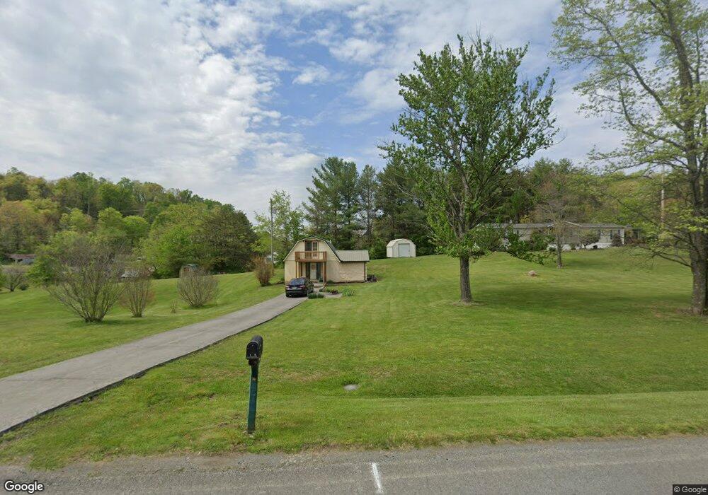
1428 Pine Brooke Rd Morristown, TN 37813
Estimated Value: $151,426 - $249,000
2
Beds
1
Bath
1,000
Sq Ft
$199/Sq Ft
Est. Value
About This Home
This home is located at 1428 Pine Brooke Rd, Morristown, TN 37813 and is currently estimated at $198,607, approximately $198 per square foot. 1428 Pine Brooke Rd is a home located in Hamblen County with nearby schools including Witt Elementary School, Lincoln Heights Middle School, and Morristown West High School.
Ownership History
Date
Name
Owned For
Owner Type
Purchase Details
Closed on
Oct 4, 1988
Bought by
Jones George M
Current Estimated Value
Purchase Details
Closed on
Sep 8, 1988
Bought by
Jones George M
Purchase Details
Closed on
May 24, 1985
Bought by
Ingle Chester B
Purchase Details
Closed on
May 14, 1985
Purchase Details
Closed on
Apr 28, 1981
Bought by
Fannon Janice M
Purchase Details
Closed on
Sep 25, 1980
Bought by
Southern Industrial Bank Corp
Purchase Details
Closed on
Oct 9, 1978
Bought by
Mckinney Jimmy
Create a Home Valuation Report for This Property
The Home Valuation Report is an in-depth analysis detailing your home's value as well as a comparison with similar homes in the area
Home Values in the Area
Average Home Value in this Area
Purchase History
| Date | Buyer | Sale Price | Title Company |
|---|---|---|---|
| Jones George M | -- | -- | |
| Jones George M | $2,000 | -- | |
| Ingle Chester B | -- | -- | |
| -- | -- | -- | |
| Fannon Janice M | -- | -- | |
| Southern Industrial Bank Corp | -- | -- | |
| Mckinney Jimmy | -- | -- |
Source: Public Records
Tax History
| Year | Tax Paid | Tax Assessment Tax Assessment Total Assessment is a certain percentage of the fair market value that is determined by local assessors to be the total taxable value of land and additions on the property. | Land | Improvement |
|---|---|---|---|---|
| 2025 | $404 | $27,475 | $3,025 | $24,450 |
| 2024 | $293 | $14,850 | $1,950 | $12,900 |
| 2023 | $293 | $14,850 | $0 | $0 |
| 2022 | $293 | $14,850 | $1,950 | $12,900 |
| 2021 | $293 | $14,850 | $1,950 | $12,900 |
| 2020 | $293 | $14,850 | $1,950 | $12,900 |
| 2019 | $284 | $13,350 | $1,500 | $11,850 |
| 2018 | $284 | $13,350 | $1,500 | $11,850 |
| 2017 | $284 | $13,350 | $1,500 | $11,850 |
| 2016 | $266 | $13,350 | $1,500 | $11,850 |
| 2015 | $247 | $13,350 | $1,500 | $11,850 |
| 2014 | -- | $13,350 | $1,500 | $11,850 |
| 2013 | -- | $14,375 | $0 | $0 |
Source: Public Records
Map
Nearby Homes
- 1160 Statem Gap Rd
- 453 Statem Gap Rd
- 2851 Coffey Rd
- 3440 Sulphur Springs Rd
- 2895 Coffey Rd
- 1100 Valley Home Rd
- 1951 Sykes Rd
- 2061 Southwood Cir
- 1049 Greenway Dr
- 701 Old Witt Rd
- 3360 Fernwood Rd
- 203 Lincoln Ave
- 2540 Castain Dr
- 715 Lincoln Ave
- 440 S Fairmont Ave
- 925 Lennie Ave
- 1500 S Davy Crockett Pkwy
- 429 Valley St
- 3023 S Davy Crockett Pkwy
- 507 W Charles St
- 1418 Pine Brooke Rd
- 1441 Mae Collins Rd
- 1400 Pine Brooke Rd
- 1447 Mae Collins Rd
- 2307 Sulphur Springs Rd
- 1442 Mae Collins Rd
- 2343 Sulphur Springs Rd
- 1418 Mae Collins Rd
- 1395 Mae Collins Rd
- 2385 Sulphur Springs Rd
- 2151 Sulphur Springs Rd
- 1480 Pine Brooke Rd
- 1390 Pine Brooke Rd
- 2264 Junction Ln
- 2368 Sulphur Springs Rd
- 2366 Sulphur Springs Rd
- 1382 Mae Collins Rd
- 2010 Sulphur Springs Rd
- 1441 Pine Brooke Rd
- 2145 Sulphur Springs Rd
Your Personal Tour Guide
Ask me questions while you tour the home.