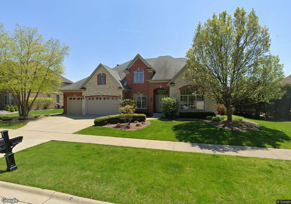
1428 Roscommon Way Lemont, IL 60439
Southeast Lemont NeighborhoodEstimated Value: $810,385 - $956,000
4
Beds
4
Baths
3,737
Sq Ft
$233/Sq Ft
Est. Value
About This Home
This home is located at 1428 Roscommon Way, Lemont, IL 60439 and is currently estimated at $869,846, approximately $232 per square foot. 1428 Roscommon Way is a home located in Cook County with nearby schools including Oakwood School, River Valley School, and Old Quarry Middle School.
Ownership History
Date
Name
Owned For
Owner Type
Purchase Details
Closed on
Jun 2, 2006
Sold by
Dignan Development Llc
Bought by
Magdziarz Daniel D and Magdziarz Peggy J
Current Estimated Value
Home Financials for this Owner
Home Financials are based on the most recent Mortgage that was taken out on this home.
Original Mortgage
$500,000
Outstanding Balance
$295,437
Interest Rate
6.66%
Mortgage Type
Fannie Mae Freddie Mac
Estimated Equity
$574,409
Create a Home Valuation Report for This Property
The Home Valuation Report is an in-depth analysis detailing your home's value as well as a comparison with similar homes in the area
Home Values in the Area
Average Home Value in this Area
Purchase History
| Date | Buyer | Sale Price | Title Company |
|---|---|---|---|
| Magdziarz Daniel D | $700,000 | Cti |
Source: Public Records
Mortgage History
| Date | Status | Borrower | Loan Amount |
|---|---|---|---|
| Open | Magdziarz Daniel D | $500,000 |
Source: Public Records
Tax History Compared to Growth
Tax History
| Year | Tax Paid | Tax Assessment Tax Assessment Total Assessment is a certain percentage of the fair market value that is determined by local assessors to be the total taxable value of land and additions on the property. | Land | Improvement |
|---|---|---|---|---|
| 2024 | $12,644 | $64,155 | $8,137 | $56,018 |
| 2023 | $10,189 | $64,155 | $8,137 | $56,018 |
| 2022 | $10,189 | $45,390 | $7,198 | $38,192 |
| 2021 | $9,899 | $45,389 | $7,197 | $38,192 |
| 2020 | $10,057 | $45,389 | $7,197 | $38,192 |
| 2019 | $9,094 | $42,748 | $7,197 | $35,551 |
| 2018 | $9,859 | $46,772 | $7,197 | $39,575 |
| 2017 | $9,725 | $46,772 | $7,197 | $39,575 |
| 2016 | $8,693 | $39,317 | $5,946 | $33,371 |
| 2015 | $9,133 | $40,737 | $5,946 | $34,791 |
| 2014 | $10,373 | $45,446 | $5,946 | $39,500 |
| 2013 | $10,009 | $49,669 | $5,946 | $43,723 |
Source: Public Records
Map
Nearby Homes
- 14318 Mccarthy Rd
- 1249 Cronin Ct
- 1297 Mccarthy Rd
- 14517 Albany Ave
- 12203 Walker Rd
- 12652 Derby Rd
- 1216 Country Ln
- 1369 Notre Dame Dr
- 12723 Caruso Ct
- 12744 Caruso Ct
- 1156 Covington Dr
- 12 Woodland Dr
- 13204 Derby Rd
- 13815 Mccarthy Rd
- 7 Loblolly Ct
- 14151 131st St
- Fremont Plan at Covington Knolls
- Eden Plan at Covington Knolls
- Danbury Plan at Covington Knolls
- Calysta Plan at Covington Knolls
- 1416 Roscommon Way
- 1440 Roscommon Way
- 1293 Drawbridge Ln
- 1289 Drawbridge Ln
- 1297 Drawbridge Ln
- 1435 Roscommon Way
- 1406 Roscommon Way
- 1429 Roscommon Way
- 1423 Roscommon Way
- 1285 Drawbridge Ln
- 1301 Drawbridge Ln
- 1415 Roscommon Way
- 1409 Roscommon Way
- 1305 Drawbridge Ln
- 1403 Roscommon Way
- 1292 Drawbridge Ln
- 1288 Drawbridge Ln
- 1430 Covington Dr
- 12474 Walker Rd
- 1436 Covington Dr