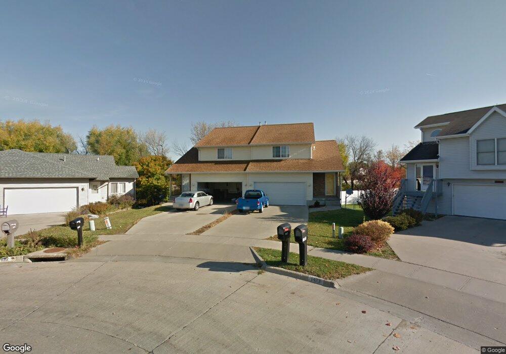
1429 Denali Ct Coralville, IA 52241
Estimated Value: $236,421 - $261,000
3
Beds
3
Baths
1,428
Sq Ft
$174/Sq Ft
Est. Value
About This Home
This home is located at 1429 Denali Ct, Coralville, IA 52241 and is currently estimated at $248,855, approximately $174 per square foot. 1429 Denali Ct is a home located in Johnson County with nearby schools including Kirkwood Elementary School, Northwest Junior High School, and West High School.
Ownership History
Date
Name
Owned For
Owner Type
Purchase Details
Closed on
Sep 1, 2006
Sold by
Johnson Todd D and Johnson Julianne S
Bought by
Klouda Houlahan Karen K
Current Estimated Value
Home Financials for this Owner
Home Financials are based on the most recent Mortgage that was taken out on this home.
Original Mortgage
$80,000
Outstanding Balance
$48,057
Interest Rate
6.77%
Mortgage Type
New Conventional
Estimated Equity
$200,798
Create a Home Valuation Report for This Property
The Home Valuation Report is an in-depth analysis detailing your home's value as well as a comparison with similar homes in the area
Home Values in the Area
Average Home Value in this Area
Purchase History
| Date | Buyer | Sale Price | Title Company |
|---|---|---|---|
| Klouda Houlahan Karen K | $130,000 | None Available |
Source: Public Records
Mortgage History
| Date | Status | Borrower | Loan Amount |
|---|---|---|---|
| Open | Klouda Houlahan Karen K | $80,000 |
Source: Public Records
Tax History Compared to Growth
Tax History
| Year | Tax Paid | Tax Assessment Tax Assessment Total Assessment is a certain percentage of the fair market value that is determined by local assessors to be the total taxable value of land and additions on the property. | Land | Improvement |
|---|---|---|---|---|
| 2025 | $4,086 | $227,500 | $30,900 | $196,600 |
| 2024 | $4,034 | $220,400 | $30,900 | $189,500 |
| 2023 | $3,650 | $220,400 | $30,900 | $189,500 |
| 2022 | $3,484 | $174,100 | $10,800 | $163,300 |
| 2021 | $3,450 | $174,100 | $10,800 | $163,300 |
| 2020 | $3,450 | $165,500 | $10,800 | $154,700 |
| 2019 | $3,426 | $165,500 | $10,800 | $154,700 |
| 2018 | $3,360 | $165,500 | $10,800 | $154,700 |
| 2017 | $3,380 | $165,500 | $10,800 | $154,700 |
| 2016 | $3,290 | $165,500 | $10,800 | $154,700 |
| 2015 | $3,290 | $165,500 | $10,800 | $154,700 |
| 2014 | $3,010 | $150,900 | $10,800 | $140,100 |
Source: Public Records
Map
Nearby Homes
- 1428 Kenai Ct
- 2100 14th St Unit 42A
- 2239 13th St
- 2267 13th St Unit 65B
- 2262 Holiday Rd Unit 104
- 1357 Ozark Ridge
- 996 22nd Ave
- 2106 Holiday Rd
- 2270 Holiday Rd Unit 509
- 2060 Holiday Rd
- 1731 Parkway Dr
- 2050 S Ridge Dr
- 2102 10th Street Place
- 1742 Park Ridge Dr
- 1455 Ozark Ridge
- 1730 Lynncrest Dr
- 930 23rd Avenue Place Unit 6
- 1202 21st Avenue Place
- 940 23rd Ave Unit D
- 2424 10th St
- 1432 Denali Ct
- 1427 Denali Ct
- 1430 Denali Ct
- 1423 Denali Ct Unit 24A
- 1421 Denali Ct
- 1426 Denali Ct
- 1417 Denali Ct
- 1424 Denali Ct
- 1415 Denali Ct
- 1420 Denali Ct Unit 20B
- 1420 Denali Ct
- 1418 Denali Ct Unit 20A
- 1418 Denali Ct
- 1409 Denali Ct
- 1427 Kenai Ct
- 1414 Denali Ct
- 1426 Kenai Ct
- 1431 Kodiak Ct
- 1412 Denali Ct Unit 19A
- 1422 Kenai Ct