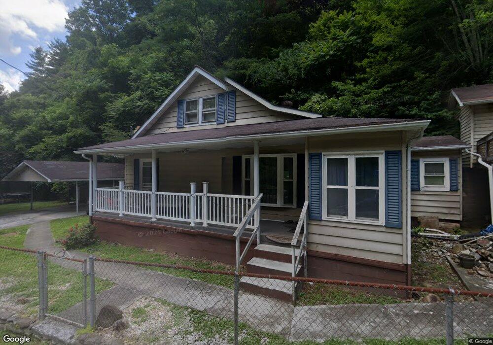
1429 Dry Fork Rd Vansant, VA 24656
Estimated Value: $99,000 - $123,000
4
Beds
2
Baths
1,602
Sq Ft
$71/Sq Ft
Est. Value
About This Home
This home is located at 1429 Dry Fork Rd, Vansant, VA 24656 and is currently estimated at $113,773, approximately $71 per square foot. 1429 Dry Fork Rd is a home located in Buchanan County with nearby schools including Riverview Elementary/Middle School and Grundy High School.
Ownership History
Date
Name
Owned For
Owner Type
Purchase Details
Closed on
Aug 18, 2015
Sold by
Mullins Dustin
Bought by
Owens Lori M
Current Estimated Value
Home Financials for this Owner
Home Financials are based on the most recent Mortgage that was taken out on this home.
Original Mortgage
$53,860
Outstanding Balance
$43,025
Interest Rate
4.5%
Mortgage Type
FHA
Estimated Equity
$70,748
Purchase Details
Closed on
Jan 3, 2008
Sold by
Equity Trustees Llc
Bought by
Wells Fargo Bank Na
Create a Home Valuation Report for This Property
The Home Valuation Report is an in-depth analysis detailing your home's value as well as a comparison with similar homes in the area
Home Values in the Area
Average Home Value in this Area
Purchase History
| Date | Buyer | Sale Price | Title Company |
|---|---|---|---|
| Owens Lori M | $56,500 | Attorney | |
| Wells Fargo Bank Na | $69,239 | First American Title Insuran |
Source: Public Records
Mortgage History
| Date | Status | Borrower | Loan Amount |
|---|---|---|---|
| Open | Owens Lori M | $53,860 |
Source: Public Records
Tax History Compared to Growth
Tax History
| Year | Tax Paid | Tax Assessment Tax Assessment Total Assessment is a certain percentage of the fair market value that is determined by local assessors to be the total taxable value of land and additions on the property. | Land | Improvement |
|---|---|---|---|---|
| 2024 | $317 | $81,400 | $18,600 | $62,800 |
| 2023 | $317 | $81,400 | $18,600 | $62,800 |
| 2022 | $317 | $81,400 | $18,600 | $62,800 |
| 2021 | $317 | $81,400 | $18,600 | $62,800 |
| 2020 | $379 | $97,100 | $18,600 | $78,500 |
| 2019 | $379 | $97,100 | $18,600 | $78,500 |
| 2017 | $379 | $74,300 | $18,600 | $55,700 |
| 2016 | $379 | $0 | $0 | $0 |
| 2015 | -- | $58,900 | $12,600 | $46,300 |
Source: Public Records
Map
Nearby Homes
- 1877 Lovers Gap Rd
- 0 Dry Fork Rd
- 18775 Riverside Dr
- TBD Cypress St
- 1104 Little Prater Rd
- 1025 White Birch Ln
- 1107 Russell Hill St
- 2477 Leemaster Dr
- TBD Riverside Dr
- 1078 Joe Hollow Rd
- 1087 Greenhouse Cir
- 1154 Fairview St
- 9725 Garden Creek Rd
- 1075 Gator Rd
- 8232 Garden Creek Rd
- 2929 Slate Creek Rd
- 8836 Lovers Gap Rd
- 1079 Highlawn Cir
- 1014 Banner Rd
- 1991 Old Greenbrier Rd
- 1401 Dry Fork Rd
- 1457 Dry Fork Rd
- 1472 Dry Fork Rd
- 1373 Dry Fork Rd
- 1428 Dry Fork Rd
- 1539 Dry Fork Rd
- 1500 Dry Fork Rd
- 1315 Dry Fork Rd
- 1543 Dry Fork Rd
- 1562 Dry Fork Rd
- 1277 Dry Fork Rd
- 1265 Dry Fork Rd
- 1614 Dry Fork Rd
- 1241 Dry Fork Rd
- 1227 Dry Fork Rd
- 1234 Dry Fork Rd
- 1506 Dry Fork Rd
- 1643 Dry Fork Rd
- 1004 Townsend Rd
- 1207 Dry Fork Rd