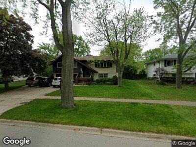
1429 Yale Ln Schaumburg, IL 60193
South Schaumburg NeighborhoodEstimated Value: $408,690 - $459,000
3
Beds
2
Baths
1,847
Sq Ft
$231/Sq Ft
Est. Value
About This Home
This home is located at 1429 Yale Ln, Schaumburg, IL 60193 and is currently estimated at $427,423, approximately $231 per square foot. 1429 Yale Ln is a home located in Cook County with nearby schools including Nathan Hale Elementary School, Jane Addams Junior High School, and Schaumburg High School.
Ownership History
Date
Name
Owned For
Owner Type
Purchase Details
Closed on
Jul 31, 2014
Sold by
Becker Peter B and Becker Lisa A
Bought by
The Becker Family 2014 Trust
Current Estimated Value
Purchase Details
Closed on
Feb 28, 1996
Sold by
Hurst Raymond and Hurst Patricia A
Bought by
Becker Peter B and Becker Lisa A
Home Financials for this Owner
Home Financials are based on the most recent Mortgage that was taken out on this home.
Original Mortgage
$163,800
Interest Rate
7.07%
Create a Home Valuation Report for This Property
The Home Valuation Report is an in-depth analysis detailing your home's value as well as a comparison with similar homes in the area
Home Values in the Area
Average Home Value in this Area
Purchase History
| Date | Buyer | Sale Price | Title Company |
|---|---|---|---|
| The Becker Family 2014 Trust | -- | None Available | |
| Becker Peter B | $182,000 | -- |
Source: Public Records
Mortgage History
| Date | Status | Borrower | Loan Amount |
|---|---|---|---|
| Closed | Becker Peter B | $137,967 | |
| Closed | Becker Peter B | $163,800 |
Source: Public Records
Tax History Compared to Growth
Tax History
| Year | Tax Paid | Tax Assessment Tax Assessment Total Assessment is a certain percentage of the fair market value that is determined by local assessors to be the total taxable value of land and additions on the property. | Land | Improvement |
|---|---|---|---|---|
| 2024 | $8,306 | $34,000 | $7,008 | $26,992 |
| 2023 | $8,306 | $34,000 | $7,008 | $26,992 |
| 2022 | $8,306 | $34,000 | $7,008 | $26,992 |
| 2021 | $7,271 | $27,318 | $4,755 | $22,563 |
| 2020 | $7,213 | $27,318 | $4,755 | $22,563 |
| 2019 | $7,308 | $30,695 | $4,755 | $25,940 |
| 2018 | $7,148 | $27,252 | $4,254 | $22,998 |
| 2017 | $7,053 | $27,252 | $4,254 | $22,998 |
| 2016 | $6,838 | $27,252 | $4,254 | $22,998 |
| 2015 | $6,200 | $23,348 | $3,754 | $19,594 |
| 2014 | $6,148 | $23,348 | $3,754 | $19,594 |
| 2013 | $5,973 | $23,348 | $3,754 | $19,594 |
Source: Public Records
Map
Nearby Homes
- 1618 Syracuse Ln
- 1629 Syracuse Ln
- 1408 Hampton Ln
- 1613 Hartmann Dr
- 1424 W Wise Rd
- 1500 W Wise Rd
- 1106 Westfield Ln
- 738 Crest Ave
- 7541 Wedgewood Dr
- 532 Cambridge Dr
- 1083 Groton Ct
- 1062 Matfield Ct
- 691 Fairhaven Dr
- 7728 Bolton Way
- 1042 Cranbrook Dr
- 1301 Fairlane Dr
- 1701 Kingston Ln
- 1018 Brighton Ct
- 1224 Kingston Ln
- 1500 W Weathersfield Way