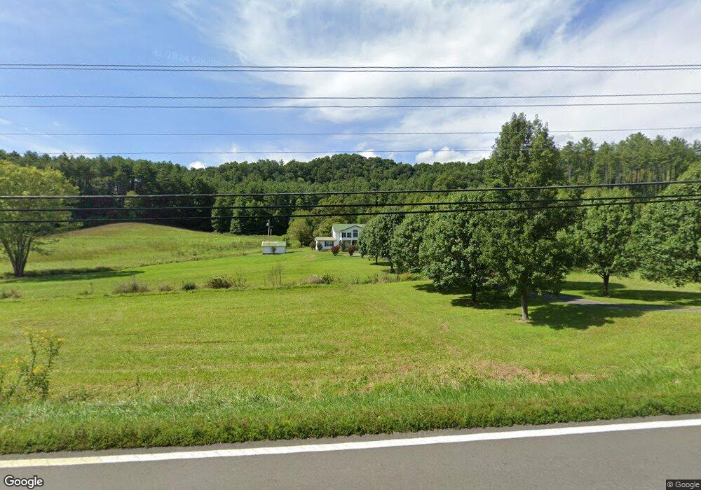
14294 Highway 67 W Butler, TN 37640
Estimated Value: $312,000 - $598,000
4
Beds
4
Baths
4,300
Sq Ft
$99/Sq Ft
Est. Value
About This Home
This home is located at 14294 Highway 67 W, Butler, TN 37640 and is currently estimated at $424,467, approximately $98 per square foot. 14294 Highway 67 W is a home located in Johnson County with nearby schools including Johnson County Middle School and Johnson County High School.
Ownership History
Date
Name
Owned For
Owner Type
Purchase Details
Closed on
Oct 27, 2011
Sold by
Pritchard Carol A
Bought by
Pritchard Michael J
Current Estimated Value
Purchase Details
Closed on
Nov 30, 2005
Sold by
Not Provided
Bought by
Pritchard Michael
Purchase Details
Closed on
Aug 5, 2005
Sold by
Not Provided
Bought by
Pritchard Michael
Purchase Details
Closed on
Oct 11, 2002
Bought by
Tobiassen Ross T and Tobiassen Mickie T
Purchase Details
Closed on
Mar 29, 1991
Bought by
Smalling Robert Allen
Purchase Details
Closed on
Apr 21, 1942
Bought by
Smalling Joy Belle
Create a Home Valuation Report for This Property
The Home Valuation Report is an in-depth analysis detailing your home's value as well as a comparison with similar homes in the area
Home Values in the Area
Average Home Value in this Area
Purchase History
| Date | Buyer | Sale Price | Title Company |
|---|---|---|---|
| Pritchard Michael J | -- | -- | |
| Pritchard Michael | $165,000 | -- | |
| Pritchard Michael | $151,841 | -- | |
| Tobiassen Ross T | $175,000 | -- | |
| Smalling Robert Allen | -- | -- | |
| Smalling Joy Belle | -- | -- |
Source: Public Records
Tax History Compared to Growth
Tax History
| Year | Tax Paid | Tax Assessment Tax Assessment Total Assessment is a certain percentage of the fair market value that is determined by local assessors to be the total taxable value of land and additions on the property. | Land | Improvement |
|---|---|---|---|---|
| 2024 | $1,009 | $45,675 | $8,125 | $37,550 |
| 2023 | $1,009 | $45,675 | $8,125 | $37,550 |
| 2022 | $827 | $45,675 | $8,125 | $37,550 |
| 2021 | $827 | $45,675 | $8,125 | $37,550 |
| 2020 | $905 | $45,675 | $8,125 | $37,550 |
| 2019 | $905 | $44,125 | $7,725 | $36,400 |
| 2018 | $1,186 | $57,875 | $21,475 | $36,400 |
| 2017 | $1,186 | $57,875 | $21,475 | $36,400 |
| 2016 | $1,186 | $57,875 | $21,475 | $36,400 |
| 2015 | $1,048 | $57,875 | $21,475 | $36,400 |
| 2014 | $1,115 | $61,575 | $21,500 | $40,075 |
Source: Public Records
Map
Nearby Homes
- 14135 W Hwy 67 (30 82 Acres)
- 14135 Hwy 67w (30 82 Acres)
- 14135 W Highway 67 (30 82 Acres)
- 00 Sink Valley Rd
- 3379 Tbd Sink Valley Rd
- 125 Dogwood Ln
- 4379 Pine Orchard Rd
- tbd H Proffitt Ln
- 3379 Tbd Sink Valley Rd
- 382 Lowell Stalcup Rd
- 118 Managoff Ln
- 268 Moreland Dr
- LOT 23 W of Dry Hill Rd
- 00 Highway 67 W
- 231 Pine St
- 0 Oak Springs Rd
- 1820 Pine Orchard Rd
- 14135 Hwy 67 W
- Lot 33 Vineyard Farms Pkwy
- Tbd Tank Rd
- 14135 Highway 67 W
- 14135 W Highway 67 (30 Acres)
- 14271 Highway 67 W
- 14391 Highway 67 W Unit W14391
- 13964 Highway 67 W
- 14419 Highway 67 W
- 13953 Highway 67 W
- 249 Cobb Creek Rd
- 508 Cobb Creek Rd
- 13657 Highway 67 W
- 13657 Highway 67 W Unit 1
- 183 Cobb Creek Rd
- 7 Wilderness Trail
- 165 Wilderness Trail
- 167 Wilderness Trail
- #5 Wilderness Trail
- Lot 1 Wilderness Trail
- 166 Wilderness Trail
- TBD Wilderness Trail
- Site 9 Wilderness Trail