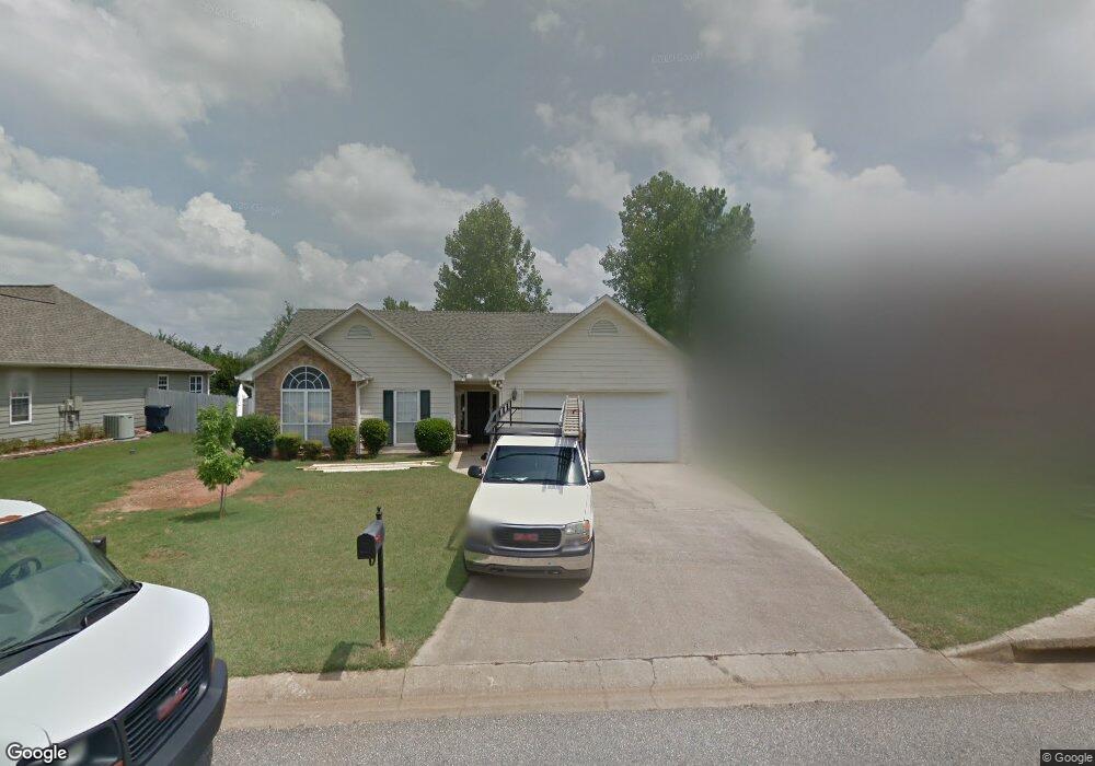
143 Cedar Grove Pkwy Maylene, AL 35114
Estimated Value: $205,000 - $247,000
--
Bed
1
Bath
1,141
Sq Ft
$198/Sq Ft
Est. Value
About This Home
This home is located at 143 Cedar Grove Pkwy, Maylene, AL 35114 and is currently estimated at $226,324, approximately $198 per square foot. 143 Cedar Grove Pkwy is a home located in Shelby County with nearby schools including Thompson Intermediate School, Thompson Middle School, and Thompson High School.
Ownership History
Date
Name
Owned For
Owner Type
Purchase Details
Closed on
Sep 3, 2020
Sold by
Combs Cheryl
Bought by
Flynn Frances and Flynn Brian
Current Estimated Value
Purchase Details
Closed on
Jun 16, 1999
Sold by
Hull John C and Justice Lee Kate
Bought by
Combs Cheryl
Home Financials for this Owner
Home Financials are based on the most recent Mortgage that was taken out on this home.
Original Mortgage
$84,800
Interest Rate
7.04%
Purchase Details
Closed on
Aug 28, 1998
Sold by
Tom Lacey Construction Co Inc
Bought by
Hull John C and Justice Lee Kate
Home Financials for this Owner
Home Financials are based on the most recent Mortgage that was taken out on this home.
Original Mortgage
$100,250
Interest Rate
6.99%
Create a Home Valuation Report for This Property
The Home Valuation Report is an in-depth analysis detailing your home's value as well as a comparison with similar homes in the area
Home Values in the Area
Average Home Value in this Area
Purchase History
| Date | Buyer | Sale Price | Title Company |
|---|---|---|---|
| Flynn Frances | $162,000 | None Available | |
| Combs Cheryl | $106,000 | -- | |
| Hull John C | $103,400 | Cahaba Title Inc |
Source: Public Records
Mortgage History
| Date | Status | Borrower | Loan Amount |
|---|---|---|---|
| Previous Owner | Combs Cheryl | $84,800 | |
| Previous Owner | Hull John C | $100,250 |
Source: Public Records
Tax History Compared to Growth
Tax History
| Year | Tax Paid | Tax Assessment Tax Assessment Total Assessment is a certain percentage of the fair market value that is determined by local assessors to be the total taxable value of land and additions on the property. | Land | Improvement |
|---|---|---|---|---|
| 2024 | $975 | $18,060 | $0 | $0 |
| 2023 | $929 | $17,200 | $0 | $0 |
| 2022 | $849 | $15,720 | $0 | $0 |
| 2021 | $742 | $13,740 | $0 | $0 |
| 2020 | $639 | $12,600 | $0 | $0 |
| 2019 | $607 | $12,000 | $0 | $0 |
| 2017 | $552 | $10,980 | $0 | $0 |
| 2015 | $520 | $10,380 | $0 | $0 |
| 2014 | $520 | $10,380 | $0 | $0 |
Source: Public Records
Map
Nearby Homes
- 501 Ramsgate Dr
- 236 Queens Gate
- 208 Queens Gate
- 155 Victoria Station
- 306 Mayfair Cir
- 549 Ramsgate Dr
- 545 Ramsgate Dr
- 217 Mayfair Park
- 309 Cedar Grove Ct
- 537 Ramsgate Dr
- 233 Norwick Forest Dr
- 109 Kingsley Cir
- 220 Cedar Meadow
- 256 Cedar Meadow
- 280 Cedar Grove Pkwy Unit 34
- 128 Oak St
- 112 Kingsley Ct
- 217 Kensington Ln
- 2014 1st Ave W
- 104 Maple St
- 139 Cedar Grove Pkwy
- 147 Cedar Grove Pkwy
- 135 Cedar Grove Pkwy
- 151 Cedar Grove Pkwy
- 105 Runnymede
- 144 Cedar Grove Pkwy
- 140 Cedar Grove Pkwy
- 146 Cedar Grove Pkwy
- 105 Runnymede
- 136 Cedar Grove Pkwy
- 129 Cedar Grove Pkwy
- 109 Runnymede
- 100 Victoria Station
- 109 Runnymede
- 132 Cedar Grove Pkwy
- 132 Cedar Grove Pkwy
- 104 Victoria Station
- 521 Cedar Grove Cir
- 125 Cedar Grove Pkwy
- 159 Cedar Grove Pkwy