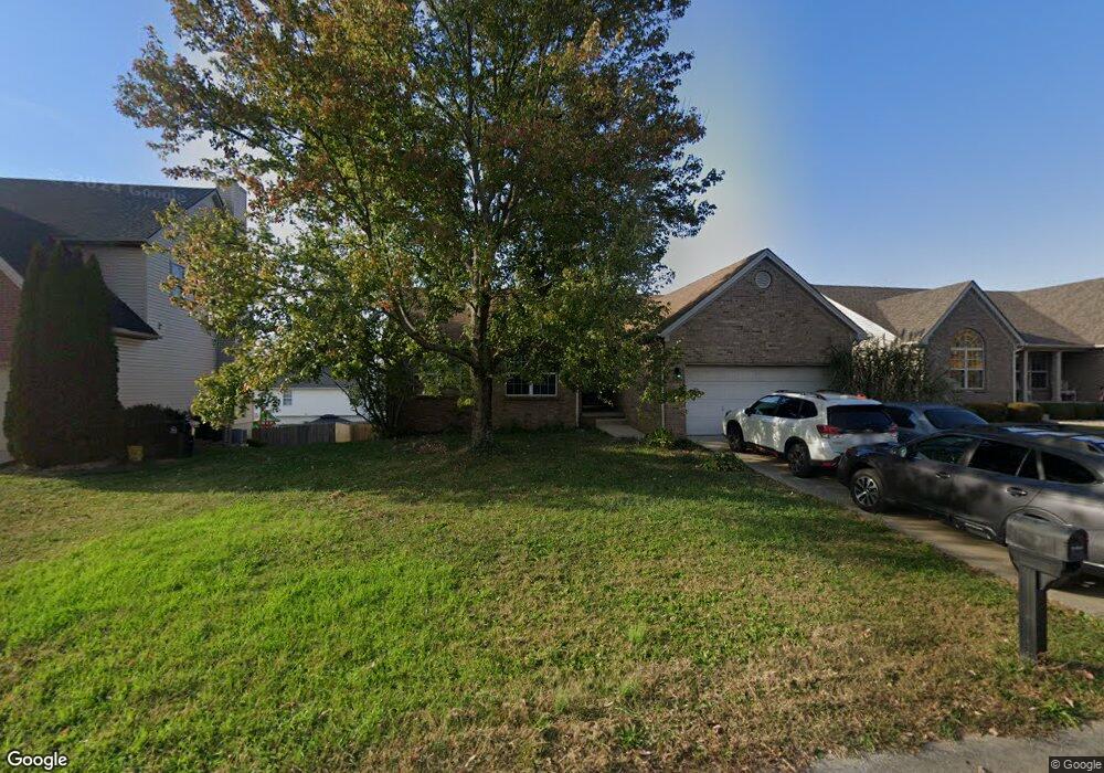
143 Irving Ln Georgetown, KY 40324
Bradford Place NeighborhoodEstimated Value: $344,000 - $379,000
3
Beds
3
Baths
3,282
Sq Ft
$109/Sq Ft
Est. Value
About This Home
This home is located at 143 Irving Ln, Georgetown, KY 40324 and is currently estimated at $359,274, approximately $109 per square foot. 143 Irving Ln is a home located in Scott County with nearby schools including Southern Elementary School, Georgetown Middle School, and Scott County High School.
Ownership History
Date
Name
Owned For
Owner Type
Purchase Details
Closed on
Sep 4, 2009
Sold by
Mcintire Trinna C
Bought by
Parker Trent S and Parker Shannon
Current Estimated Value
Home Financials for this Owner
Home Financials are based on the most recent Mortgage that was taken out on this home.
Original Mortgage
$188,522
Outstanding Balance
$121,276
Interest Rate
5.19%
Mortgage Type
FHA
Estimated Equity
$237,998
Create a Home Valuation Report for This Property
The Home Valuation Report is an in-depth analysis detailing your home's value as well as a comparison with similar homes in the area
Home Values in the Area
Average Home Value in this Area
Purchase History
| Date | Buyer | Sale Price | Title Company |
|---|---|---|---|
| Parker Trent S | $192,000 | None Available |
Source: Public Records
Mortgage History
| Date | Status | Borrower | Loan Amount |
|---|---|---|---|
| Open | Parker Trent S | $188,522 |
Source: Public Records
Tax History
| Year | Tax Paid | Tax Assessment Tax Assessment Total Assessment is a certain percentage of the fair market value that is determined by local assessors to be the total taxable value of land and additions on the property. | Land | Improvement |
|---|---|---|---|---|
| 2025 | $3,046 | $342,000 | $0 | $0 |
| 2024 | $2,607 | $289,900 | $0 | $0 |
| 2023 | $2,512 | $277,000 | $42,000 | $235,000 |
| 2022 | $2,155 | $253,500 | $35,000 | $218,500 |
| 2021 | $2,250 | $238,800 | $35,000 | $203,800 |
| 2020 | $1,882 | $219,100 | $35,000 | $184,100 |
| 2019 | $1,840 | $210,800 | $0 | $0 |
| 2018 | $1,779 | $205,021 | $0 | $0 |
| 2017 | $1,788 | $205,021 | $0 | $0 |
| 2016 | $1,618 | $200,916 | $0 | $0 |
| 2015 | $1,585 | $198,100 | $0 | $0 |
| 2014 | $1,615 | $194,790 | $0 | $0 |
| 2011 | $121 | $194,790 | $0 | $0 |
Source: Public Records
Map
Nearby Homes
- 113 Walden Cove Unit 3I
- 115 Victor Place
- 512 Pocahontas Trail
- 106 Ransom Trace
- 104 Bronte Place
- 232 W Showalter Dr
- 1117 Pawnee Trail
- 206 Hiawatha Trail
- 107 Oconner Ct
- 1003 Parkside Dr
- 1026 Parkside Dr
- 251 W Showalter Dr
- 106 Somerset Cove
- 1010 Walker Way
- 264 W Showalter Dr
- 108 Pinwheel Ct
- 164 Stapleton Way
- 140 Magellan Ln
- 144 Magellan Ln
- 109 Crescent Way
- 141 Irving Ln
- 145 Irving Ln
- 220 Ransom Trace
- 218 Ransom Trace
- 222 Ransom Trace
- 139 Irving Ln Unit 5
- 147 Irving Ln
- 144 Irving Ln
- 146 Irving Ln
- 142 Irving Ln Unit 3D
- 216 Ransom Trace
- 224 Ransom Trace
- 137 Irving Ln
- 140 Irving Ln
- 148 Irving Ln
- 149 Irving Ln
- 214 Ransom Trace
- 226 Ransom Trace
- 135 Irving Ln
- 150 Irving Ln
Your Personal Tour Guide
Ask me questions while you tour the home.