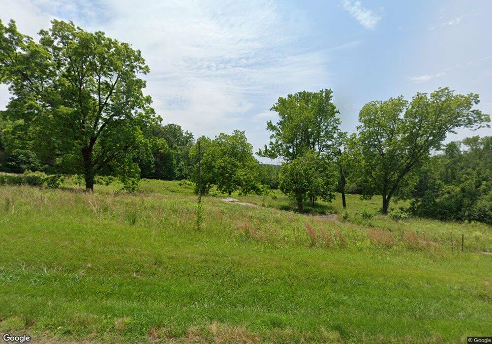
143 Maddox Rd Buford, GA 30518
Estimated Value: $374,635
3
Beds
1
Bath
1,568
Sq Ft
$239/Sq Ft
Est. Value
About This Home
This home is located at 143 Maddox Rd, Buford, GA 30518 and is currently estimated at $374,635, approximately $238 per square foot. 143 Maddox Rd is a home located in Gwinnett County with nearby schools including Buford Elementary School, Buford Senior Academy, and Buford Academy.
Ownership History
Date
Name
Owned For
Owner Type
Purchase Details
Closed on
May 24, 2005
Sold by
Reed Garrett
Bought by
B & G Cornerstone Investments Llc
Current Estimated Value
Home Financials for this Owner
Home Financials are based on the most recent Mortgage that was taken out on this home.
Original Mortgage
$120,000
Interest Rate
5.74%
Purchase Details
Closed on
Mar 29, 2005
Sold by
Clinton Brenda R
Bought by
Reed Garrett and Reed James
Home Financials for this Owner
Home Financials are based on the most recent Mortgage that was taken out on this home.
Original Mortgage
$120,000
Interest Rate
5.74%
Create a Home Valuation Report for This Property
The Home Valuation Report is an in-depth analysis detailing your home's value as well as a comparison with similar homes in the area
Home Values in the Area
Average Home Value in this Area
Purchase History
| Date | Buyer | Sale Price | Title Company |
|---|---|---|---|
| B & G Cornerstone Investments Llc | $165,000 | -- | |
| Reed Garrett | $100,000 | -- |
Source: Public Records
Mortgage History
| Date | Status | Borrower | Loan Amount |
|---|---|---|---|
| Closed | B & G Cornerstone Investments Llc | $120,000 | |
| Previous Owner | Reed Garrett | $100,000 |
Source: Public Records
Tax History Compared to Growth
Tax History
| Year | Tax Paid | Tax Assessment Tax Assessment Total Assessment is a certain percentage of the fair market value that is determined by local assessors to be the total taxable value of land and additions on the property. | Land | Improvement |
|---|---|---|---|---|
| 2025 | -- | $281,440 | $281,440 | -- |
| 2024 | $4,039 | $281,440 | $281,440 | -- |
| 2023 | $4,039 | $210,800 | $210,800 | $0 |
| 2022 | $1,781 | $124,080 | $124,080 | $0 |
| 2021 | $2,124 | $148,040 | $132,800 | $15,240 |
| 2020 | $2,124 | $148,040 | $132,800 | $15,240 |
| 2019 | $1,918 | $148,040 | $132,800 | $15,240 |
| 2018 | $1,011 | $78,000 | $70,000 | $8,000 |
| 2016 | $1,000 | $78,000 | $70,000 | $8,000 |
| 2015 | $1,035 | $78,000 | $70,000 | $8,000 |
| 2014 | $1,052 | $78,000 | $70,000 | $8,000 |
Source: Public Records
Map
Nearby Homes
- 190 Maddox Rd
- 103 Maddox Rd
- 4316 Woodland Bank Blvd
- 4245 Woodland Bank Blvd
- 0 French Blvd
- 2398 E Maddox Rd
- 3684 Heritage Crest Pkwy
- 3600 Devenwood Way
- 3735 Fir Dr
- 2446 Thrasher Rd
- 1781 Plunketts Rd
- 2267 Pink Hawthorn Dr
- 2101 E Maddox Rd
- 2040 Harvest Ridge Cir
- 2040 Harvest Ridge Cir NE
- 3671 Quail Creek Dr
- 2140 Harvest Ridge Cir
- 2262 Silver Fox Ln
- 4238 Hamilton Mill Rd
- 0 Maddox Rd
- 0 Maddox Rd Unit 7414276
- 0 Maddox Rd Unit 7264539
- 0 Maddox Rd Unit 7064917
- 0 Maddox Rd Unit 3199379
- 0 Maddox Rd Unit 3199368
- 0 Maddox Rd Unit 8983646
- 0 Maddox Rd Unit 8155232
- 0 Maddox Rd Unit 3196646
- 0 Maddox Rd Unit 3250547
- 0 Maddox Rd Unit 3281608
- 0 Maddox Rd Unit 7097420
- 0 Maddox Rd Unit 8198871
- 0 Maddox Rd Unit 8284825
- 154 Maddox Rd
- 155 Maddox Rd
- 156 Maddox Rd
- 157 Maddox Rd Unit Tract
- 157 Maddox Rd
- 159 Maddox Rd
