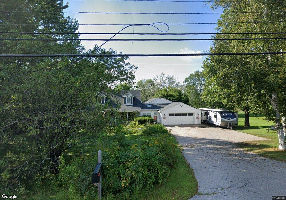
143 Merrimack St Hooksett, NH 03106
Estimated Value: $472,000 - $677,000
3
Beds
2
Baths
2,323
Sq Ft
$250/Sq Ft
Est. Value
About This Home
This home is located at 143 Merrimack St, Hooksett, NH 03106 and is currently estimated at $580,434, approximately $249 per square foot. 143 Merrimack St is a home located in Merrimack County with nearby schools including Fred C. Underhill School, Hooksett Memorial School, and David R. Cawley Middle School.
Ownership History
Date
Name
Owned For
Owner Type
Purchase Details
Closed on
Mar 25, 2002
Sold by
Daniels Emilie
Bought by
Leroux David A and Leroux Deborah A
Current Estimated Value
Home Financials for this Owner
Home Financials are based on the most recent Mortgage that was taken out on this home.
Original Mortgage
$175,500
Interest Rate
6.91%
Purchase Details
Closed on
Jan 3, 2001
Sold by
Wings Rlty Inc
Bought by
Daniels Emilie
Home Financials for this Owner
Home Financials are based on the most recent Mortgage that was taken out on this home.
Original Mortgage
$160,000
Interest Rate
7.69%
Purchase Details
Closed on
Oct 13, 2000
Sold by
Bettez Keith R and Bettez Heidi C
Bought by
Wings Rlty Inc
Create a Home Valuation Report for This Property
The Home Valuation Report is an in-depth analysis detailing your home's value as well as a comparison with similar homes in the area
Home Values in the Area
Average Home Value in this Area
Purchase History
| Date | Buyer | Sale Price | Title Company |
|---|---|---|---|
| Leroux David A | $195,000 | -- | |
| Daniels Emilie | $190,000 | -- | |
| Wings Rlty Inc | $141,600 | -- |
Source: Public Records
Mortgage History
| Date | Status | Borrower | Loan Amount |
|---|---|---|---|
| Open | Wings Rlty Inc | $237,840 | |
| Closed | Wings Rlty Inc | $175,500 | |
| Previous Owner | Wings Rlty Inc | $160,000 |
Source: Public Records
Tax History
| Year | Tax Paid | Tax Assessment Tax Assessment Total Assessment is a certain percentage of the fair market value that is determined by local assessors to be the total taxable value of land and additions on the property. | Land | Improvement |
|---|---|---|---|---|
| 2024 | $8,037 | $473,900 | $120,800 | $353,100 |
| 2023 | $7,573 | $473,900 | $120,800 | $353,100 |
| 2022 | $7,140 | $296,900 | $82,300 | $214,600 |
| 2021 | $6,597 | $296,900 | $82,300 | $214,600 |
| 2020 | $8,325 | $296,900 | $82,300 | $214,600 |
| 2019 | $7,918 | $296,900 | $82,300 | $214,600 |
| 2018 | $7,267 | $296,900 | $82,300 | $214,600 |
| 2017 | $7,627 | $270,000 | $89,000 | $181,000 |
| 2016 | $7,125 | $270,000 | $89,000 | $181,000 |
| 2015 | $6,674 | $270,000 | $89,000 | $181,000 |
| 2014 | $6,704 | $270,000 | $89,000 | $181,000 |
| 2013 | $6,340 | $270,000 | $89,000 | $181,000 |
Source: Public Records
Map
Nearby Homes
- 131 Merrimack St
- 117 Merrimack St
- 1821 Hooksett Rd
- 7 Oak St
- 2 Brandywine Dr
- 422 Dawn Dr Unit 23
- 427 Dawn Dr Unit 15
- 430 Dawn Dr Unit 20
- 0 Granite St Unit 48
- 19 Sullivan Dr
- 100 Main St Unit 108
- 8 Short Ave
- 10 Lane Dr
- 135 Main St
- 9 Pleasant View Dr
- 27 River Rd
- 7 Morgan Dr
- 0 Chester Turnpike Unit 18
- 1601 Hooksett Rd
- 259 Pembroke St
- 141 Merrimack St
- 145 Merrimack St
- 139 Merrimack St
- 140 Merrimack St
- 147 Merrimack St
- 148 Merrimack St
- 149 Merrimack St
- 138 Merrimack St
- 150 Merrimack St
- 152 Merrimack St
- 151 Merrimack St
- 154 Merrimack St
- 128 Merrimack St
- 156 Merrimack St
- 153 Merrimack St
- 26 Pleasant St
- 24 Pleasant St
- 155 Merrimack St
- 158 Merrimack St
- 30 Pleasant St
Your Personal Tour Guide
Ask me questions while you tour the home.