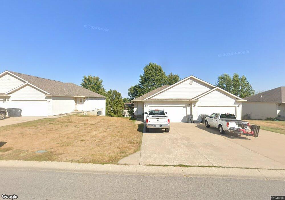
143 NW Barr Rd Grain Valley, MO 64029
Estimated Value: $200,000 - $390,958
8
Beds
4
Baths
1,976
Sq Ft
$156/Sq Ft
Est. Value
About This Home
This home is located at 143 NW Barr Rd, Grain Valley, MO 64029 and is currently estimated at $308,990, approximately $156 per square foot. 143 NW Barr Rd is a home with nearby schools including Grain Valley High School.
Ownership History
Date
Name
Owned For
Owner Type
Purchase Details
Closed on
Mar 5, 2007
Sold by
Fannie Mae
Bought by
Winkler Wendy
Current Estimated Value
Purchase Details
Closed on
Nov 27, 2006
Sold by
Reynolds Debbie and Reynolds Gary
Bought by
Federal National Mortgage Association
Purchase Details
Closed on
Jul 29, 2004
Sold by
Fothergill David R and Fothergill Nadine I
Bought by
Reynolds Gary and Reynolds Debbie
Create a Home Valuation Report for This Property
The Home Valuation Report is an in-depth analysis detailing your home's value as well as a comparison with similar homes in the area
Home Values in the Area
Average Home Value in this Area
Purchase History
| Date | Buyer | Sale Price | Title Company |
|---|---|---|---|
| Winkler Wendy | -- | Stewart Title | |
| Federal National Mortgage Association | $319,842 | None Available | |
| Reynolds Gary | -- | -- | |
| Reynolds Gary | -- | Coffelt Land Title Inc | |
| Reynolds Gary | -- | Coffelt Land Title Inc | |
| Reynolds Gary | -- | Coffelt Land Title Inc |
Source: Public Records
Tax History Compared to Growth
Tax History
| Year | Tax Paid | Tax Assessment Tax Assessment Total Assessment is a certain percentage of the fair market value that is determined by local assessors to be the total taxable value of land and additions on the property. | Land | Improvement |
|---|---|---|---|---|
| 2025 | $5,086 | $59,301 | $6,865 | $52,436 |
| 2024 | $4,896 | $61,750 | $10,074 | $51,676 |
| 2023 | $4,896 | $61,750 | $10,074 | $51,676 |
| 2022 | $4,065 | $44,840 | $3,534 | $41,306 |
| 2021 | $3,970 | $44,840 | $3,534 | $41,306 |
| 2020 | $3,528 | $39,311 | $3,534 | $35,777 |
| 2019 | $3,457 | $39,311 | $3,534 | $35,777 |
| 2018 | $2,682 | $28,500 | $4,056 | $24,444 |
| 2017 | $2,934 | $32,000 | $4,056 | $27,944 |
| 2016 | $2,934 | $31,198 | $5,434 | $25,764 |
| 2014 | $2,575 | $27,170 | $6,787 | $20,383 |
Source: Public Records
Map
Nearby Homes
- 1235 NW Ashley Ln
- 1206 NW Baytree Dr
- 1211 NW Scenic Dr
- 605 NW Silverstone Cir
- 1007 NW Long Dr
- 708 Pavillion Dr
- 704 NW Eagle Dr
- 2601 NE Wheatley Dr
- 2512 NE Wheatley Dr
- 1208 NW Golfview Dr
- 2513 NE Wheatley Dr
- 2700 NE Crestview St
- 2701 NE Crestview St
- 2601 NE Crestview St
- 2705 NE Wheatley Dr
- 2613 NE Amanda Ln
- 2601 NE Amanda Ln
- 2704 NE Amanda Ln
- 1418 SW Blue Branch Dr
- 1402 NW Broadway Throughway
- 145 NW Barr Rd
- 1306 NW Ashley Dr
- 1308 NW Ashley Dr
- 1215 NW Long Dr
- 149 NW Barr Rd
- 1234 NW Ashley Dr
- 600 NW Scenic Dr
- 1232 NW Ashley Dr
- 1230 NW Ashley Dr
- 153 NW Barr Rd
- 1228 NW Ashley Dr
- 1305 NW Ashley Dr
- 1213 NW Long Dr
- 1303 NW Ashley Dr
- 602 NW Scenic Dr
- 1235 NW Ashley Dr
- 1233 NW Ashley Dr
- 1231 NW Ashley Dr
- 1224 NW Ashley Dr
- 157 NW Barr Rd