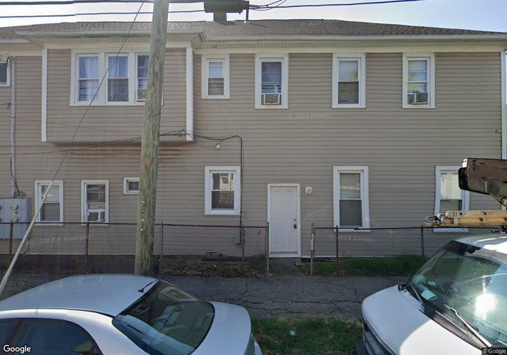
143 Parrott Ave Bridgeport, CT 06606
Brooklawn-Saint Vincent NeighborhoodEstimated Value: $279,798 - $835,000
8
Beds
3
Baths
3,148
Sq Ft
$197/Sq Ft
Est. Value
About This Home
This home is located at 143 Parrott Ave, Bridgeport, CT 06606 and is currently estimated at $621,700, approximately $197 per square foot. 143 Parrott Ave is a home located in Fairfield County with nearby schools including Read School, Central High School, and Catholic Academy of Bridgeport-St. Raphael Academy.
Ownership History
Date
Name
Owned For
Owner Type
Purchase Details
Closed on
Feb 1, 2000
Sold by
Schwartz Martin and Schwartz Elaine
Bought by
Huynh Ben
Current Estimated Value
Home Financials for this Owner
Home Financials are based on the most recent Mortgage that was taken out on this home.
Original Mortgage
$95,400
Interest Rate
7.83%
Create a Home Valuation Report for This Property
The Home Valuation Report is an in-depth analysis detailing your home's value as well as a comparison with similar homes in the area
Home Values in the Area
Average Home Value in this Area
Purchase History
| Date | Buyer | Sale Price | Title Company |
|---|---|---|---|
| Huynh Ben | $106,000 | -- | |
| Huynh Ben | $106,000 | -- |
Source: Public Records
Mortgage History
| Date | Status | Borrower | Loan Amount |
|---|---|---|---|
| Open | Huynh Ben | $143,500 | |
| Closed | Huynh Ben | $95,400 |
Source: Public Records
Tax History Compared to Growth
Tax History
| Year | Tax Paid | Tax Assessment Tax Assessment Total Assessment is a certain percentage of the fair market value that is determined by local assessors to be the total taxable value of land and additions on the property. | Land | Improvement |
|---|---|---|---|---|
| 2025 | $10,528 | $242,290 | $63,810 | $178,480 |
| 2024 | $10,528 | $242,290 | $63,810 | $178,480 |
| 2023 | $10,528 | $242,290 | $63,810 | $178,480 |
| 2022 | $10,528 | $242,290 | $63,810 | $178,480 |
| 2021 | $10,528 | $242,290 | $63,810 | $178,480 |
| 2020 | $9,586 | $177,550 | $38,680 | $138,870 |
| 2019 | $9,586 | $177,550 | $38,680 | $138,870 |
| 2018 | $9,653 | $177,550 | $38,680 | $138,870 |
| 2017 | $9,653 | $177,550 | $38,680 | $138,870 |
| 2016 | $9,653 | $177,550 | $38,680 | $138,870 |
| 2015 | $8,833 | $209,310 | $39,000 | $170,310 |
| 2014 | $8,833 | $209,310 | $39,000 | $170,310 |
Source: Public Records
Map
Nearby Homes
- 2395 Main St Unit 2397
- 76 Porter St
- 330 French St
- 90 Tom Thumb St
- 78 Fairmount Ave
- 724 Capitol Ave Unit 726
- 390 Charles St Unit 106
- 152 River St
- 178 Island Brook Ave
- 119 Madison Terrace
- 936 Lindley St
- 31 Taft Ave
- 508 Hawley Ave
- 957 William St Unit A
- 106 Manhattan Ave Unit 108
- 604 William St
- 123 Harlem Ave
- 926 Hart St
- 916 Hart St
- 318 Center St
- 133 Parrott Ave
- 161 Parrott Ave
- 125 Parrott Ave
- 125 Parrott Ave Unit 2
- 144 Parrott Ave
- 119 Parrott Ave
- 119 - 121 Parrott Ave
- 152 Parrott Ave
- 138 Parrott Ave
- 167 Parrott Ave
- 150 Whitney Ave
- 150 Whitney Ave Unit 3
- 150 Whitney Ave Unit 1
- 160 Parrott Ave
- 174 Whitney Ave
- 132 Whitney Ave
- 179 Parrott Ave Unit 3
- 109 Parrott Ave
- 170 Parrott Ave
- 175 Parrott Ave