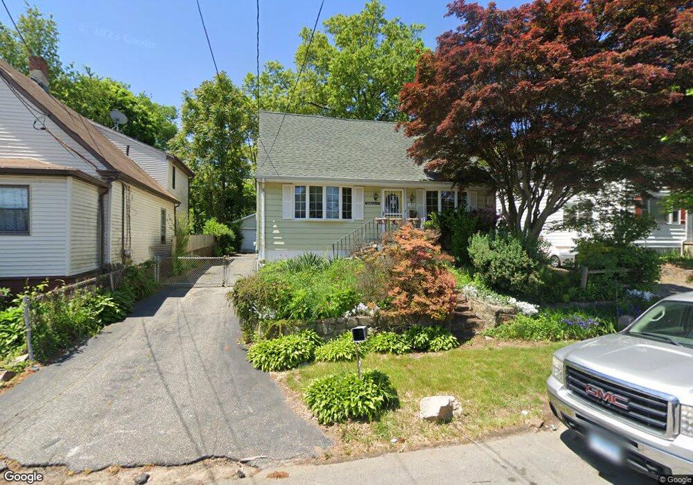
143 Sampson St Bridgeport, CT 06606
Brooklawn-Saint Vincent NeighborhoodEstimated Value: $315,000 - $446,000
3
Beds
2
Baths
1,470
Sq Ft
$263/Sq Ft
Est. Value
About This Home
This home is located at 143 Sampson St, Bridgeport, CT 06606 and is currently estimated at $386,865, approximately $263 per square foot. 143 Sampson St is a home located in Fairfield County with nearby schools including Blackham School, Central High School, and Capital Prep Harbor Upper School.
Ownership History
Date
Name
Owned For
Owner Type
Purchase Details
Closed on
Jan 21, 2025
Sold by
Lacoursiere Regina Est and Lacoursiere
Bought by
Lopez Katherine and Lopez Jorge
Current Estimated Value
Home Financials for this Owner
Home Financials are based on the most recent Mortgage that was taken out on this home.
Original Mortgage
$252,000
Outstanding Balance
$250,178
Interest Rate
6.6%
Mortgage Type
Purchase Money Mortgage
Estimated Equity
$136,687
Create a Home Valuation Report for This Property
The Home Valuation Report is an in-depth analysis detailing your home's value as well as a comparison with similar homes in the area
Home Values in the Area
Average Home Value in this Area
Purchase History
| Date | Buyer | Sale Price | Title Company |
|---|---|---|---|
| Lopez Katherine | $315,000 | None Available | |
| Lopez Katherine | $315,000 | None Available |
Source: Public Records
Mortgage History
| Date | Status | Borrower | Loan Amount |
|---|---|---|---|
| Open | Lopez Katherine | $252,000 | |
| Closed | Lopez Katherine | $252,000 |
Source: Public Records
Tax History
| Year | Tax Paid | Tax Assessment Tax Assessment Total Assessment is a certain percentage of the fair market value that is determined by local assessors to be the total taxable value of land and additions on the property. | Land | Improvement |
|---|---|---|---|---|
| 2025 | $7,213 | $166,000 | $75,410 | $90,590 |
| 2024 | $7,213 | $166,000 | $75,410 | $90,590 |
| 2023 | $7,213 | $166,000 | $75,410 | $90,590 |
| 2022 | $7,213 | $166,000 | $75,410 | $90,590 |
| 2021 | $7,213 | $166,000 | $75,410 | $90,590 |
| 2020 | $6,293 | $116,550 | $39,390 | $77,160 |
| 2019 | $6,293 | $116,550 | $39,390 | $77,160 |
| 2018 | $6,337 | $116,550 | $39,390 | $77,160 |
| 2017 | $6,337 | $116,550 | $39,390 | $77,160 |
| 2016 | $6,337 | $116,550 | $39,390 | $77,160 |
| 2015 | $6,692 | $158,590 | $47,660 | $110,930 |
| 2014 | $6,692 | $158,590 | $47,660 | $110,930 |
Source: Public Records
Map
Nearby Homes
- 25 Myron Ave
- 130 Holroyd St
- 11 Myron Ave
- 85-89 Alexander Dr
- 125-127 Alexander Dr
- 95 Alexander Ave
- 203 Wayne St
- 2625 Park Ave Unit 9R
- 2625 Park Ave Unit 4F
- 252 Harlem Ave Unit C4
- 2675 Park Ave Unit 26
- 254 Wayne St
- 123 Harlem Ave
- 631 Fairview Ave
- 708 Capitol Ave Unit 710
- 525 Westfield Ave
- 405 Westfield Ave
- 92 Lincoln Ave
- 74 Harlem Ave
- 248 Salem St
- 135 Sampson St
- 151 Sampson St
- 91-93 High Ridge Dr
- 159 Sampson St Unit 161
- 2 Myron Ave
- 115 Sampson St
- 173 Sampson St
- 146 Sampson St
- 160 Sampson St
- 10 Myron Ave
- 99 High Ridge Dr Unit 101
- 91 High Ridge Dr Unit 93
- 126 Sampson St
- 103 Sampson St
- 172 Sampson St
- 105 Sampson St
- 108 Sampson St
- 116 Sampson St
- 20 Myron Ave
- 107 High Ridge Dr Unit 115
Your Personal Tour Guide
Ask me questions while you tour the home.