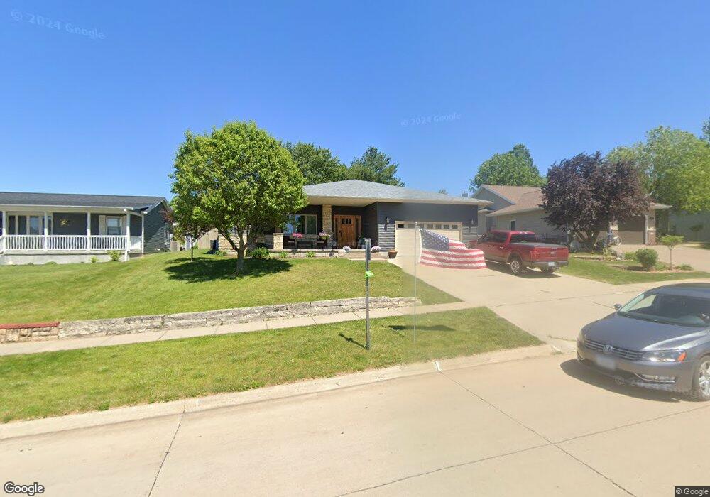
143 Scott Dr West Branch, IA 52358
Estimated Value: $320,000 - $396,000
3
Beds
3
Baths
1,857
Sq Ft
$196/Sq Ft
Est. Value
About This Home
This home is located at 143 Scott Dr, West Branch, IA 52358 and is currently estimated at $364,792, approximately $196 per square foot. 143 Scott Dr is a home located in Cedar County with nearby schools including Hoover Elementary School, West Branch Middle School, and West Branch High School.
Ownership History
Date
Name
Owned For
Owner Type
Purchase Details
Closed on
Jul 30, 2018
Sold by
Mundell Andrew R and Mundell Jennifer L
Bought by
Vanscoyoc Matthew S and Vanscoyoc Kristen R
Current Estimated Value
Home Financials for this Owner
Home Financials are based on the most recent Mortgage that was taken out on this home.
Original Mortgage
$30,350
Outstanding Balance
$17,423
Interest Rate
4.5%
Mortgage Type
Unknown
Estimated Equity
$347,369
Purchase Details
Closed on
Jun 22, 2018
Sold by
Tracy L Goetz
Bought by
Mundell Jennifer and Mundell Andrew
Home Financials for this Owner
Home Financials are based on the most recent Mortgage that was taken out on this home.
Original Mortgage
$30,350
Outstanding Balance
$17,423
Interest Rate
4.5%
Mortgage Type
Unknown
Estimated Equity
$347,369
Create a Home Valuation Report for This Property
The Home Valuation Report is an in-depth analysis detailing your home's value as well as a comparison with similar homes in the area
Home Values in the Area
Average Home Value in this Area
Purchase History
| Date | Buyer | Sale Price | Title Company |
|---|---|---|---|
| Vanscoyoc Matthew S | $303,500 | -- | |
| Mundell Jennifer | -- | -- |
Source: Public Records
Mortgage History
| Date | Status | Borrower | Loan Amount |
|---|---|---|---|
| Open | Vanscoyoc Matthew S | $30,350 | |
| Open | Vanscoyoc Matthew S | $273,150 | |
| Previous Owner | Mundell Jennifer | $130,000 | |
| Previous Owner | Mundell Jennifer | -- |
Source: Public Records
Tax History Compared to Growth
Tax History
| Year | Tax Paid | Tax Assessment Tax Assessment Total Assessment is a certain percentage of the fair market value that is determined by local assessors to be the total taxable value of land and additions on the property. | Land | Improvement |
|---|---|---|---|---|
| 2025 | $6,336 | $399,200 | $41,010 | $358,190 |
| 2024 | $6,336 | $383,180 | $41,010 | $342,170 |
| 2023 | $6,030 | $369,580 | $41,010 | $328,570 |
| 2022 | $5,610 | $299,050 | $39,060 | $259,990 |
| 2021 | $5,758 | $299,050 | $39,060 | $259,990 |
| 2020 | $5,576 | $293,190 | $33,200 | $259,990 |
| 2019 | $4,892 | $276,740 | $0 | $0 |
| 2018 | $4,786 | $276,740 | $0 | $0 |
| 2017 | $4,738 | $257,430 | $0 | $0 |
| 2016 | $4,716 | $257,430 | $0 | $0 |
| 2015 | $4,698 | $255,430 | $0 | $0 |
| 2014 | $4,698 | $255,430 | $0 | $0 |
Source: Public Records
Map
Nearby Homes
- 609 W Orange St
- 611 Riley Ln
- 173 Hilltop Dr
- 120 N Downey St
- 127 N Downey St
- 719 Sullivan St
- Lot 17 Meadows Subdivision Part 5
- 426 N 1st St
- 212 Dawson Dr
- 817 Prairie View Dr
- Lot 17 the Meadows Subdivision Part 5
- Lot 19 Meadows Subdivision Part 6
- 121 Northridge Dr Unit 121-139
- Lot 17 Meadows Subdivision Part 6
- Lot 16 Meadows Subdivision Part 6
- Lot 18 Meadows Subdivision Part 6
- Lot 14 Meadows Subdivision Part 6
- Lot 15 Meadows Subdivision Part 6
- Lot 11 Meadows Subdivision Part 6
- Lot 6 Meadows Subdivision Part 6