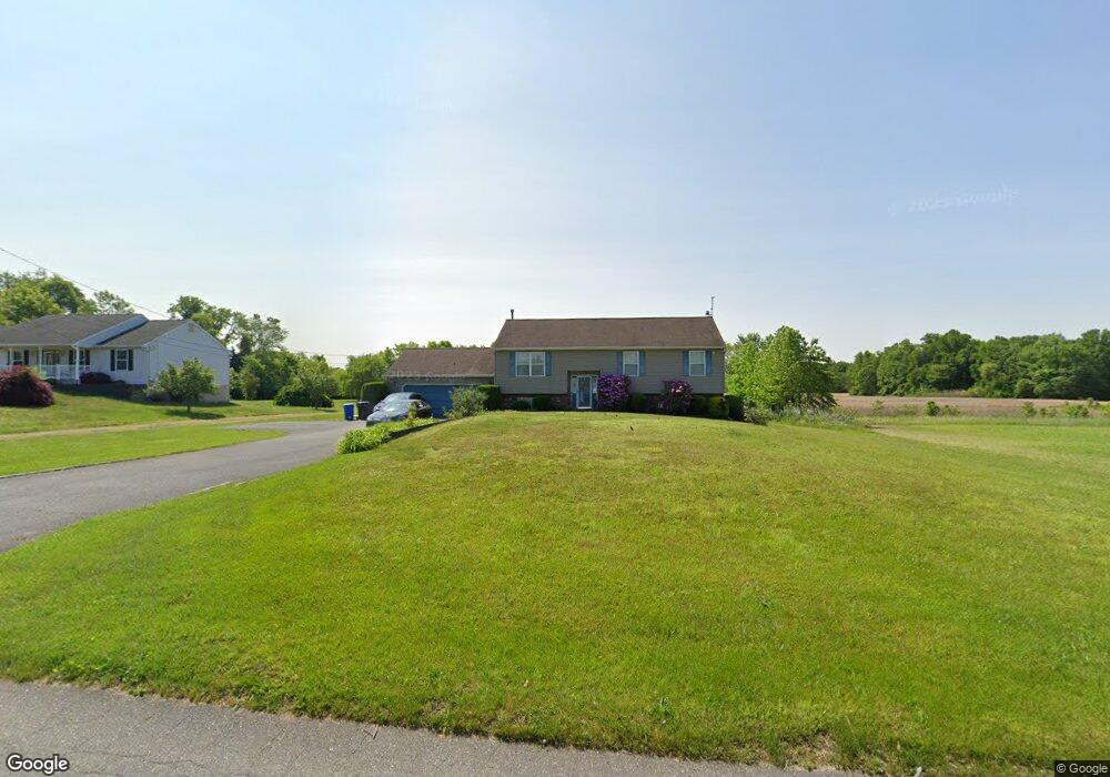
143 W Wolfert Station Rd Mickleton, NJ 08056
East Greenwich Township NeighborhoodEstimated Value: $480,878 - $643,000
--
Bed
--
Bath
2,042
Sq Ft
$272/Sq Ft
Est. Value
About This Home
This home is located at 143 W Wolfert Station Rd, Mickleton, NJ 08056 and is currently estimated at $555,470, approximately $272 per square foot. 143 W Wolfert Station Rd is a home located in Gloucester County with nearby schools including Jeffrey Clark School, Samuel Mickle School, and Kingsway Regional Middle School.
Ownership History
Date
Name
Owned For
Owner Type
Purchase Details
Closed on
Oct 29, 1998
Sold by
Massi Suellen
Bought by
Bieszart Walter J
Current Estimated Value
Home Financials for this Owner
Home Financials are based on the most recent Mortgage that was taken out on this home.
Original Mortgage
$143,100
Outstanding Balance
$31,373
Interest Rate
6.64%
Estimated Equity
$524,097
Purchase Details
Closed on
Jun 15, 1994
Sold by
Tremont Construction
Bought by
Massi Suellen
Create a Home Valuation Report for This Property
The Home Valuation Report is an in-depth analysis detailing your home's value as well as a comparison with similar homes in the area
Home Values in the Area
Average Home Value in this Area
Purchase History
| Date | Buyer | Sale Price | Title Company |
|---|---|---|---|
| Bieszart Walter J | $159,000 | -- | |
| Massi Suellen | $136,000 | Fidelity Title Abstract Co |
Source: Public Records
Mortgage History
| Date | Status | Borrower | Loan Amount |
|---|---|---|---|
| Open | Bieszart Walter J | $143,100 |
Source: Public Records
Tax History Compared to Growth
Tax History
| Year | Tax Paid | Tax Assessment Tax Assessment Total Assessment is a certain percentage of the fair market value that is determined by local assessors to be the total taxable value of land and additions on the property. | Land | Improvement |
|---|---|---|---|---|
| 2025 | $9,416 | $296,200 | $90,000 | $206,200 |
| 2024 | $9,117 | $296,200 | $90,000 | $206,200 |
| 2023 | $9,117 | $296,200 | $90,000 | $206,200 |
| 2022 | $8,859 | $296,200 | $90,000 | $206,200 |
| 2021 | $8,919 | $296,200 | $90,000 | $206,200 |
| 2020 | $8,866 | $293,100 | $90,000 | $203,100 |
| 2019 | $8,775 | $293,100 | $90,000 | $203,100 |
| 2018 | $8,193 | $248,500 | $69,800 | $178,700 |
| 2017 | $8,086 | $248,500 | $69,800 | $178,700 |
| 2016 | $7,992 | $248,500 | $69,800 | $178,700 |
| 2015 | $7,659 | $248,500 | $69,800 | $178,700 |
| 2014 | $7,187 | $248,500 | $69,800 | $178,700 |
Source: Public Records
Map
Nearby Homes
- 71 W Tomlin Station Rd
- 78 W Tomlin Station Rd
- 123 W Tomlin Station Rd
- 50 Mill Rd
- 0 Rd Unit NJGL2061600
- 159 Mill Rd
- 792 Paulsboro Rd
- 788 Paulsboro Rd
- 67 E Rattling Run Rd
- 347 Paulsboro Rd
- 560 Partridge Ct
- 43 45 Repaupo Station Rd
- 9 Still Run Rd
- 558 Hereford Ln
- 552 Hereford Ln
- 163 Erica Ct
- 48 Garwin Rd
- 155 Erica Ct
- 0 S Democrat Rd Unit NJGL2065008
- 0 Swedesboro Ave Unit NJGL2061592
- 141 W Wolfert Station Rd
- 144 W Wolfert Station Rd
- 144 W Wolfert Station Rd
- 148 W Wolfert Station Rd
- 142 W Wolfert Station Rd
- 140 W Wolfert Station Rd
- 138 W Wolfert Station Rd
- 131 W Wolfert Station Rd
- 105 W Tomlin Station Rd
- 90 W Tomlin Station Rd
- 100 W Tomlin Station Rd
- 181 W Wolfert Station Rd
- 86 W Tomlin Station Rd
- 109 W Tomlin Station Rd
- 159 W Wolfert Station Rd
- 106 W Tomlin Station Rd
- 84 W Tomlin Station Rd
- 82 W Tomlin Station Rd
- 110 W Tomlin Station Rd
- 123 W Wolfert Station Rd