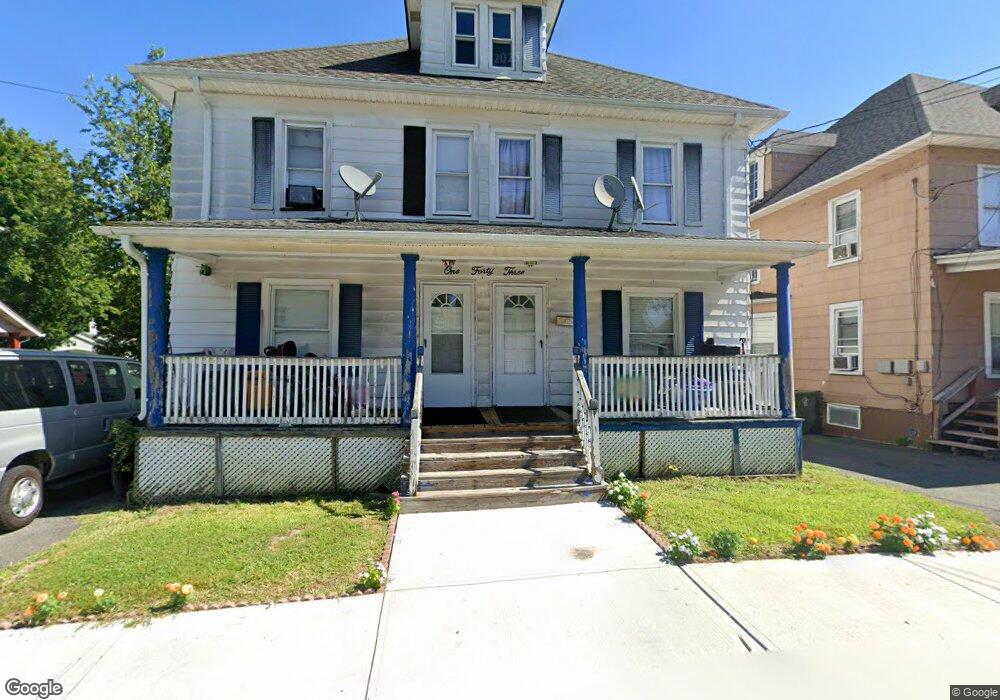
143 Wisner Ave Middletown, NY 10940
Estimated Value: $307,000 - $470,000
8
Beds
2
Baths
2,534
Sq Ft
$164/Sq Ft
Est. Value
About This Home
This home is located at 143 Wisner Ave, Middletown, NY 10940 and is currently estimated at $414,663, approximately $163 per square foot. 143 Wisner Ave is a home located in Orange County with nearby schools including Presidential Park Elementary School, Middletown Twin Towers Middle School, and Monhagen Middle School.
Ownership History
Date
Name
Owned For
Owner Type
Purchase Details
Closed on
Nov 16, 2021
Sold by
Sullivan Richard M
Bought by
Sullivan Monica
Current Estimated Value
Purchase Details
Closed on
Feb 22, 2002
Sold by
City Of Middletown
Bought by
Rodriguez Ramiro and Rodriguez Ernestina
Home Financials for this Owner
Home Financials are based on the most recent Mortgage that was taken out on this home.
Original Mortgage
$94,090
Interest Rate
6.85%
Mortgage Type
Purchase Money Mortgage
Purchase Details
Closed on
Sep 28, 1995
Sold by
Lewis Patricia A and Endy Patricia
Bought by
Plg Ltd Liability Company
Create a Home Valuation Report for This Property
The Home Valuation Report is an in-depth analysis detailing your home's value as well as a comparison with similar homes in the area
Home Values in the Area
Average Home Value in this Area
Purchase History
| Date | Buyer | Sale Price | Title Company |
|---|---|---|---|
| Sullivan Monica | -- | None Available | |
| Rodriguez Ramiro | $55,000 | -- | |
| Plg Ltd Liability Company | -- | -- |
Source: Public Records
Mortgage History
| Date | Status | Borrower | Loan Amount |
|---|---|---|---|
| Previous Owner | Rodriguez Ramiro | $94,090 |
Source: Public Records
Tax History Compared to Growth
Tax History
| Year | Tax Paid | Tax Assessment Tax Assessment Total Assessment is a certain percentage of the fair market value that is determined by local assessors to be the total taxable value of land and additions on the property. | Land | Improvement |
|---|---|---|---|---|
| 2024 | $7,906 | $28,800 | $7,900 | $20,900 |
| 2023 | $7,906 | $28,800 | $7,900 | $20,900 |
| 2022 | $7,744 | $28,800 | $7,900 | $20,900 |
| 2021 | $8,147 | $28,800 | $7,900 | $20,900 |
| 2020 | $3,336 | $28,800 | $7,900 | $20,900 |
| 2019 | $3,246 | $28,800 | $7,900 | $20,900 |
| 2018 | $6,871 | $28,800 | $7,900 | $20,900 |
| 2017 | $6,652 | $28,800 | $7,900 | $20,900 |
| 2016 | $6,689 | $28,800 | $7,900 | $20,900 |
| 2015 | -- | $28,800 | $7,900 | $20,900 |
| 2014 | -- | $28,800 | $7,900 | $20,900 |
Source: Public Records
Map
Nearby Homes
- 80 Beattie Ave
- 57 Overhill Rd
- 105 Sheffield Dr
- 47 Prince St
- 31 Beattie Ave
- 10 Royce Ave
- 13 Smith St
- 77 Prince St
- 143 N Beacon St
- 92 Linden Ave
- 37 Wisner Ave Unit 39
- 115 Vincent Dr
- 221 E Main St
- 256 E Main St
- 1 Polly Kay Dr
- 73 Watkins Ave
- 47 Carpenter Ave
- 38 Prospect St
- 71 Commonwealth Ave
- 17 Magnolia Park Rd
- 141 Wisner Ave
- 139 Wisner Ave
- 10 Blanchard St
- 8 Blanchard St
- 12 Blanchard St
- 1471/2 Wisner Ave
- 147-1/2 Wisner Ave
- 147 1/2 Wisner Ave
- 6 Blanchard St
- 14 Blanchard St
- 147 Wisner Ave
- 42 Sproat St
- 38 Sproat St
- 40 Sproat St
- 146 Wisner Ave
- 5 Blanchard St
- 16 Blanchard St Unit 2
- 16 Blanchard St Unit 1
- 16 Blanchard St
- 44 Sproat St