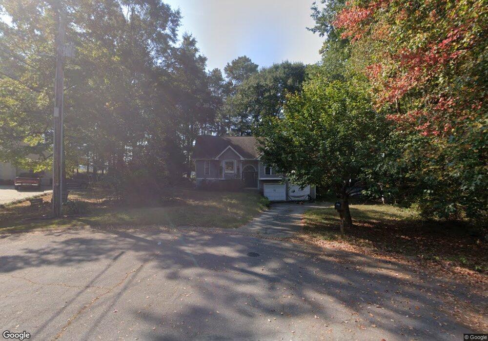
143 Wooddale Ln Carrollton, GA 30117
Estimated Value: $285,729 - $300,000
3
Beds
2
Baths
1,620
Sq Ft
$181/Sq Ft
Est. Value
About This Home
This home is located at 143 Wooddale Ln, Carrollton, GA 30117 and is currently estimated at $293,182, approximately $180 per square foot. 143 Wooddale Ln is a home located in Carroll County with nearby schools including Central Elementary School, Central Middle School, and Central High School.
Ownership History
Date
Name
Owned For
Owner Type
Purchase Details
Closed on
Apr 12, 2018
Sold by
Bingham Lynda
Bought by
Kipp Lovvorn
Current Estimated Value
Home Financials for this Owner
Home Financials are based on the most recent Mortgage that was taken out on this home.
Original Mortgage
$161,515
Outstanding Balance
$138,900
Interest Rate
4.44%
Mortgage Type
New Conventional
Estimated Equity
$154,282
Purchase Details
Closed on
Oct 30, 2008
Sold by
Wysoczynski Gerald Paul
Bought by
Bingham Lynda and Bingham Joshua
Home Financials for this Owner
Home Financials are based on the most recent Mortgage that was taken out on this home.
Original Mortgage
$127,991
Interest Rate
6.11%
Mortgage Type
FHA
Purchase Details
Closed on
Jul 22, 1992
Sold by
Shaw Ii Hugh Frazier
Bought by
Wysoczynski
Purchase Details
Closed on
Mar 11, 1991
Bought by
Shaw Ii Hugh Frazier
Create a Home Valuation Report for This Property
The Home Valuation Report is an in-depth analysis detailing your home's value as well as a comparison with similar homes in the area
Home Values in the Area
Average Home Value in this Area
Purchase History
| Date | Buyer | Sale Price | Title Company |
|---|---|---|---|
| Kipp Lovvorn | $159,900 | -- | |
| Bingham Lynda | $130,000 | -- | |
| Wysoczynski | $91,000 | -- | |
| Shaw Ii Hugh Frazier | $20,000 | -- |
Source: Public Records
Mortgage History
| Date | Status | Borrower | Loan Amount |
|---|---|---|---|
| Open | Kipp Lovvorn | $161,515 | |
| Previous Owner | Bingham Lynda | $127,991 |
Source: Public Records
Tax History Compared to Growth
Tax History
| Year | Tax Paid | Tax Assessment Tax Assessment Total Assessment is a certain percentage of the fair market value that is determined by local assessors to be the total taxable value of land and additions on the property. | Land | Improvement |
|---|---|---|---|---|
| 2024 | $2,332 | $103,065 | $6,000 | $97,065 |
| 2023 | $2,332 | $100,750 | $6,000 | $94,750 |
| 2022 | $2,058 | $82,067 | $6,000 | $76,067 |
| 2021 | $1,825 | $71,204 | $6,000 | $65,204 |
| 2020 | $1,648 | $64,198 | $6,000 | $58,198 |
| 2019 | $1,653 | $63,891 | $10,000 | $53,891 |
| 2018 | $1,173 | $48,668 | $10,000 | $38,668 |
| 2017 | $1,282 | $48,668 | $10,000 | $38,668 |
| 2016 | $1,282 | $48,668 | $10,000 | $38,668 |
| 2015 | $1,093 | $39,088 | $4,800 | $34,288 |
| 2014 | $1,098 | $39,088 | $4,800 | $34,288 |
Source: Public Records
Map
Nearby Homes
- 105 Woodbine Dr
- 345 Piney Grove Rd
- 399 Old Camp Church Rd
- 0 Bonner Rd Unit 10635754
- 20 Camp Ct
- 95 Camp Ln
- 0 Buffalo Creek Rd Unit 10624169
- 533 Buffalo Creek Rd
- The Coleman Plan at Summerfield Place
- The Pearson Plan at Summerfield Place
- The Piedmont Plan at Summerfield Place
- The Harrington Plan at Summerfield Place
- The McGinnis Plan at Summerfield Place
- The Telfair Plan at Summerfield Place
- 21 Crabapple Place
- 1531 Tyus Carrollton Rd
- 115 Greenwood Ln
- 40 Red Holly Gap
- 130 Maple Crossing Unit 1
- 130 Maple Crossing Unit LOT 2
- 154 Wooddale Ln
- 24 Sunny Brook
- 0.6+/- Sunny Brook Ln
- 144 Wooddale Ln
- 24 Sunny Brook Ln
- 38 Sunny Brook Ln
- 30 Sunny Brook Ln
- 0 Sunny Brook Ln Unit 20092055
- 134 Wooddale Ln
- 30 Sunny Brook
- 11 Sunny Brook
- 710 Old Camp Church Rd
- 124 Wooddale Ln
- 27 Sunny Brook Ln
- 27 Sunny Brook
- 715 Old Camp Church Rd
- 117 Wooddale Ln
- 38 Sunny Brook
- 114 Wooddale Ln
- 31 Sunny Brook