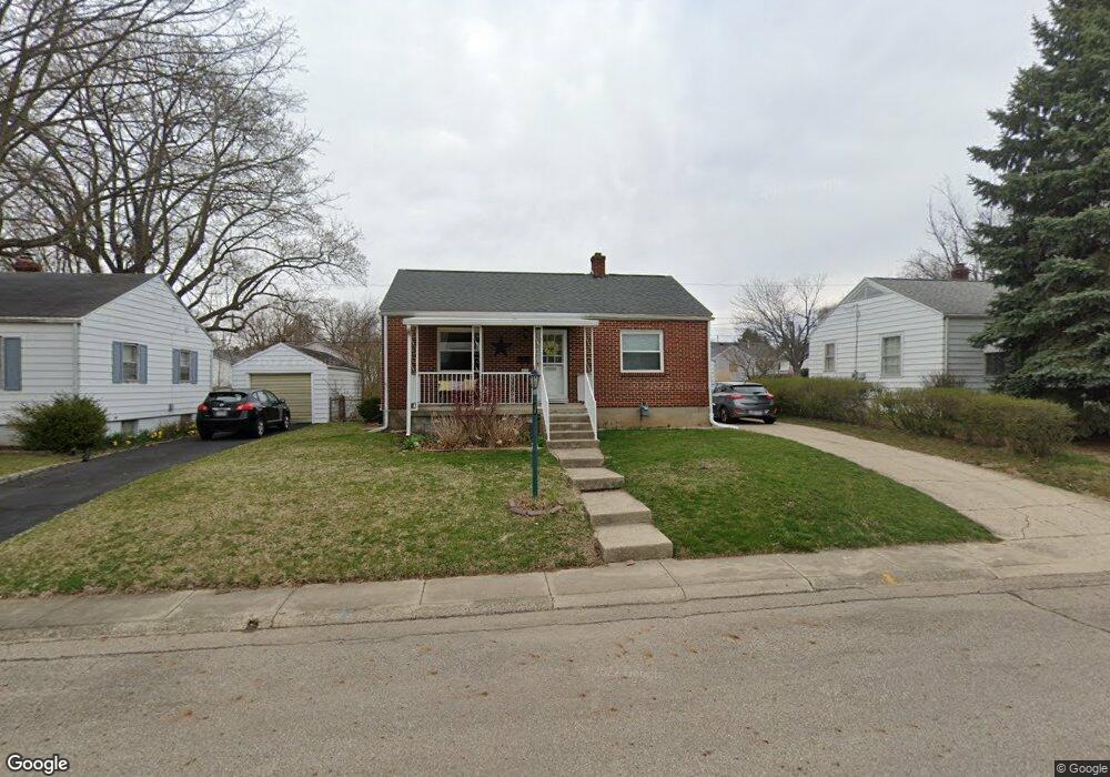
1430 Amherst Rd Springfield, OH 45504
Estimated Value: $146,552 - $160,000
2
Beds
1
Bath
768
Sq Ft
$196/Sq Ft
Est. Value
About This Home
This home is located at 1430 Amherst Rd, Springfield, OH 45504 and is currently estimated at $150,888, approximately $196 per square foot. 1430 Amherst Rd is a home located in Clark County with nearby schools including Snowhill Elementary School, Roosevelt Middle School, and Springfield High School.
Ownership History
Date
Name
Owned For
Owner Type
Purchase Details
Closed on
Jan 23, 2003
Sold by
Wood James W
Bought by
Mefford Scott A and Mefford Mai D
Current Estimated Value
Home Financials for this Owner
Home Financials are based on the most recent Mortgage that was taken out on this home.
Original Mortgage
$71,912
Outstanding Balance
$30,082
Interest Rate
6.13%
Mortgage Type
Purchase Money Mortgage
Estimated Equity
$120,806
Purchase Details
Closed on
Apr 15, 1999
Sold by
Taylor Richard H and Taylor Cindy M
Bought by
Wood James W and Wood Regina C
Home Financials for this Owner
Home Financials are based on the most recent Mortgage that was taken out on this home.
Original Mortgage
$62,550
Interest Rate
7.1%
Mortgage Type
Purchase Money Mortgage
Purchase Details
Closed on
Aug 8, 1994
Sold by
Simpson Donald E
Bought by
Taylor Richard H
Home Financials for this Owner
Home Financials are based on the most recent Mortgage that was taken out on this home.
Original Mortgage
$51,278
Interest Rate
8.53%
Mortgage Type
FHA
Create a Home Valuation Report for This Property
The Home Valuation Report is an in-depth analysis detailing your home's value as well as a comparison with similar homes in the area
Home Values in the Area
Average Home Value in this Area
Purchase History
| Date | Buyer | Sale Price | Title Company |
|---|---|---|---|
| Mefford Scott A | $72,500 | Titlequest Agency Inc | |
| Wood James W | $69,500 | -- | |
| Taylor Richard H | $51,000 | -- |
Source: Public Records
Mortgage History
| Date | Status | Borrower | Loan Amount |
|---|---|---|---|
| Open | Mefford Scott A | $71,912 | |
| Previous Owner | Wood James W | $62,550 | |
| Previous Owner | Taylor Richard H | $51,278 |
Source: Public Records
Tax History
| Year | Tax Paid | Tax Assessment Tax Assessment Total Assessment is a certain percentage of the fair market value that is determined by local assessors to be the total taxable value of land and additions on the property. | Land | Improvement |
|---|---|---|---|---|
| 2025 | $1,686 | $43,950 | $7,790 | $36,160 |
| 2024 | $1,686 | $34,080 | $7,180 | $26,900 |
| 2023 | $1,642 | $34,080 | $7,180 | $26,900 |
| 2022 | $1,682 | $34,080 | $7,180 | $26,900 |
| 2021 | $1,421 | $26,580 | $5,570 | $21,010 |
| 2020 | $1,424 | $26,580 | $5,570 | $21,010 |
| 2019 | $1,428 | $26,580 | $5,570 | $21,010 |
| 2018 | $1,497 | $26,740 | $5,130 | $21,610 |
| 2017 | $1,496 | $26,079 | $5,131 | $20,948 |
| 2016 | $1,497 | $26,079 | $5,131 | $20,948 |
| 2015 | $1,374 | $24,105 | $4,841 | $19,264 |
| 2014 | $1,368 | $24,105 | $4,841 | $19,264 |
| 2013 | $1,354 | $24,105 | $4,841 | $19,264 |
Source: Public Records
Map
Nearby Homes
- 1329 Lamar Dr
- 827 Snowhill Blvd
- 1425 Sheaff Rd
- 1708 Brookhollow Dr
- 735 Tanglewood Dr
- 820 W 1st St
- 648 N Tanglewood Dr
- 1224 Beverly Ave
- 1015 Hillcrest Ave
- 327 Ardmore Rd
- 125 Hawthorne Rd
- 264 S Broadmoor Blvd
- 412 Dakota Ave
- 423 N Jackson St Unit 425
- 366 N Isabella St
- 1107 N Fountain Ave
- 24 Bill Edwards Dr
- 0 E McCreight Ave
- 306 N Bechtle Ave
- 263 N Isabella St Unit 265
- 1500 Amherst Rd
- 1424 Amherst Rd
- 1506 Amherst Rd
- 1418 Amherst Rd
- 1433 Lamar Dr
- 1429 Lamar Dr
- 1425 Lamar Dr
- 1421 Lamar Dr
- 1412 Amherst Rd
- 1505 Lamar Dr
- 1431 Amherst Rd
- 1425 Amherst Rd
- 1501 Amherst Rd
- 1415 Lamar Dr
- 1509 Amherst Rd
- 1419 Amherst Rd
- 1515 Lamar Dr
- 1518 Northgate Rd
- 1411 Lamar Dr
- 1406 Amherst Rd
Your Personal Tour Guide
Ask me questions while you tour the home.